
120 Hours Across Southern Utah
 Oct 1, 2007 | 10:19 PM
#1
Thread Starter
Contributing Member
Joined: Jun 2005
Posts: 3,415
Likes: 9
From: Phx, AZ
120 Hours Across Southern Utah
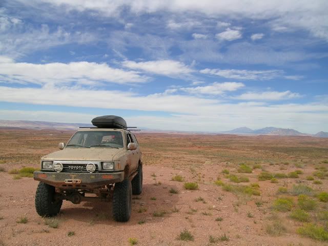
Had to head back out and see what Escalante and the surrounding areas had left to show us so we headed up from Scottsdale to the town of Big Water... which is just slightly NW of Page, AZ.
Day 1...
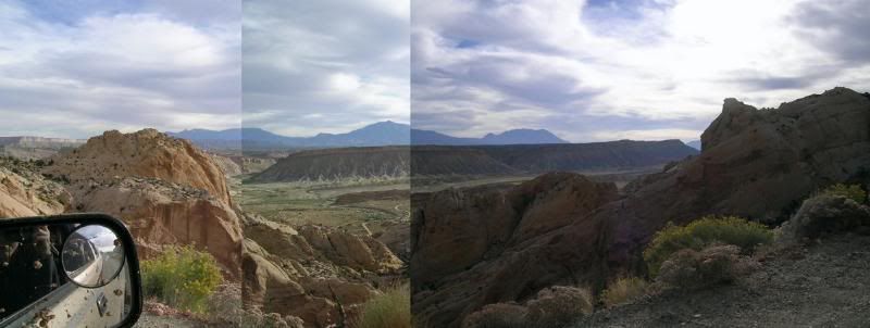
With a map my Dad had picked up from the Escalante ranger station a few months back and some exploring on Google Earth the night before, we decided to take "Nipple Bench Trail" from Big Water, and then connect to "Heads of the Creek Trail" with hopes of reaching "Hole in the Rock Road" via "Collet Canyon".
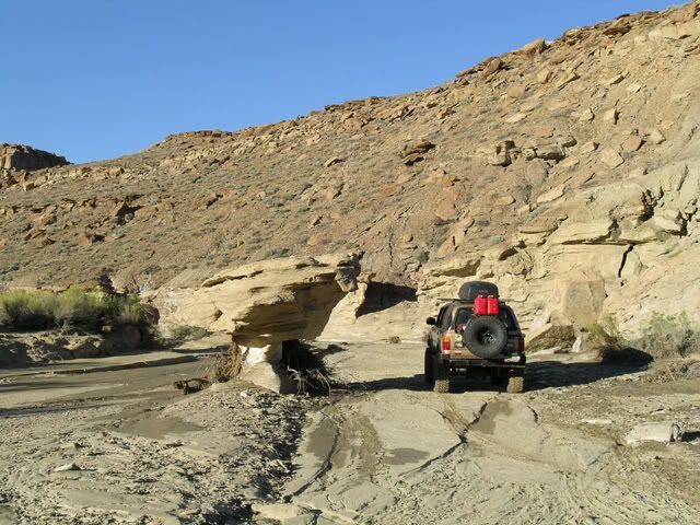
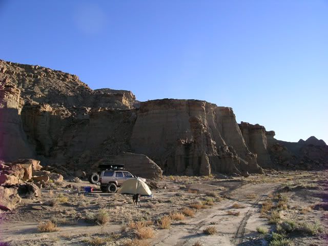
Turns out the first section of trail is basically a wash. Very fun... and zero traffic.
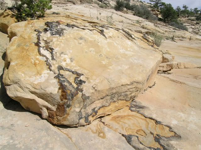
Balancing rock as big as the truck:
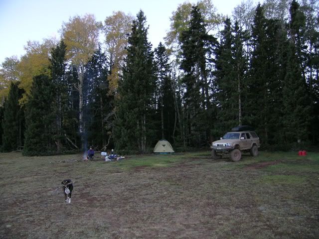
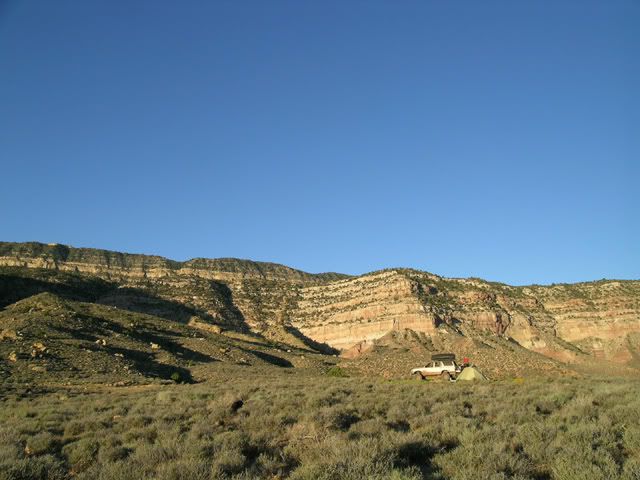
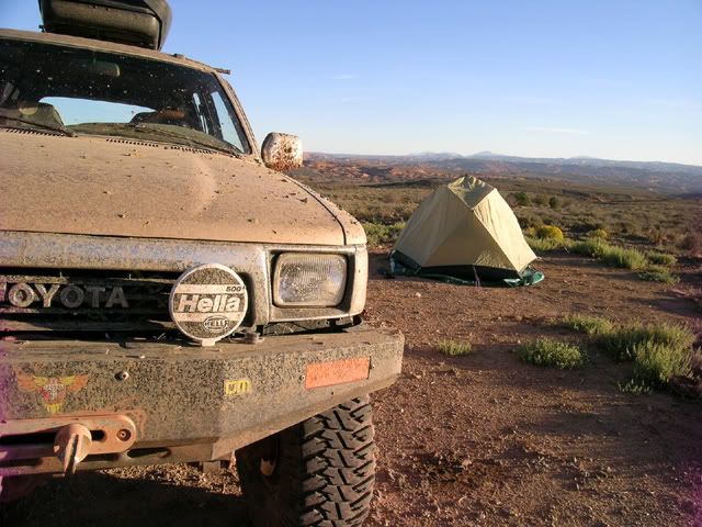
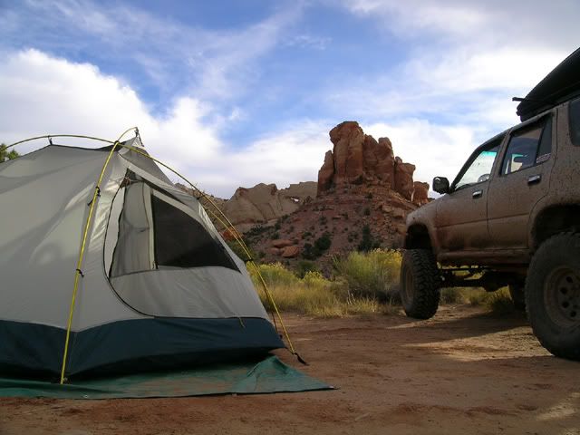
First camp site:
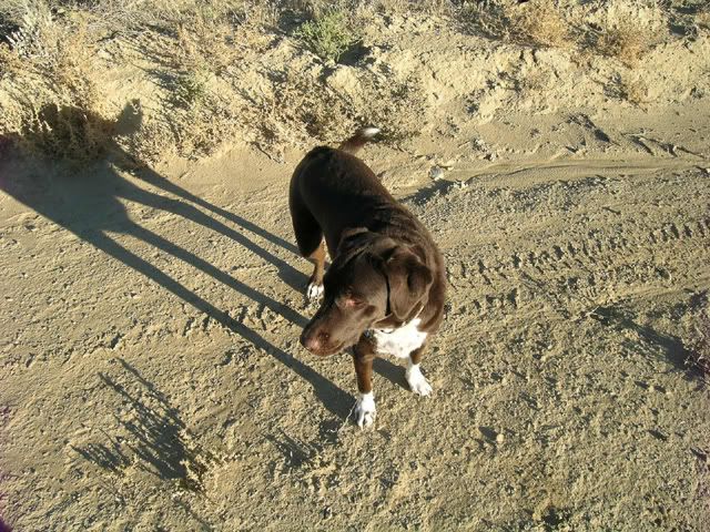
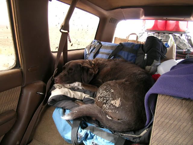
Dog checking things out:
Navigation was a bit difficult in the area, and lot's of previous erosion from the last storm made things interesting. We had first tracks on the whole route.
On to Day Two....
Day 1...
With a map my Dad had picked up from the Escalante ranger station a few months back and some exploring on Google Earth the night before, we decided to take "Nipple Bench Trail" from Big Water, and then connect to "Heads of the Creek Trail" with hopes of reaching "Hole in the Rock Road" via "Collet Canyon".
Turns out the first section of trail is basically a wash. Very fun... and zero traffic.
Balancing rock as big as the truck:
First camp site:
Dog checking things out:
Navigation was a bit difficult in the area, and lot's of previous erosion from the last storm made things interesting. We had first tracks on the whole route.
On to Day Two....
Oct 1, 2007 | 10:19 PM
#2
Thread Starter
Contributing Member
Joined: Jun 2005
Posts: 3,415
Likes: 9
From: Phx, AZ
Day 2...
Plan was to connect "Heads of the Creek Trail" to "Collet Canyon" which would keep us out of civilization and make the long ride out "Hole in the Rock Road" that much shorter.
Some ruins on the way ( 37 27'31.21"N, 111 29'19.10"W):
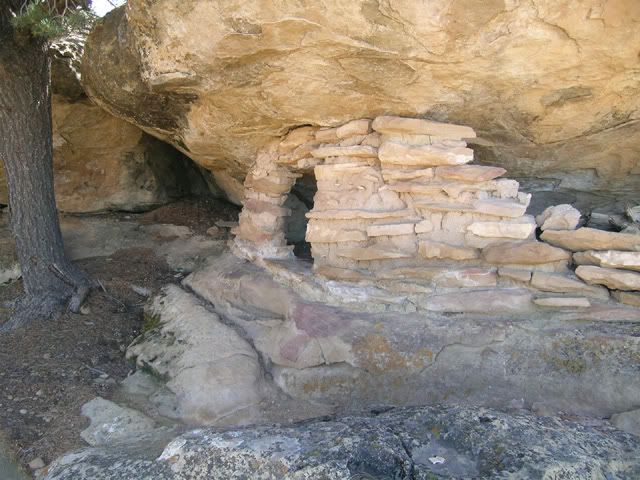
Pretty dang good use of a natural rock feature:
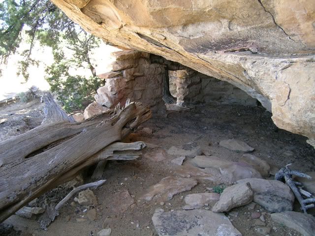
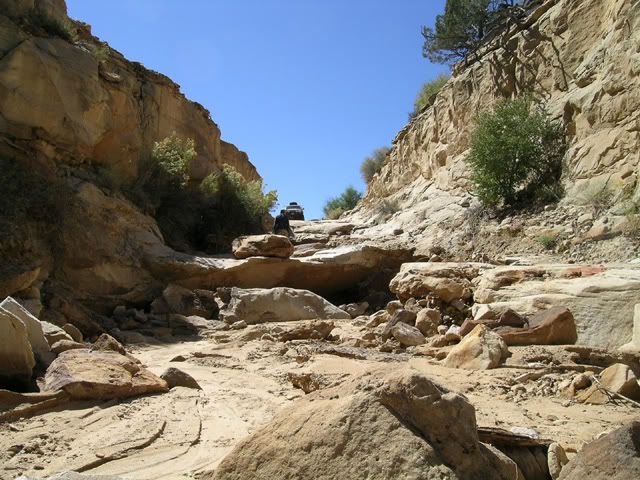
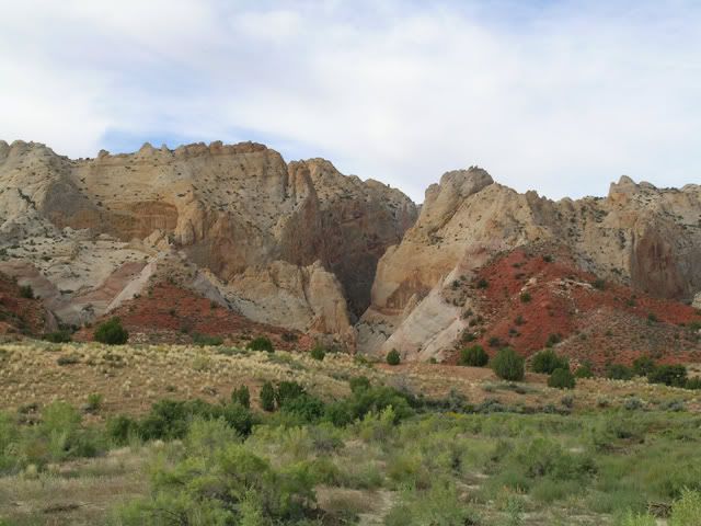
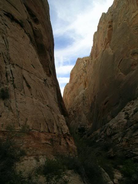
Just past the ruins we entered "Collet Canyon Trail". We were looking forward to the road as we had heard the views were great and it was a bit of a challenge.
Here is a shot I found of the trail entry a few years back:
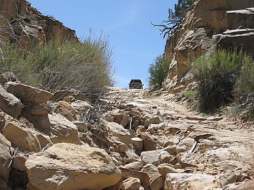
And here are some shots of what it looked like the day we showed up:
For scale, that board you see is a full 4x8 sheet of plywood :
:
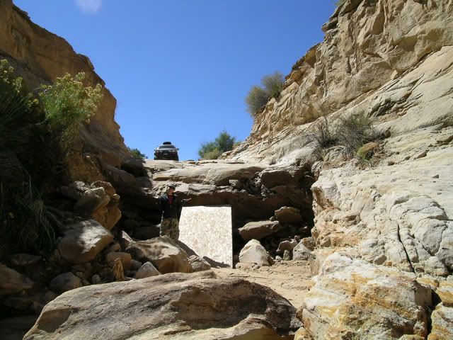
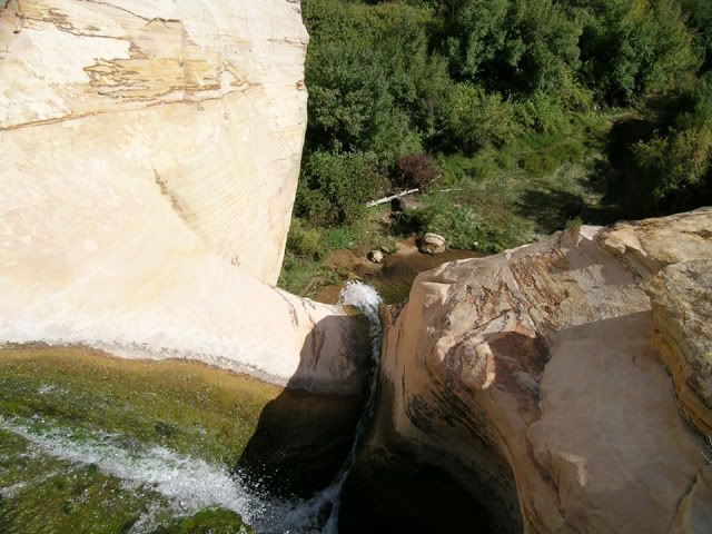
The road had been completely decimated by the last rains. Very disappointing. There was no way down. Well, maybe one way down... but I needed to keep my glass and try to have the body stay a little straight. We opted for the longer route to Escalante and then up into the mountain behind.
Camping at 9,200 feet (dog bringing me a stick she was quite proud of):
Was pretty darn cold, but we did get to see several deer, one elk... and about six wild turkeys on the way up to the camp spot.
Day Three to follow the wagons....
Plan was to connect "Heads of the Creek Trail" to "Collet Canyon" which would keep us out of civilization and make the long ride out "Hole in the Rock Road" that much shorter.
Some ruins on the way ( 37 27'31.21"N, 111 29'19.10"W):
Pretty dang good use of a natural rock feature:
Just past the ruins we entered "Collet Canyon Trail". We were looking forward to the road as we had heard the views were great and it was a bit of a challenge.
Here is a shot I found of the trail entry a few years back:
And here are some shots of what it looked like the day we showed up:
For scale, that board you see is a full 4x8 sheet of plywood
:The road had been completely decimated by the last rains. Very disappointing. There was no way down. Well, maybe one way down... but I needed to keep my glass and try to have the body stay a little straight. We opted for the longer route to Escalante and then up into the mountain behind.
Camping at 9,200 feet (dog bringing me a stick she was quite proud of):
Was pretty darn cold, but we did get to see several deer, one elk... and about six wild turkeys on the way up to the camp spot.
Day Three to follow the wagons....
Last edited by Elvota; Oct 1, 2007 at 10:51 PM.
Oct 1, 2007 | 10:20 PM
#3
Thread Starter
Contributing Member
Joined: Jun 2005
Posts: 3,415
Likes: 9
From: Phx, AZ
Day 3....
Wanted to head out to the end of "Hole in the Rock" road and see where the Mormon pioneers had lowered their wagons over the cliff face to continue on their journeys. This is the road that stopped us before when my exhaust failed. For those YT regulars out there, my infamous "peach can" exhaust fix was duly noted.
"Hole in the Rock" is a very, very, very long road. Simple enough, 2WD the whole way with a bit of slickrock at the end for fun. Lot's of good scenery along the way though.
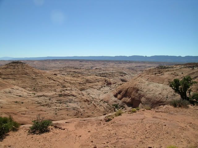
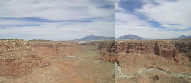
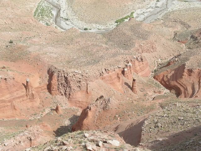
Canyon off of side road to Egypt. Couldn't even see the bottom:
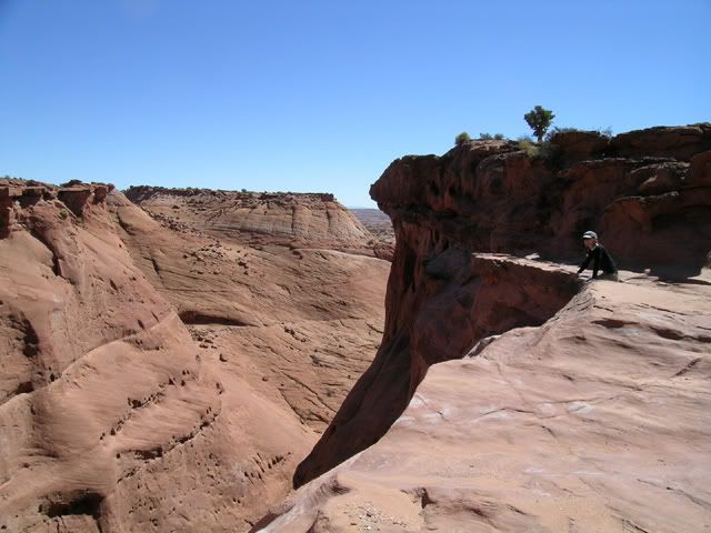
General view in the same area:
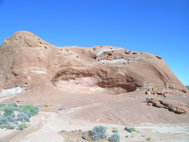
Almost at the end you come across "Dance Hall Rock". Where the early pioneers actually played their instruments and held dances. The acoustics of the natural bowl are pretty impressive.
No performers this day:
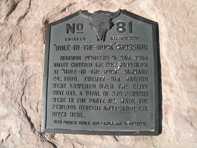
Just after "Dance Hall" you finally reach the end of the road. 50 miles on dirt... but worth the trip. "Hole in the Rock" is amazing to see in person once you realize what was accomplished there.
Plaque explaining it all (1880... there wasn't even Marlin Crawlers back then :
:
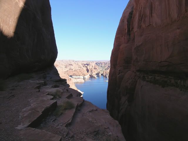
The route itself:
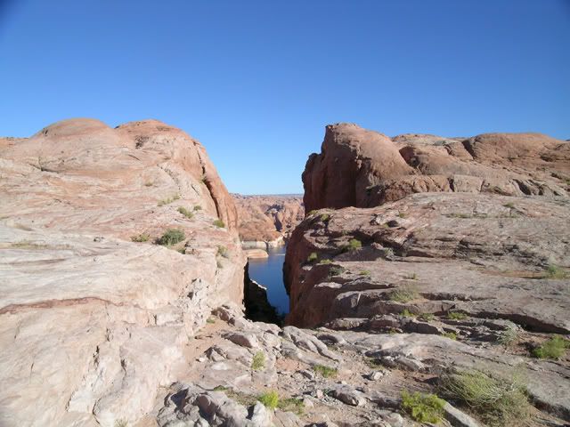
Lake Powell below:
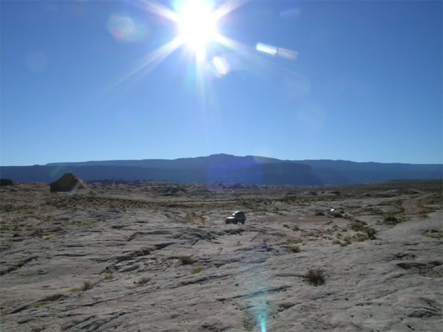
Slickrock parking area... with just one solitary Toyota:
Decided to camp off "Hole in the Rock Road" just where "50 Mile Bench" heads up the bluff. That looks like a great trail which we will have to hit next time.
"50 Mile Bench" in the background:
Great view (oh... and some pretty good scenery in the background as well):
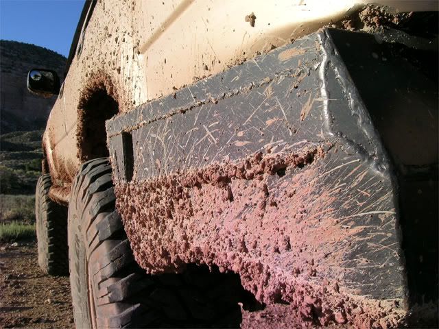
After 3 days in various Utah mud and dust... I noticed I had quite the art project going on my 4Runner.
Perfect coverage:
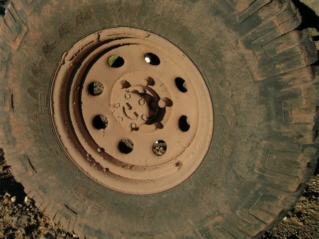
Multicolor:
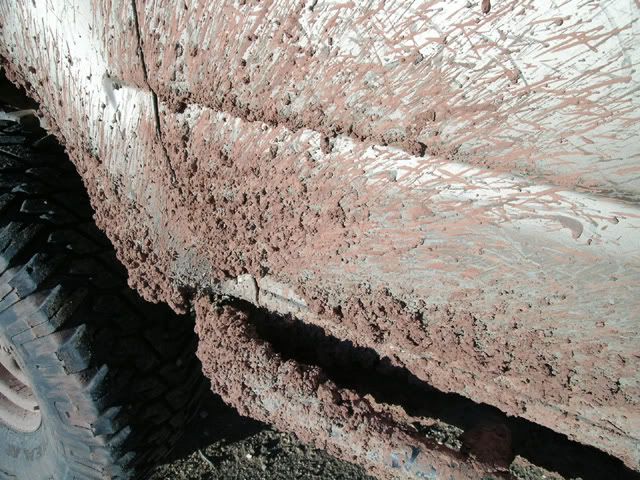
Bumper changing shape:
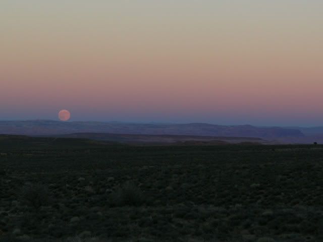
Sun began to set and then the moon popped up just perfectly. Was a pretty amazing evening.
Daylit moon:
Day Four... slots and waterfalls...
Wanted to head out to the end of "Hole in the Rock" road and see where the Mormon pioneers had lowered their wagons over the cliff face to continue on their journeys. This is the road that stopped us before when my exhaust failed. For those YT regulars out there, my infamous "peach can" exhaust fix was duly noted.
"Hole in the Rock" is a very, very, very long road. Simple enough, 2WD the whole way with a bit of slickrock at the end for fun. Lot's of good scenery along the way though.
Canyon off of side road to Egypt. Couldn't even see the bottom
:General view in the same area:
Almost at the end you come across "Dance Hall Rock". Where the early pioneers actually played their instruments and held dances. The acoustics of the natural bowl are pretty impressive.
No performers this day:
Just after "Dance Hall" you finally reach the end of the road. 50 miles on dirt... but worth the trip. "Hole in the Rock" is amazing to see in person once you realize what was accomplished there.
Plaque explaining it all (1880... there wasn't even Marlin Crawlers back then
:The route itself:
Lake Powell below:
Slickrock parking area... with just one solitary Toyota
:Decided to camp off "Hole in the Rock Road" just where "50 Mile Bench" heads up the bluff. That looks like a great trail which we will have to hit next time.
"50 Mile Bench" in the background:
Great view (oh... and some pretty good scenery in the background as well):
After 3 days in various Utah mud and dust... I noticed I had quite the art project going on my 4Runner.
Perfect coverage:
Multicolor:
Bumper changing shape:
Sun began to set and then the moon popped up just perfectly. Was a pretty amazing evening.
Daylit moon:
Day Four... slots and waterfalls...
Oct 1, 2007 | 10:20 PM
#4
Thread Starter
Contributing Member
Joined: Jun 2005
Posts: 3,415
Likes: 9
From: Phx, AZ
Day 4...Part Uno...
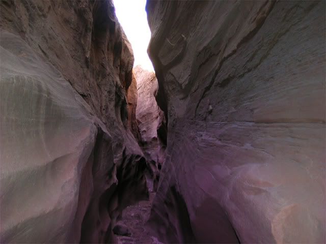
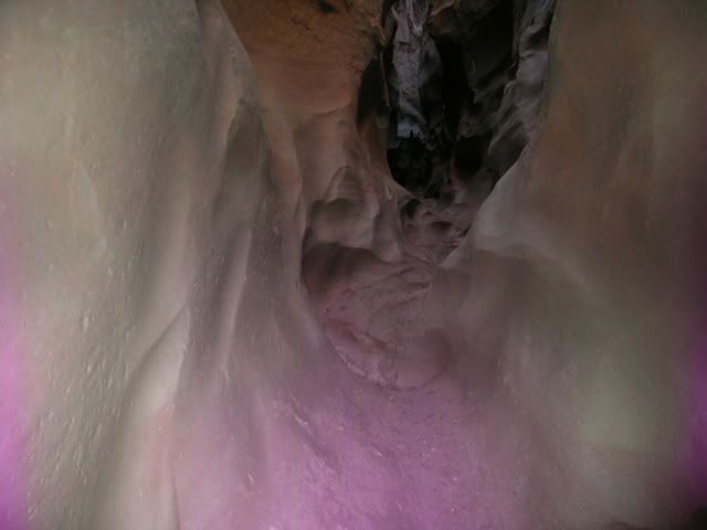
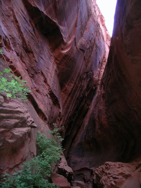
Headed to "Spooky" and "Peekaboo" trail head to do some slot canyon exploring with the dog. Unfortunately, we got a little lost on an unnamed side canyon, but still had some fun.
Weird thing was the digital camera started acting funny... but we didn't realize until we got home. Added some odd color to the photos we snapped. Kind of makes them interesting though. All the purple isn't natural... maybe we were in "Spooky" slot after all. Ooooh... scary.
Getting tighter:
Girl having fun:
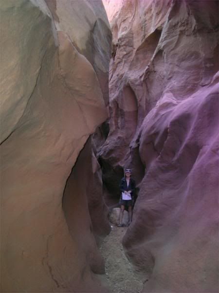
You want me to go through there??:
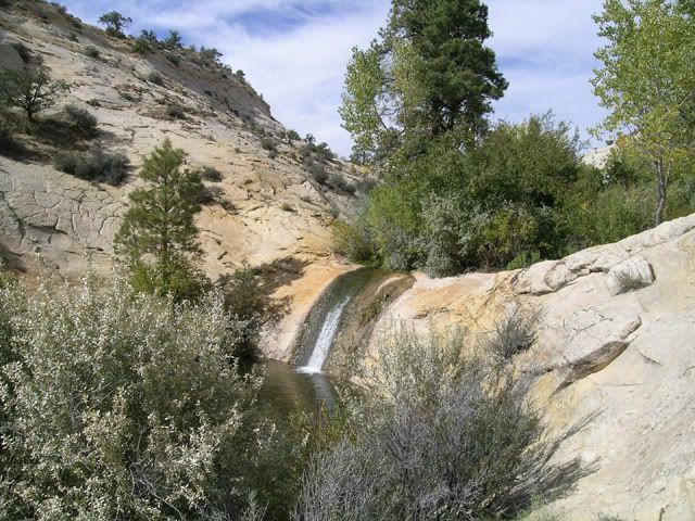
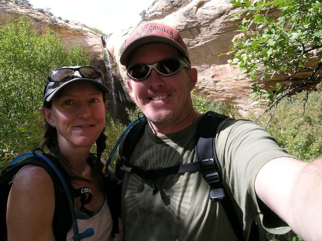
It was a struggle getting the dog over and through some sections of the canyon. She was bushed by the time we got out. Decided to head North from Escalante and hike "Upper Calf Creek Falls".
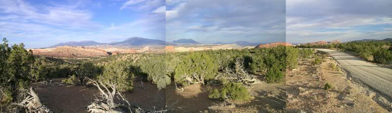
Terribly pieced together pano of the trail head:
Well worth the steep hike down:
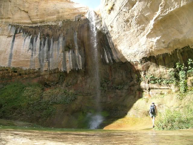
Not a soul here but us:
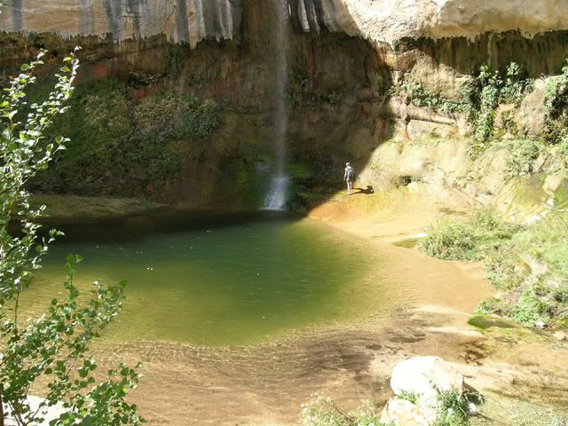
Once you've had your fill at the bottom, a shorter secondary hike will let you look down from the top.
Long way down:
"Just a few more steps backwards for the perfect shot...":
Upper swimming hole:
Unique rock markings:
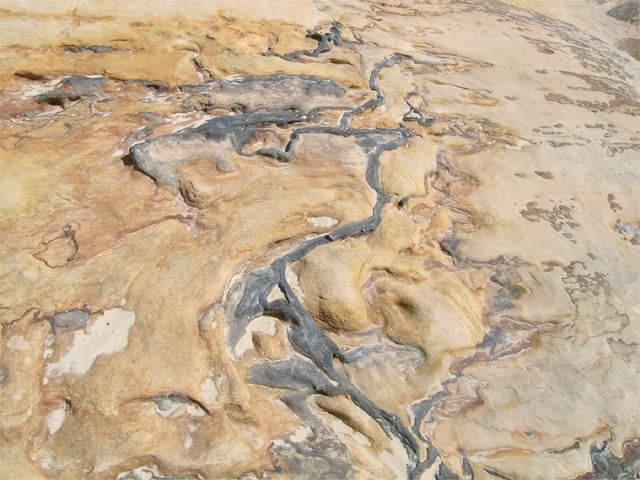
This one looks like the boulder itself is rusting:
The hike out is STEEEP... but I finally made it. Plan was to travel on through Boulder and into "Capitol Reef" park...
Headed to "Spooky" and "Peekaboo" trail head to do some slot canyon exploring with the dog. Unfortunately, we got a little lost on an unnamed side canyon, but still had some fun.
Weird thing was the digital camera started acting funny... but we didn't realize until we got home. Added some odd color to the photos we snapped. Kind of makes them interesting though. All the purple isn't natural... maybe we were in "Spooky" slot after all. Ooooh... scary.
Getting tighter:
Girl having fun:
You want me to go through there??:
It was a struggle getting the dog over and through some sections of the canyon. She was bushed by the time we got out. Decided to head North from Escalante and hike "Upper Calf Creek Falls".
Terribly pieced together pano of the trail head:
Well worth the steep hike down:
Not a soul here but us
:Once you've had your fill at the bottom, a shorter secondary hike will let you look down from the top.
Long way down:
"Just a few more steps backwards for the perfect shot...":
Upper swimming hole:
Unique rock markings:
This one looks like the boulder itself is rusting:
The hike out is STEEEP... but I finally made it. Plan was to travel on through Boulder and into "Capitol Reef" park...
Last edited by Elvota; Oct 1, 2007 at 10:24 PM.
Oct 1, 2007 | 10:21 PM
#5
Thread Starter
Contributing Member
Joined: Jun 2005
Posts: 3,415
Likes: 9
From: Phx, AZ
Day 4... Part Dos...
After finding an amazing well equipped gas station/ mini-mart (GPS 37 53'57.07"N, 111 26'19.07"W) in Boulder, we were off down "Long Canyon" and onto the "Burr Trail"... both simple 2WD dirt or asphalt roads with some amazing views along the way.
Entering "Long Canyon":
Slot just off the road:
Random view:
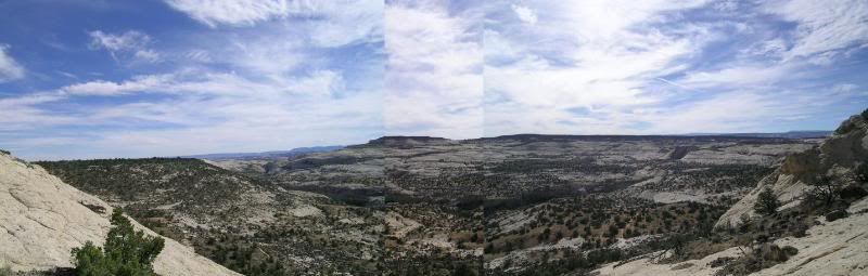
After exiting "Long Canyon" and some amazing views, you enter "Capitol Reef Park" and are simply blown away as you come across the top of a rise. This mangled pano doesn't do the scenery justice.
Best view you'll probably ever see from a 2WD dirt road:
The "Capitol Reef" area is truly amazing. Definitely plan to go back for some more exploring. Found a cool place to camp with a natural arch (more like a window) in the background. Many coyote sang us to sleep that night. Well... the dog didn't sleep much... she wanted to go outside and play with the other "dogs"
Can you see the arch?:
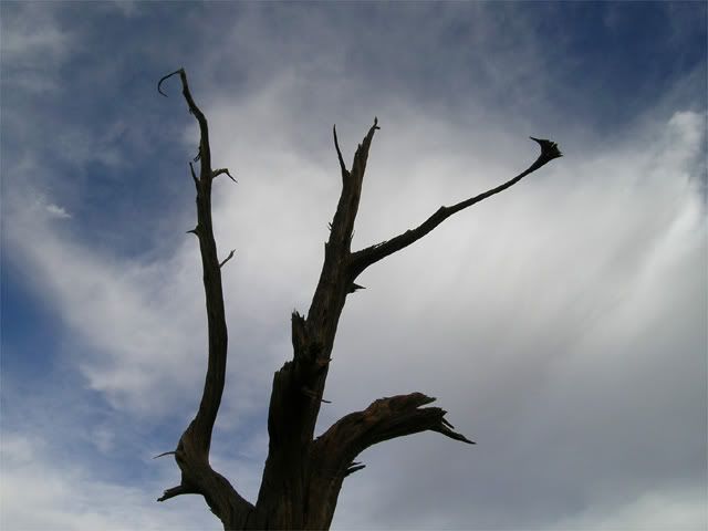
A few artsy pics:
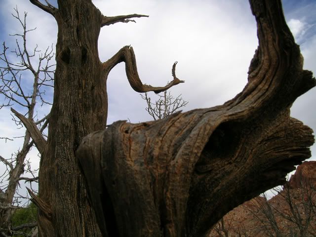
What tales trees could tell...:
On to the final day. Bonus ferry footage included.
After finding an amazing well equipped gas station/ mini-mart (GPS 37 53'57.07"N, 111 26'19.07"W
) in Boulder, we were off down "Long Canyon" and onto the "Burr Trail"... both simple 2WD dirt or asphalt roads with some amazing views along the way.Entering "Long Canyon":
Slot just off the road:
Random view:
After exiting "Long Canyon" and some amazing views, you enter "Capitol Reef Park" and are simply blown away as you come across the top of a rise. This mangled pano doesn't do the scenery justice.
Best view you'll probably ever see from a 2WD dirt road:
The "Capitol Reef" area is truly amazing. Definitely plan to go back for some more exploring. Found a cool place to camp with a natural arch (more like a window) in the background. Many coyote sang us to sleep that night. Well... the dog didn't sleep much... she wanted to go outside and play with the other "dogs"
Can you see the arch?:
A few artsy pics:
What tales trees could tell...:
On to the final day. Bonus ferry footage included.
Last edited by Elvota; Oct 1, 2007 at 10:52 PM.
Oct 1, 2007 | 10:21 PM
#6
Thread Starter
Contributing Member
Joined: Jun 2005
Posts: 3,415
Likes: 9
From: Phx, AZ
Day 5...
Plan was to finish off the "Burr Trail" and hit the ferry across Lake Powell, then down through Kayenta with hopefully enough time to eat at Oregano's in Flagstaff. I was already getting hungry.
Famous "Burr Trail" switchbacks. Windey little suckers:
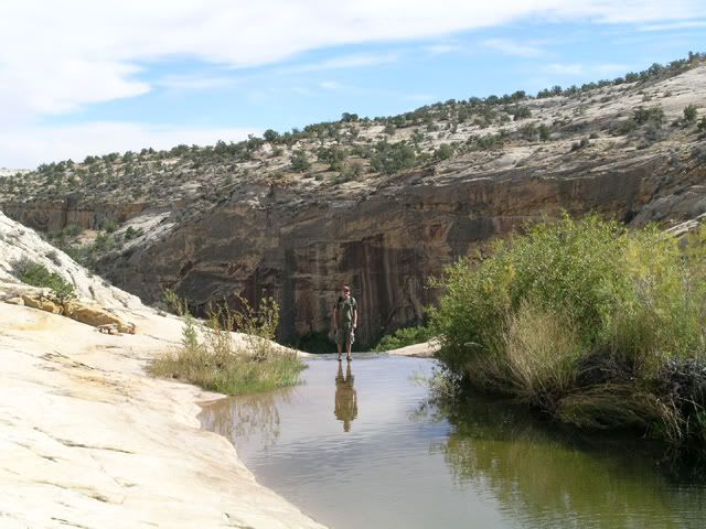
Saw a trail head... and had to hike it. The approach to "Surprise Canyon" (37 50'17.83"N, 110 59'19.68"W):
Very, very tall walls:
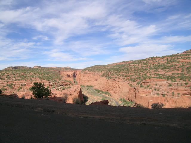
Back on the road, views of the scenery continually astound. Then a canyon which in some ways rivals the Grand Canyon opens up on your left.
Looking into and across "Clay Canyon":
Interesting cap stone pillar erosion way down at the bottom:
This entire area had been ravaged by recent rains. Creeks had overflowed their banks by considerable margins and left mud and debris everywhere. Much of the designated camping spots at Lake Powell were closed. We were lucky we hadn't come a week earlier, as the main road had been shut down from damage.
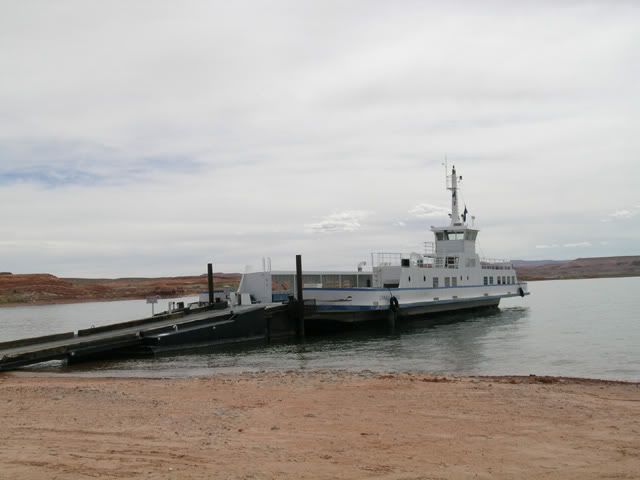
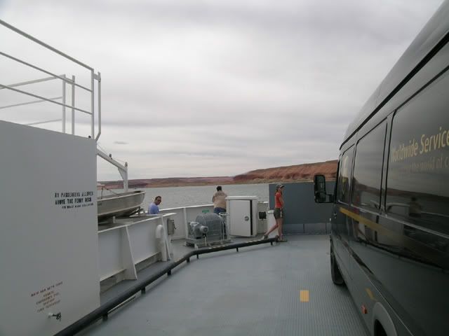
Finally at Powell, we learned the ferry left on every odd hour. It was 12:30, so we lucked out and drove down with 15 minutes to spare.
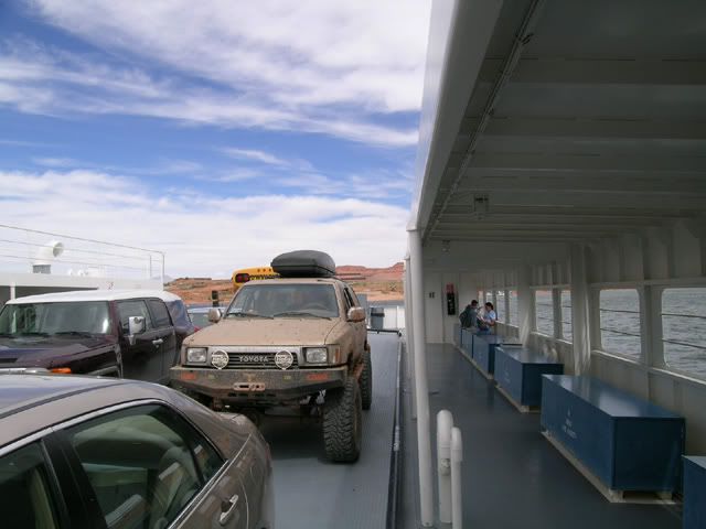
Waiting to board:
One of these trucks is not like the others :
:
Trusty GPS says we sailed at 9.2 MPH... :
Once across, we found a high mesa for lunch:
Dog... was... done...:
... and so were we... basically. After lunch it was on through Mexican Hat, then Monument Valley... Kayenta and into Flagstaff. Oregano's was slammed as usual, but for some reason a table for 2 was open and we just walked right in. Perhaps the Gods of the Road where smiling upon us with respect for our travels.
1,200 miles, at least 225 in dirt... and never broke out a single tool.
Was a good trip. I've got GPS routes and waypoints of hikes and camping if anyone is interested. Every time we go to Southern Utah we find something even more amazing. Highly recommend others make the trip.
See you on the trails.
Plan was to finish off the "Burr Trail" and hit the ferry across Lake Powell, then down through Kayenta with hopefully enough time to eat at Oregano's in Flagstaff. I was already getting hungry.
Famous "Burr Trail" switchbacks. Windey little suckers:
Saw a trail head... and had to hike it. The approach to "Surprise Canyon" (37 50'17.83"N, 110 59'19.68"W):
Very, very tall walls:
Back on the road, views of the scenery continually astound. Then a canyon which in some ways rivals the Grand Canyon opens up on your left.
Looking into and across "Clay Canyon":
Interesting cap stone pillar erosion way down at the bottom:
This entire area had been ravaged by recent rains. Creeks had overflowed their banks by considerable margins and left mud and debris everywhere. Much of the designated camping spots at Lake Powell were closed. We were lucky we hadn't come a week earlier, as the main road had been shut down from damage.
Finally at Powell, we learned the ferry left on every odd hour. It was 12:30, so we lucked out and drove down with 15 minutes to spare.
Waiting to board:
One of these trucks is not like the others
:Trusty GPS says we sailed at 9.2 MPH... :
Once across, we found a high mesa for lunch:
Dog... was... done...
:... and so were we... basically. After lunch it was on through Mexican Hat, then Monument Valley... Kayenta and into Flagstaff. Oregano's was slammed as usual, but for some reason a table for 2 was open and we just walked right in. Perhaps the Gods of the Road where smiling upon us with respect for our travels.
1,200 miles, at least 225 in dirt... and never broke out a single tool.
Was a good trip. I've got GPS routes and waypoints of hikes and camping if anyone is interested. Every time we go to Southern Utah we find something even more amazing. Highly recommend others make the trip.
See you on the trails.
Last edited by Elvota; Oct 1, 2007 at 10:56 PM.
Trending Topics
Oct 2, 2007 | 06:22 AM
#9
Registered User
Joined: Aug 2006
Posts: 1,691
Likes: 0
From: Colorado Springs, Co
Day 2...
And here are some shots of what it looked like the day we showed up:
For scale, that board you see is a full 4x8 sheet of plywood:
The road had been completely decimated by the last rains. Very disappointing. There was no way down. Well, maybe one way down... but I needed to keep my glass and try to have the body stay a little straight. We opted for the longer route to Escalante and then up into the mountain behind.
Day Three to follow the wagons....
And here are some shots of what it looked like the day we showed up:
For scale, that board you see is a full 4x8 sheet of plywood
:The road had been completely decimated by the last rains. Very disappointing. There was no way down. Well, maybe one way down... but I needed to keep my glass and try to have the body stay a little straight. We opted for the longer route to Escalante and then up into the mountain behind.
Day Three to follow the wagons....
Just kidding. After spending 11 months in Southern Utah I learned that rain can make good roads turn to crap and that flash floods suck.
Looks like you guys had a good time. Those slot canyons make for some interesting photo's. Just watch out for flash floods in the those things because you'd be screwed.
Oct 2, 2007 | 06:55 AM
#10
Contributing Member
Joined: Apr 2004
Posts: 5,464
Likes: 6
From: Arvada, Colorado
Oh man, that is one of my favorite places. Your camp out there on Hole in the Rock was damn close to the spot we found a couple years ago.
Those slot canyons are beautiful, aren't they? One of my all time favorite hikes. Even more impressive, IMO, was the fact that mormons drug giant wagons up that cut. That is some will power. When we were there, my brother and I hiked a ways down. It was almost impossible for us, and we were just two guys. With a wagon and horses, I couldn't believe it.
Those slot canyons are beautiful, aren't they? One of my all time favorite hikes. Even more impressive, IMO, was the fact that mormons drug giant wagons up that cut. That is some will power. When we were there, my brother and I hiked a ways down. It was almost impossible for us, and we were just two guys. With a wagon and horses, I couldn't believe it.
 Oct 2, 2007 | 08:37 AM
#12
Registered User
Joined: Aug 2004
Posts: 976
Likes: 0
From: AZ
Very cool and impressive scenery. Thanks for sharing the photos and report.
Now if the mormons were able to lower their wagons over the cliff, you'd think you would be able to 'lower' your 4runner over that ledge??
Now if the mormons were able to lower their wagons over the cliff, you'd think you would be able to 'lower' your 4runner over that ledge??
Oct 2, 2007 | 09:04 AM
#13
Contributing Member
Joined: Dec 2003
Posts: 3,659
Likes: 0
From: Between a rock and a hard place, AZ
Elvota, this ranks among the best trail reports I've ever seen on here. Excellent work. I grew up spending my family vacations up in the Zion area, and we would often go over towards Escalante, and hike Bryce Canyon at least once a year. I love that area. I've never wheeled there...yet. A few more mods, and it's on, though.
Great pics, great report. You, my friend, get an A+!
Great pics, great report. You, my friend, get an A+!
Oct 2, 2007 | 09:30 AM
#14
Thread Starter
Contributing Member
Joined: Jun 2005
Posts: 3,415
Likes: 9
From: Phx, AZ
Good point... I need to stop being such a whimp.
The whole area is really amazing. To many slot canyons to count. Will probably go back next year to find more. Not much rock crawling around, but scenery more than makes up for it.
I agree about "Hole in the Rock"... no pictures truly do justice to the determination it must have took to get up or down the cliff.
We thought about getting in, but remembered your story. Although it might have been cool to wrestle a snake Tarzan style in the middle of the pond... assuming I would have survived.
Good point... I did have a winch. Should have given it a try.
This would be a perfect area to get that new FJ out exploring by the way, not that you don't already have enough terrain in AZ.
Woah... we are getting graded here on YT?? That's a bit more pressure then I needed.
I don't recall the grade on my last report...
https://www.yotatech.com/forums/f100...alante-113982/
... but that was a really great trip as well.
It's funny, when you are in Southern Utah it's like no one else has ever been there... as we almost never see a soul. It's nice to know a lot of YT'rs are getting out and seeing the area.
Those slot canyons are beautiful, aren't they? One of my all time favorite hikes. Even more impressive, IMO, was the fact that mormons drug giant wagons up that cut. That is some will power. When we were there, my brother and I hiked a ways down. It was almost impossible for us, and we were just two guys. With a wagon and horses, I couldn't believe it.
I agree about "Hole in the Rock"... no pictures truly do justice to the determination it must have took to get up or down the cliff.
This would be a perfect area to get that new FJ out exploring by the way, not that you don't already have enough terrain in AZ.
Woah... we are getting graded here on YT?? That's a bit more pressure then I needed.
I don't recall the grade on my last report...
https://www.yotatech.com/forums/f100...alante-113982/
... but that was a really great trip as well.
It's funny, when you are in Southern Utah it's like no one else has ever been there... as we almost never see a soul. It's nice to know a lot of YT'rs are getting out and seeing the area.
Oct 2, 2007 | 09:46 AM
#15
Contributing Member
Joined: Dec 2003
Posts: 3,659
Likes: 0
From: Between a rock and a hard place, AZ
I don't recall the grade on my last report...
https://www.yotatech.com/forums/f100...alante-113982/
... but that was a really great trip as well.
https://www.yotatech.com/forums/f100...alante-113982/
... but that was a really great trip as well.
I have been on Hell's Backbone loop before. A very fun drive!
Oct 2, 2007 | 09:55 AM
#16
Registered User
Joined: Aug 2004
Posts: 976
Likes: 0
From: AZ
Next summer I would like to make it up to Southern Utah in the FJ - explore Escalante and fly fish the Boulder Mtns and Panguitch area...
Oct 2, 2007 | 02:15 PM
#18
Registered User
Joined: Apr 2007
Posts: 104
Likes: 0
From: Missoula, MT
Great photos, I've got to get back there!
Oct 2, 2007 | 03:48 PM
#19
Elvota: Awesome write up, even read the one about the peach can muffler fix. That is some beautiful scenery. I think I just found out where I will be spending part of my 8 week sabbatical next summer. Will be sending a PM for some coordinates. For that long of trip I think that I will take the Taco...
Thanks,
Robb
Thanks,
Robb

Thread
Thread Starter
Forum
Replies
Last Post
ashamsuddin
General Vehicle Related Topics (Non Year Related)
17
Jul 22, 2024 03:59 AM
Brodetski
86-95 Trucks & 4Runners (Build-Up Section)
0
Sep 30, 2015 11:50 PM


