
Where to find Southern UTAH Info?
 May 2, 2007 | 02:30 PM
#1
Thread Starter
Contributing Member
Joined: Jun 2006
Posts: 806
Likes: 0
I am doing a trip to monument valley, mexican hat etc over memorial day weekend. I am doing a lot of my research just by searching on this site!!
Are there any good sources for more info to help plan my trip??
Are there any good maps or better yet MAP DOWNLOADS FOR MY LOWRANCE EXPEDITION C?????
Are there any good sources for more info to help plan my trip??
Are there any good maps or better yet MAP DOWNLOADS FOR MY LOWRANCE EXPEDITION C?????
May 2, 2007 | 03:25 PM
#2
Registered User
Joined: Aug 2006
Posts: 1,691
Likes: 2
From: Colorado Springs, Co
I was in that area for a bit a couple of years ago. Head up the mokee dugway to over see the goosenecks - last I was up there in 2002 they had a geocaching (sp) spot.
You can get out to lake powell fromt that area but from my understanding if you get stuck out there your screwed. (no one for miles)
You can get to the 4 corners monument a back way but it's kind of difficult to explain (you avoid paying ). Some of the backroads down there are fun for high speed.
Give me some time to see if I can come up with anything else.
Edit *Mexican Hat there isn't much there"
http://www.utah.com/monumentvalley/
http://www.4x4now.com/trutse.htm
ATV map but gives you an idea:
http://www.otbpmaps.com/Custom%20Map...0Safari%20Maps
You can get out to lake powell fromt that area but from my understanding if you get stuck out there your screwed. (no one for miles)
You can get to the 4 corners monument a back way but it's kind of difficult to explain (you avoid paying
). Some of the backroads down there are fun for high speed. Give me some time to see if I can come up with anything else.
Edit *Mexican Hat there isn't much there"
http://www.utah.com/monumentvalley/
http://www.4x4now.com/trutse.htm
ATV map but gives you an idea:
http://www.otbpmaps.com/Custom%20Map...0Safari%20Maps
Last edited by wormhole; May 2, 2007 at 03:34 PM.
May 2, 2007 | 07:38 PM
#3
Contributing Member
Joined: Jun 2005
Posts: 3,415
Likes: 9
From: Phx, AZ
Goosenecks is worth the short drive to see.
A really big horseshoe bend in the river...

Mexican Hat is just a rock, that looks like a Mexican sitting with a big hat.
See....

What D'Ya mean we're in the way?
Also, XPLORx4 sent me this great link on my Escalante Trip thread:
http://www.americansouthwest.net/
Seems like there is a ton of info there.
A really big horseshoe bend in the river...
Mexican Hat is just a rock, that looks like a Mexican sitting with a big hat.
See....
What D'Ya mean we're in the way?
Also, XPLORx4 sent me this great link on my Escalante Trip thread:
http://www.americansouthwest.net/
Seems like there is a ton of info there.
May 2, 2007 | 08:27 PM
#4
Thread Starter
Contributing Member
Joined: Jun 2006
Posts: 806
Likes: 0
Thanks wormhole! I just checked out those sites. What did you use for a map?
Elvota, You head is always in the way of the scenery! and what did YOU use for a map?
I was thinking about trying to 1 get my map create software to actually work for my expedition C and then get one of the offroad atlas's for utah...?
Elvota, You head is always in the way of the scenery! and what did YOU use for a map?
I was thinking about trying to 1 get my map create software to actually work for my expedition C and then get one of the offroad atlas's for utah...?
May 2, 2007 | 09:20 PM
#5
Registered User
Joined: Aug 2006
Posts: 1,691
Likes: 2
From: Colorado Springs, Co
A bunch of topo maps and san juan county maps.
The funny thing is that I haven't been down there for about 4 years and I still remember most of the roads around Montezuma Creek and few around mexican hat like that back of my hand. That's what I get for being in that area for 11 months (LDS missionary if your wondering).
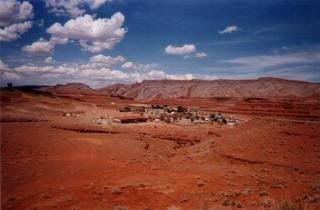
There is another area that you can visit if you can find it because it's not really marked on a map. Well, it is in a since that it calls it out but it doesn't show the road. It's called Poncho's House, it's a bunch of indian dwellings along side a cliff. You have to park at the top and walk down to it. I remember right it's somewhere between a 1/2 - 1 mile of a walk.
Poncho's House:

If you walk it over towards Bluff there are some cliff dwellings over there as well. If you head towards Montzuma Creek right after you pass a catholic mission there will be a turn off to the right (right before a curve) and take that to a parking spot and cross the foot bridge. You'll see some dwellings off in the distance that are pretty interesting as well.
** Just remember there is Hoovenweep just NW of Montezuma Creek and North of Aneth. If you able to get a topo map or san juan country map. It's quicker to back gravel roads (used for the oil fields) than the regular. Plus, they are alot more fun. Valleyt of the Gods is right there around monument valley as well. (There is an enterance by the Mokee dugway). It's kind of dull but that's just me. Then there's bull frog passing/crossing just west of Blanding.
Hope this helps! If I can think of anything else I'll let you know. Go by one of the street stores/stand and eat a piece of fry bread with a little of salt. It's so good!!! Aslo check our some of the artwork. It's expensive but cool.
The funny thing is that I haven't been down there for about 4 years and I still remember most of the roads around Montezuma Creek and few around mexican hat like that back of my hand. That's what I get for being in that area for 11 months (LDS missionary if your wondering).
There is another area that you can visit if you can find it because it's not really marked on a map. Well, it is in a since that it calls it out but it doesn't show the road. It's called Poncho's House, it's a bunch of indian dwellings along side a cliff. You have to park at the top and walk down to it. I remember right it's somewhere between a 1/2 - 1 mile of a walk.
Poncho's House:
If you walk it over towards Bluff there are some cliff dwellings over there as well. If you head towards Montzuma Creek right after you pass a catholic mission there will be a turn off to the right (right before a curve) and take that to a parking spot and cross the foot bridge. You'll see some dwellings off in the distance that are pretty interesting as well.
** Just remember there is Hoovenweep just NW of Montezuma Creek and North of Aneth. If you able to get a topo map or san juan country map. It's quicker to back gravel roads (used for the oil fields) than the regular. Plus, they are alot more fun. Valleyt of the Gods is right there around monument valley as well. (There is an enterance by the Mokee dugway). It's kind of dull but that's just me. Then there's bull frog passing/crossing just west of Blanding.
Hope this helps! If I can think of anything else I'll let you know. Go by one of the street stores/stand and eat a piece of fry bread with a little of salt. It's so good!!! Aslo check our some of the artwork. It's expensive but cool.
Last edited by wormhole; May 2, 2007 at 10:00 PM.
May 2, 2007 | 09:56 PM
#6
Contributing Member
Joined: Jun 2005
Posts: 3,415
Likes: 9
From: Phx, AZ
Maps... I just got a standard atlas. It's pretty detailed, will show a fair amount of dirt roads and has lot's of general information.
http://www.benchmarkmaps.com/
I got one for AZ and one for UT at the Wide World of Maps (Frank Loyd Wright and Scottsdale). I have seen them at local bookstores as well though.
http://www.benchmarkmaps.com/
I got one for AZ and one for UT at the Wide World of Maps (Frank Loyd Wright and Scottsdale). I have seen them at local bookstores as well though.
May 2, 2007 | 11:17 PM
#7
Contributing Member
Joined: Sep 2005
Posts: 5,400
Likes: 0
From: Clear Lake City, TX
Hands down these are some of the best maps out there
http://www.ngmapstore.com/jump.jsp?i...GORY&itemID=54
And they are not just for National Parks but of much of the state (in sections of course)
Here are the state series maps for Utah:
http://www.ngmapstore.com/jump.jsp?i...54&iSubCat=115
I have almost every state series Map for Colorado and I rely heavily on them for wheeling trails!
Trending Topics
May 3, 2007 | 07:22 AM
#8
Thread Starter
Contributing Member
Joined: Jun 2006
Posts: 806
Likes: 0
A bunch of topo maps and san juan county maps.
The funny thing is that I haven't been down there for about 4 years and I still remember most of the roads around Montezuma Creek and few around mexican hat like that back of my hand. That's what I get for being in that area for 11 months (LDS missionary if your wondering).
There is another area that you can visit if you can find it because it's not really marked on a map. Well, it is in a since that it calls it out but it doesn't show the road. It's called Poncho's House, it's a bunch of indian dwellings along side a cliff. You have to park at the top and walk down to it. I remember right it's somewhere between a 1/2 - 1 mile of a walk.
Poncho's House:
If you walk it over towards Bluff there are some cliff dwellings over there as well. If you head towards Montzuma Creek right after you pass a catholic mission there will be a turn off to the right (right before a curve) and take that to a parking spot and cross the foot bridge. You'll see some dwellings off in the distance that are pretty interesting as well.
** Just remember there is Hoovenweep just NW of Montezuma Creek and North of Aneth. If you able to get a topo map or san juan country map. It's quicker to back gravel roads (used for the oil fields) than the regular. Plus, they are alot more fun. Valleyt of the Gods is right there around monument valley as well. (There is an enterance by the Mokee dugway). It's kind of dull but that's just me. Then there's bull frog passing/crossing just west of Blanding.
Hope this helps! If I can think of anything else I'll let you know. Go by one of the street stores/stand and eat a piece of fry bread with a little of salt. It's so good!!! Aslo check our some of the artwork. It's expensive but cool.
I'm going to see if I can find it on one of the maps I buy today. I like seeing ruins when there isn't a trail with a hand rail and a bus parked nearby!
I may ask a couple more questions. Thanks!
May 3, 2007 | 07:23 AM
#9
Thread Starter
Contributing Member
Joined: Jun 2006
Posts: 806
Likes: 0
Maps... I just got a standard atlas. It's pretty detailed, will show a fair amount of dirt roads and has lot's of general information.
http://www.benchmarkmaps.com/
I got one for AZ and one for UT at the Wide World of Maps (Frank Loyd Wright and Scottsdale). I have seen them at local bookstores as well though.
http://www.benchmarkmaps.com/
I got one for AZ and one for UT at the Wide World of Maps (Frank Loyd Wright and Scottsdale). I have seen them at local bookstores as well though.
May 3, 2007 | 07:24 AM
#10
Thread Starter
Contributing Member
Joined: Jun 2006
Posts: 806
Likes: 0
Hands down these are some of the best maps out there
http://www.ngmapstore.com/jump.jsp?i...GORY&itemID=54
And they are not just for National Parks but of much of the state (in sections of course)
Here are the state series maps for Utah:
http://www.ngmapstore.com/jump.jsp?i...54&iSubCat=115
I have almost every state series Map for Colorado and I rely heavily on them for wheeling trails!
http://www.ngmapstore.com/jump.jsp?i...GORY&itemID=54
And they are not just for National Parks but of much of the state (in sections of course)
Here are the state series maps for Utah:
http://www.ngmapstore.com/jump.jsp?i...54&iSubCat=115
I have almost every state series Map for Colorado and I rely heavily on them for wheeling trails!
May 3, 2007 | 12:37 PM
#11

Registered User
Joined: Mar 2007
Posts: 21
Likes: 0
If you're a member of AAA, I highly recommend using their "Indian Country" map, which pretty much covers the 4 corners region.
I took a trip through Monument Valley, 4 corners, etc. a few years ago. It was awesome. I used to have a whole bunch of photos from that trip hosted online, but the site closed my account when it went to a fee-based structure.
You can easily do Monument Valley, Mexican Hat, Goosenecks, Mokee Dugway, Muley Point, Valley of the Gods, and 4 Corners in 1 day if you start early from Kayenta.
If you have an extra day, I would highly recommend visiting Page, AZ, and checking out the Horseshoe Bend (marked only by a "Scenic Viewpoint" sign about 2 miles south of Page on Hwy 89) Buckskin Gulch and Lower Antelope Canyon.
Visit americansouthwest.net and use google to research more details on all of those places.
Last edited by XPLORx4; May 3, 2007 at 12:42 PM.
May 3, 2007 | 02:07 PM
#12
Thread Starter
Contributing Member
Joined: Jun 2006
Posts: 806
Likes: 0
Thanks! now that I know what names to search for I'm getting a better mental picture of the area.
MOAB is so over talked about that I'm just starting to realize how huge and cool looking escalante is.
OPINIONS: Try and see as much of escalante over a 4 day weekend or do the southeastern area I;ve been talking about. or some combo of the two?? What do I do!
MOAB is so over talked about that I'm just starting to realize how huge and cool looking escalante is.
OPINIONS: Try and see as much of escalante over a 4 day weekend or do the southeastern area I;ve been talking about. or some combo of the two??
What do I do!
May 3, 2007 | 02:41 PM
#13
Registered User
Joined: Oct 2006
Posts: 366
Likes: 0
From: Some where in Utah
If you find yourself in the south west corner of Utah ( St. George/Zion NP) you should drop me a pm before you leave and I can show you some really good spots. The wheel'n is real similar to Moab, lots of slickrock, plenty of obsticles. Then scenery is also great! Have fun on what-ever you decide.
May 3, 2007 | 05:04 PM
#14
Registered User
Joined: Mar 2007
Posts: 21
Likes: 0
If you don't mind rising a little early on your first day, and you want to pack as much into each day as possible, try this:
Day 1, AM: Scottsdale to Page
Visit Antelope Canyon, Horseshoe Bend. Antelope Canyon is best between 11am-1pm.
Day 1, PM: Page to Kayenta. Overnight in Kayenta
Day 2: Kayenta-Blanding: Monument Valley, Mexican Hat, Goosenecks, Mokee Dugway, Muley Point, Valley of the Gods. Overnight in Blanding
Day 3: Blanding-Boulder: Capitol Reef NP, Waterpocket Fold, Burr Trail
Day 4: Boulder-Scottsdale: Escalante NM, Hole in the Rock, Devil's Garden, etc.
Day 4 would be a very long day. Maybe that's too agressive for just a 4-day trip.
Make liberal use of americansouthwest.net for planning.
May 4, 2007 | 07:40 AM
#15
Thread Starter
Contributing Member
Joined: Jun 2006
Posts: 806
Likes: 0
If you find yourself in the south west corner of Utah ( St. George/Zion NP) you should drop me a pm before you leave and I can show you some really good spots. The wheel'n is real similar to Moab, lots of slickrock, plenty of obsticles. Then scenery is also great! Have fun on what-ever you decide.
I will! I'll be out there from Friday to tuesday over memorial day weekend.
Thank you!!
 May 4, 2007 | 08:13 AM
#16
Thread Starter
Contributing Member
Joined: Jun 2006
Posts: 806
Likes: 0
Damnit I just wrote this and lost it.
But here again is what i have so far:
Friday after work: Scottsdale to Page.
Saturday: Check out horse shoe bend and off to cottonwood road. (what hikes and side trails do you recommend?) Then, if there is no reason to go to Cannonville, (why leave the dirt!! ) I'll take 4mile bench road > Horse Mtn rd > Death Ridge > to the town of Escalante > Calf creek water falls and then > and maybe a little
  if I'm lucky. Haha!
Sunday: Go down hole in the rock road/ smokey mountain (either or both if its worth it) Turn around at the dead end and go over on the Burr trail into cpaitol reef and then ...
...
Thats as far as I have planned so far.
But here again is what i have so far:
Friday after work: Scottsdale to Page.
Saturday: Check out horse shoe bend and off to cottonwood road. (what hikes and side trails do you recommend?) Then, if there is no reason to go to Cannonville, (why leave the dirt!!
) I'll take 4mile bench road > Horse Mtn rd > Death Ridge > to the town of Escalante > Calf creek water falls and then > and maybe a little if I'm lucky. Haha!Sunday: Go down hole in the rock road/ smokey mountain (either or both if its worth it) Turn around at the dead end and go over on the Burr trail into cpaitol reef and then
... Thats as far as I have planned so far.
May 4, 2007 | 10:53 AM
#17
Registered User
Joined: Mar 2007
Posts: 21
Likes: 0
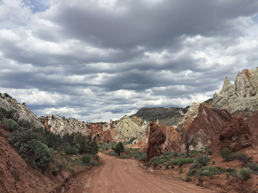
Cottonwood Road has lots of really neat things to see. (google "cottonwood road") There's a pretty cool narrow canyon called the Cottonwood Wash Narrows. The narrows are immediately adjacent to the west side of the road, at this unmistakable section of the trail:
There's also the very picturesque Grosvenor Arch, and Kodachrome Basin State Park, (pics here) closer to Cannonville.
If you do intend to visit Lower Calf Creek Falls, the round-trip hike will take about 3 hours.
Keep in mind that UT observes daylight savings, so you lose an hour when you cross the state line. This actually put a kink in my itinerary the last time I visited that region. I forgot UT observes DST, and we got to Escalante too late in the evening. All of the restaurants in town had already closed, so we had to eat our "lunch/snacks" for dinner. It kinda sucked.
If you have plans to head down Hole in the Rock Road, unfortunately, there's just not enough time in one day to see it all. Sights along HITR Rd include: Devil's Garden, Spooky Gulch, Peekaboo Gulch, Dance Hall Rock, and of course the actual Hole-in-the-Rock at the end of the trail.
If you've never been there, I HIGHLY recommend hiking Peekaboo and Spooky Gulch (as long as the weather is clear!) Click to see a short video about it. It's a superb slot canyon, although it's sort of hard to find. You'll need a hand-held GPS in order to find them. When I have time, I'll find and post the coordinates for Peekaboo and Spooky. If you see nothing else on HITR Rd, see those.
BTW, are you planning to camp, or stay at motels?
Last edited by XPLORx4; May 4, 2007 at 11:18 AM.
May 4, 2007 | 11:18 AM
#18
Thread Starter
Contributing Member
Joined: Jun 2006
Posts: 806
Likes: 0
All car camping in on my sleeping platform. If, for instance we find a cool place to ground camp after a hike we'll do that.
Where are some of the slot canyons that are skinny and have a little water running through them.
I'm bringing my GPS and I'm going to try and mark all of the areas that you mentioned before I go to make sure if I can I hit as many as possible
Where are some of the slot canyons that are skinny and have a little water running through them.
I'm bringing my GPS and I'm going to try and mark all of the areas that you mentioned before I go to make sure if I can I hit as many as possible
May 4, 2007 | 11:21 AM
#19
Registered User
Joined: Mar 2007
Posts: 21
Likes: 0
Water in the slot canyons depends on the time of year, and whether there has been recent rain. I've been in Spooky Gulch when there were several pools of standing water that got my boots soggy, and also when it was bone dry.
I also updated my post above, and linked to a video that shows spooky gulch.
I also updated my post above, and linked to a video that shows spooky gulch.
May 4, 2007 | 02:25 PM
#20
Thread Starter
Contributing Member
Joined: Jun 2006
Posts: 806
Likes: 0
Thanks Xplorx4,
That video has me stoked!
I think I'm going to have to sue and require that they put in hand rails and blast the canyon wider because its discriminatory to fat people... har har har!
That looks like it will be fun and a little clastraphobic. I cant wait!!!
That video has me stoked!
I think I'm going to have to sue and require that they put in hand rails and blast the canyon wider because its discriminatory to fat people... har har har!
That looks like it will be fun and a little clastraphobic. I cant wait!!!


