
4 Days through Escalante
 Apr 26, 2007 | 11:00 AM
#21

Registered User
Joined: Mar 2007
Posts: 21
Likes: 0
Great photos! The Grand Staircase is an awesome place to explore where you'll see few (if any) other vehicles.
There are tons of super cool slot canyons to explore all throughout that area. Two of my favorites are Spooky Gulch off Hole in the Rock, and Buckskin Gulch (which is between Page, AZ and Kanab, UT in the Paria Wilderness just south of Hwy 89A.) And of course, Antelope Canyon, about 2 miles east of Page, close to the power plant, is spectacular for photography.
If you guys want more details on dozens of slot canyons throughout AZ and UT, I highly recommend browsing through AmericanSouthwest.net.
Oh yes, one more thing- the view (and hike) down to Hole in the Rock is worth it.
Again, nice pics. It makes me want to go back.
Apr 27, 2007 | 09:21 PM
#22
Thread Starter
Contributing Member
Joined: Jun 2005
Posts: 3,415
Likes: 9
From: Phx, AZ
Thanks for the link.
Just glancing through and you are right, tons of info on UT and other areas in the SW.
We'll be sure to use that as a source for planning our next trip. Really looking forward to getting to see many of the slot canyons in the area.
We only got the smallest taste this last trip.
Just glancing through and you are right, tons of info on UT and other areas in the SW.
We'll be sure to use that as a source for planning our next trip. Really looking forward to getting to see many of the slot canyons in the area.
We only got the smallest taste this last trip.
May 3, 2007 | 02:17 PM
#26
Contributing Member
Joined: Jun 2006
Posts: 806
Likes: 0
I am totally changing my trip plans to check out this area... I think....
Any other input would be grateful. I would love to do some several hour hikes into some of these slot canyons, especially any with a little water in them!
Any other input would be grateful. I would love to do some several hour hikes into some of these slot canyons, especially any with a little water in them!
May 3, 2007 | 02:42 PM
#27
Thread Starter
Contributing Member
Joined: Jun 2005
Posts: 3,415
Likes: 9
From: Phx, AZ
No one can see all of Utah, or even Escalante... in just four days. But you can definitely get an idea of what can be seen in that time.
EXPLORx4's link has pics of many of the Escalante slot canyons. Some descriptions will let you know if there is water. Lower Calf Creek is evidently along the water with a tall waterfall at the end. That's just N of Escalante town.
http://www.americansouthwest.net/
I think you would have a lot of fun in the Escalante area, either tracking down some of the places I have shown or searching out some of your own.
You really should try and drive the Devil's Backbone route from Escalante to Boulder and then back down to Escalante. An amazing route, maybe 5 hours. Easy 2 wheel drive dirt for many miles.
It would be possible to drive up Cottonwood Canyon road, get to Escalante, do the Devil's Backbone route, then head up to Bryce Canyon and even drop into the great expanse that is Zion... which is the visual pinnacle of Utah as far as awe inspiring scenery... in my opinion.
That would be a full four days... with lot's of miles between. If you had the time and where up for the adventure of 65 miles in the dirt alone, I'd drop back down from Escalante on the Smokey Mtn. Backroad for your route home. Allow 5 or 6 hours just for the dirt section. It would be an incredible way to finish off your trip... but that may just be to much to fit into 4 days.
Most of the roads and places I have mentioned will be found on a good, standard atlas of Utah.
If you PM me your E-Mail I can send you the *.kmz file of the route we took and you can check it out on Google Earth.
Last edited by Elvota; May 3, 2007 at 09:05 PM.
May 3, 2007 | 08:41 PM
#29
Contributing Member
Joined: Mar 2005
Posts: 901
Likes: 0
From: The Republic Texas
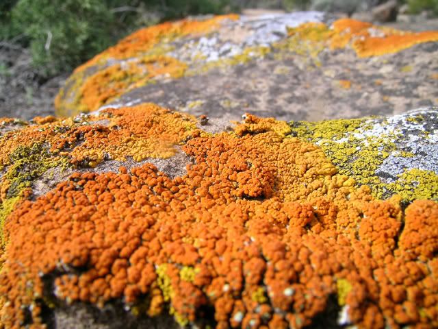
FYI, that is a Lichen (pronounced "liken"). It is a symbiotic (benificial for both) relationship between a fungus and a cyanobacteria (photosythetic) or an Algae.
Nice picture! That is a very colorful one!
And thanks for sharing your pics....
Nice picture! That is a very colorful one!
And thanks for sharing your pics....
Last edited by nieuwendyk-25; May 3, 2007 at 08:43 PM.
May 3, 2007 | 09:34 PM
#30
Contributing Member
Joined: Jun 2006
Posts: 806
Likes: 0
No one can see all of Utah, or even Escalante... in just four days. But you can definitely get an idea of what can be seen in that time.
EXPLORx4's link has pics of many of the Escalante slot canyons. Some descriptions will let you know if there is water. Lower Calf Creek is evidently along the water with a tall waterfall at the end. That's just N of Escalante town.
http://www.americansouthwest.net/
I think you would have a lot of fun in the Escalante area, either tracking down some of the places I have shown or searching out some of your own.
You really should try and drive the Devil's Backbone route from Escalante to Boulder and then back down to Escalante. An amazing route, maybe 5 hours. Easy 2 wheel drive dirt for many miles.
It would be possible to drive up Cottonwood Canyon road, get to Escalante, do the Devil's Backbone route, then head up to Bryce Canyon and even drop into the great expanse that is Zion... which is the visual pinnacle of Utah as far as awe inspiring scenery... in my opinion.
That would be a full four days... with lot's of miles between. If you had the time and where up for the adventure of 65 miles in the dirt alone, I'd drop back down from Escalante on the Smokey Mtn. Backroad for your route home. Allow 5 or 6 hours just for the dirt section. It would be an incredible way to finish off your trip... but that may just be to much to fit into 4 days.
Most of the roads and places I have mentioned will be found on a good, standard atlas of Utah.
If you PM me your E-Mail I can send you the *.kmz file of the route we took and you can check it out on Google Earth.
EXPLORx4's link has pics of many of the Escalante slot canyons. Some descriptions will let you know if there is water. Lower Calf Creek is evidently along the water with a tall waterfall at the end. That's just N of Escalante town.
http://www.americansouthwest.net/
I think you would have a lot of fun in the Escalante area, either tracking down some of the places I have shown or searching out some of your own.
You really should try and drive the Devil's Backbone route from Escalante to Boulder and then back down to Escalante. An amazing route, maybe 5 hours. Easy 2 wheel drive dirt for many miles.
It would be possible to drive up Cottonwood Canyon road, get to Escalante, do the Devil's Backbone route, then head up to Bryce Canyon and even drop into the great expanse that is Zion... which is the visual pinnacle of Utah as far as awe inspiring scenery... in my opinion.
That would be a full four days... with lot's of miles between. If you had the time and where up for the adventure of 65 miles in the dirt alone, I'd drop back down from Escalante on the Smokey Mtn. Backroad for your route home. Allow 5 or 6 hours just for the dirt section. It would be an incredible way to finish off your trip... but that may just be to much to fit into 4 days.
Most of the roads and places I have mentioned will be found on a good, standard atlas of Utah.
If you PM me your E-Mail I can send you the *.kmz file of the route we took and you can check it out on Google Earth.
AMAZING, and I'm glad I'm not trying to fit it in!
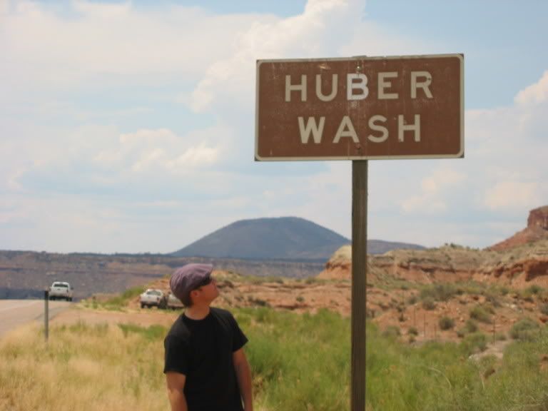 Just outside of ZION
 narrows
 LOVE THAT PLACE.
I went to the wide world of maps today. What do you think about the GPS map software? I want to get something more detailed for the trip.
May 3, 2007 | 09:38 PM
#31
Thread Starter
Contributing Member
Joined: Jun 2005
Posts: 3,415
Likes: 9
From: Phx, AZ
The best software I have found so far is the National Geographic state series. The catch... state by state has to be purchased. At around $90 per state, I only have AZ. 
National Geographic also makes software for wider areas (like the Southwest) but the detail is not as good. Might be more than enough for most applications however.
I am still a newbie when it comes to GPS mapping and tracking... but having lot's of fun learning as I go.
National Geographic also makes software for wider areas (like the Southwest) but the detail is not as good. Might be more than enough for most applications however.
I am still a newbie when it comes to GPS mapping and tracking... but having lot's of fun learning as I go.
May 4, 2007 | 08:19 AM
#34
Contributing Member
Joined: Jun 2006
Posts: 806
Likes: 0
The best software I have found so far is the National Geographic state series. The catch... state by state has to be purchased. At around $90 per state, I only have AZ.
National Geographic also makes software for wider areas (like the Southwest) but the detail is not as good. Might be more than enough for most applications however.
I am still a newbie when it comes to GPS mapping and tracking... but having lot's of fun learning as I go.
National Geographic also makes software for wider areas (like the Southwest) but the detail is not as good. Might be more than enough for most applications however.
I am still a newbie when it comes to GPS mapping and tracking... but having lot's of fun learning as I go.
I think I'll look into getting the south west and maybe the az detailed!
May 4, 2007 | 01:49 PM
#35
Thread Starter
Contributing Member
Joined: Jun 2005
Posts: 3,415
Likes: 9
From: Phx, AZ
Guess that's how I justify the amount of coin that goes into my rig.
The Southwest is a really great place for wheelin' and other endless outdoor adventures.
May 4, 2007 | 07:00 PM
#36
Contributing Member
Joined: May 2006
Posts: 618
Likes: 0
From: cookeville tn.
Great THX...ya know there should be some kinda ride share system, where people just had to fly to different parts of the country then hookup to use a trail rig there. ?
And part of the "fun" of wheelin is braken something "oh crap" then the survival mode kicks in and we smile with the ah ha moment
And part of the "fun" of wheelin is braken something "oh crap" then the survival mode kicks in and we smile with the ah ha moment

Thread
Thread Starter
Forum
Replies
Last Post
the1998sr5
95.5-2004 Tacomas & 96-2002 4Runners
15
Jul 14, 2020 08:35 PM


