Eagle Lakes, Signal Peak, and Pierce OHV 9/2010
 09-28-2010, 09:31 AM
#1
Eagle Lakes, Signal Peak, and Pierce OHV 9/2010
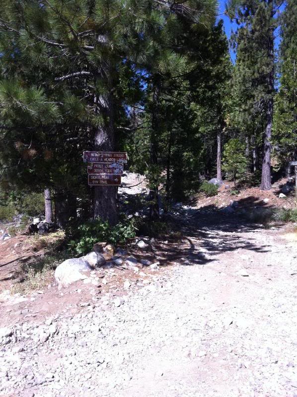
Went out wheeling with a buddy two Saturdays in a row. Both trips we wheeled off the Eagle Lakes exit on I-80, CA. As some of you may or may not know there are several popular trails in the area: Signal Peak (4), Eagle Lakes (5), Fordyce (10), and the Pierce OHV area. Since I had never really wheeled the area, I did some research on the trails and didn't find a whole lot of info, but there is some (like here).
Rig 1: 93 xcab 2" BJ spacer/OME lift, 4.88s locked rear 31s
Rig 2: 98 xcab stock with trd locker and 31s
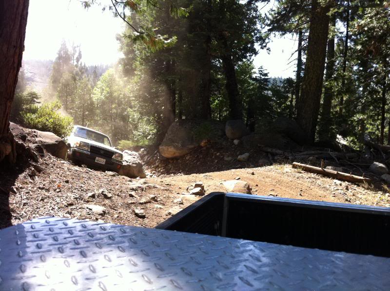
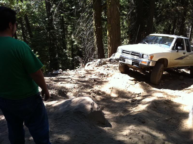
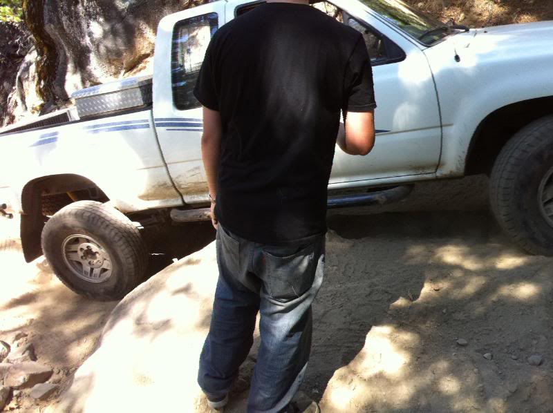
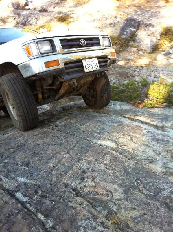
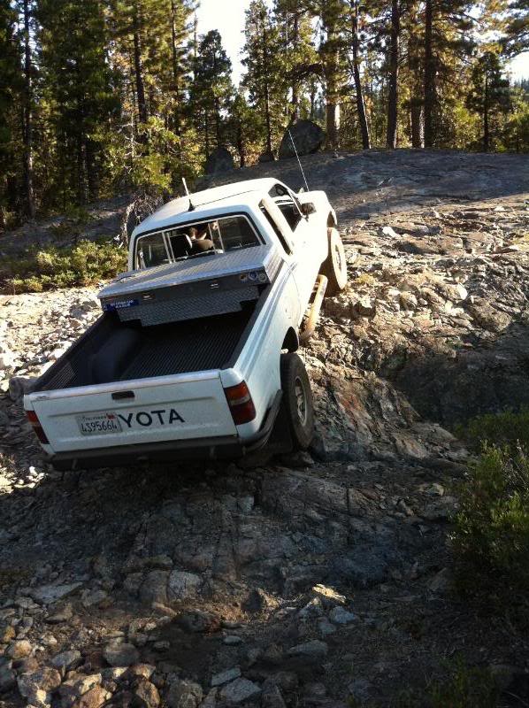
First day out was 9/19 and we decided to go out and try to do the Eagle Lakes trail. Never been on the trail and thought it'd be a good choice since it's one of the closer "5-rated" trails to me. Went out down the trailhead and mistakenly went on the Pierce OHV area which was fun but we turned around when you get to the open area near the creek - was going to cross but there were campers on the other side and we'd have to go through their camp. headed back out to where i thought i saw the sign to Eagle lakes/Fordyce and got onto the actual trail. Ended up doing the bypass for what i'm assuming is driveshaft hill - perhaps with some sliders and some redbulls i might attempt going up that hill, you gotta be nuts to go up that in a stockish rig. With that being said about attempting rocks with stock rigs, we accidentally took a right at a split and ended up on the Fordyce trail. Now THAT was some tough wheeling. We actually ended up getting pretty far. I made it all the way to the top of Sunrise Hill (?) and my buddy made it about 3/4 the way up and turned around at this nice flat spot that people obviously used to camp at that had a nice view. Didn't take any damage somehow until we were coming back. Since I continued up further than Chris, I ended up tagging a nice boulder coming back down the obstacle that he didn't want to attempt (thinking I was in reverse) on the driver's corner of my front bumper and pushed it up enough to put a small crease in my fender and pop out my turn signal. Chris ended up taking a hit on a random boulder when we got closer to where the Eagle Lakes trail branches off - said he slid into it sideways and ended up denting his rocker panel under the xcab section. After taking a breather at the split we decided to at least go down the eagle lakes trail for a bit although it was getting later in the afternoon. decided to turn around and head back after the 1st lake.
(i'll have to add the pics in from this day later)
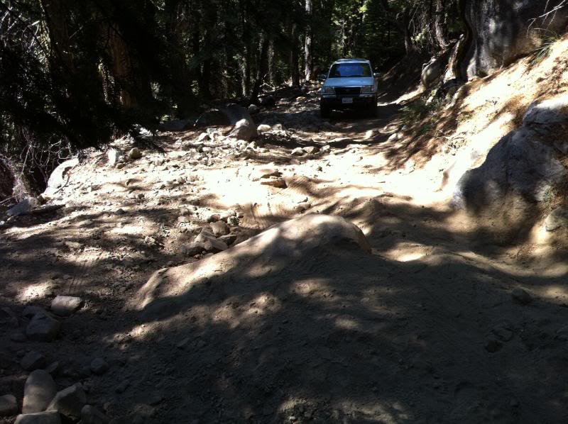
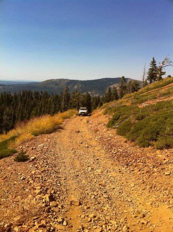
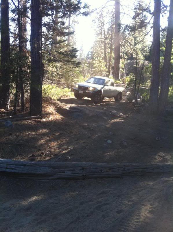
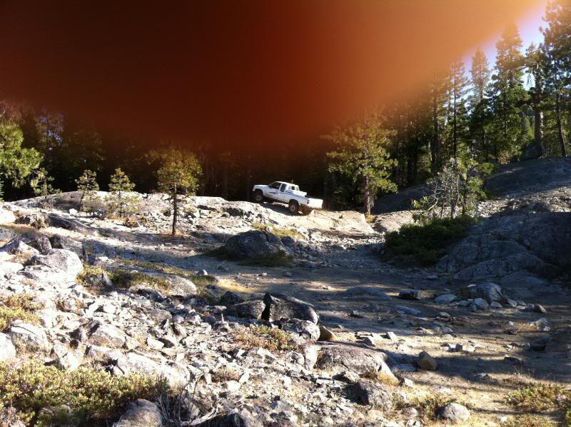
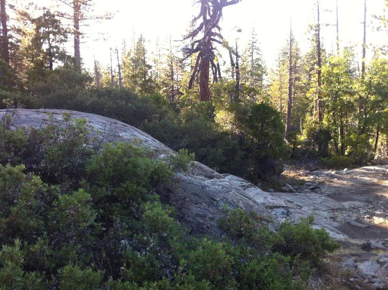
Second weekend, 9/26, we decided to go back out and wheel Signal Peak thinking it would be much easier and chris wouldn't have to worry about not having sliders again. We went up the Signal Peak trail, starting at the Eagle lakes staging area/bathrooms. There wasn't too much info regarding this trail when I searched, especially regarding the rocky uphill section that I had been worried about. Well, now I know why there aren't too many pics and if you see them, they don't do any justice as to how high you climb during that ascent.
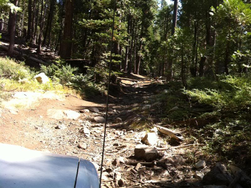
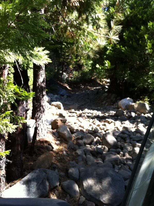
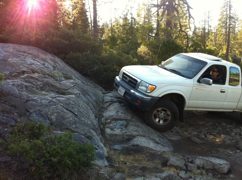
The first section is a fairly easy ascent with some good size boulders that you have to navigate around
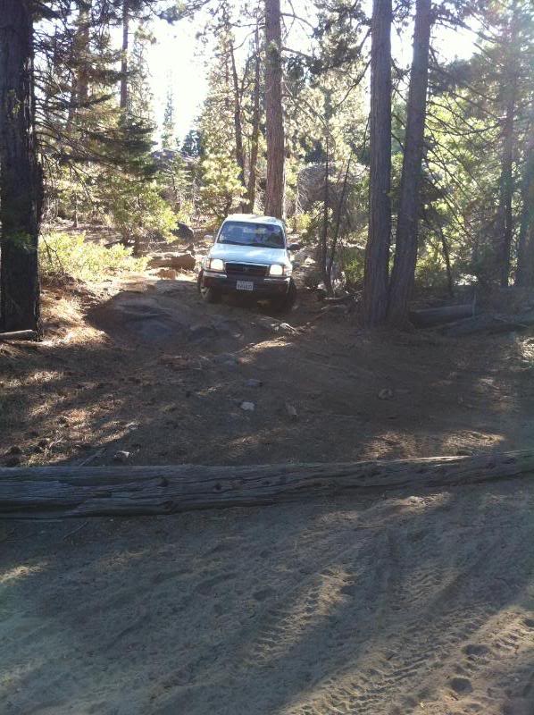
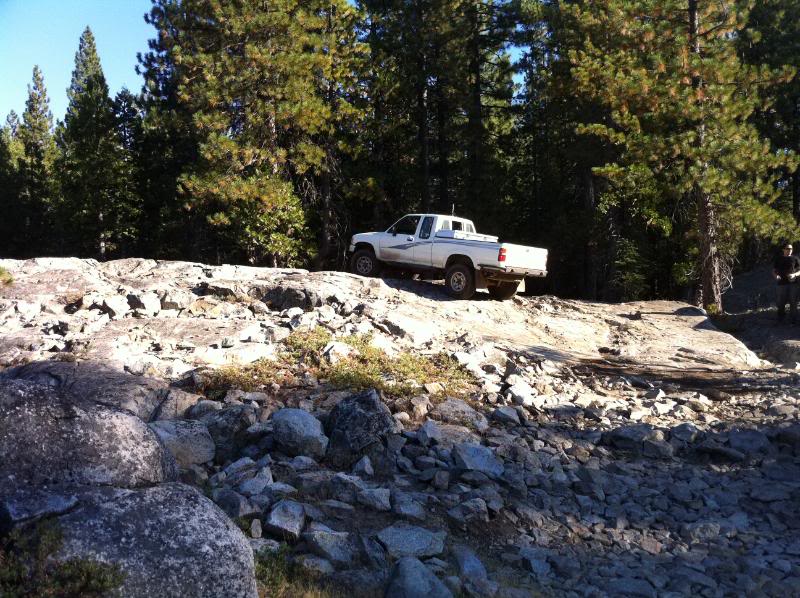
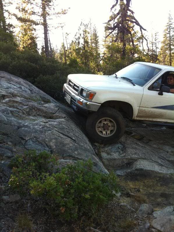
the first ascent ends with a boulder that you have to creep past and then you make a hard right hand switchback and begin a steeper uphill section similar to the first:
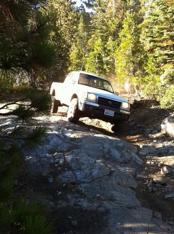
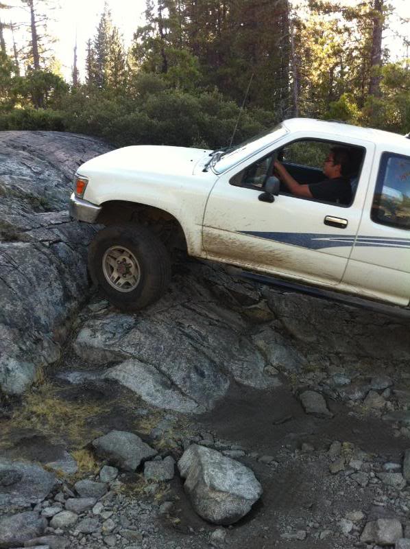
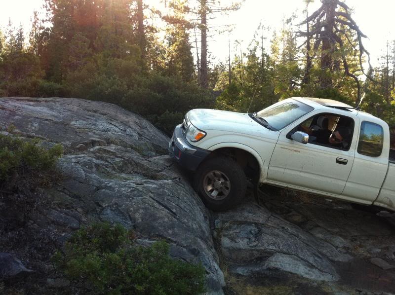
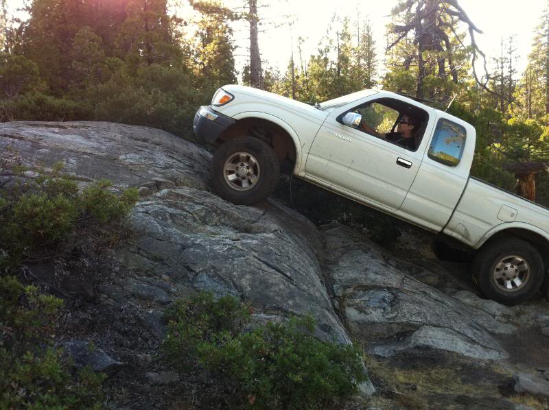
near the top of this section is a boulder in the middle of the trail with a fat rock on one side and a nice drop off on the other side. Either way, you've gotta put your tires on the middle boulder in order to get past it. I went on the inside (req more clearance) and chris went on the outside:
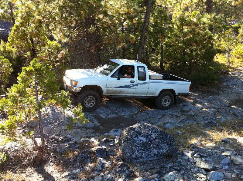
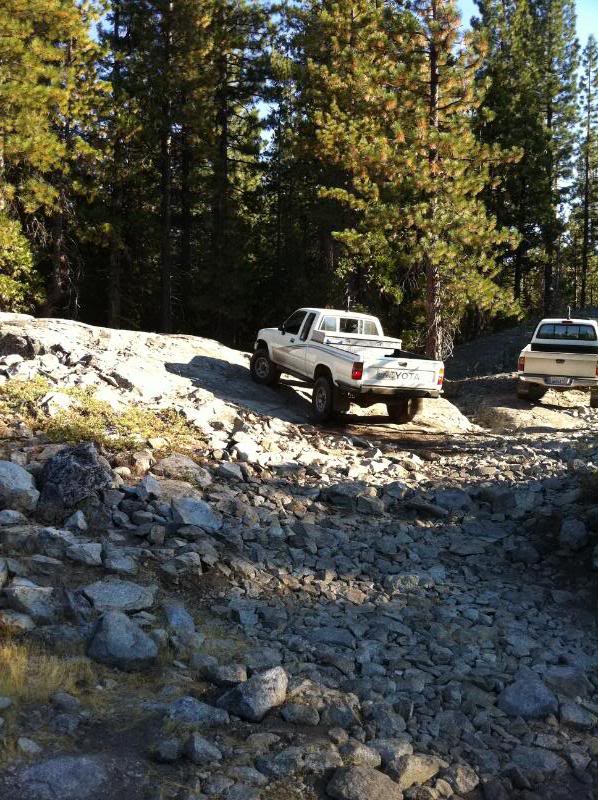
after that is a nice little rock garden:
followed by an increasingly steep uphill section that has a nasty metal bar that crosses it (assuming it's to keep from eroding the already difficult section) - let's just say that that bar is quite shiny from all the tires slipping on it and if you don't hit it just right you're not gonna make it, mostly because the hill is already a 45* angle before the hiccup. I didn't think much of it and went right up and didn't get any pics, but waited at the top for chris only to find that he needed some spotting after several failed attempts. at the next flat spot there is a nice view of the hwy
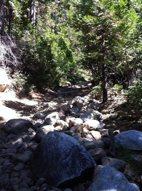
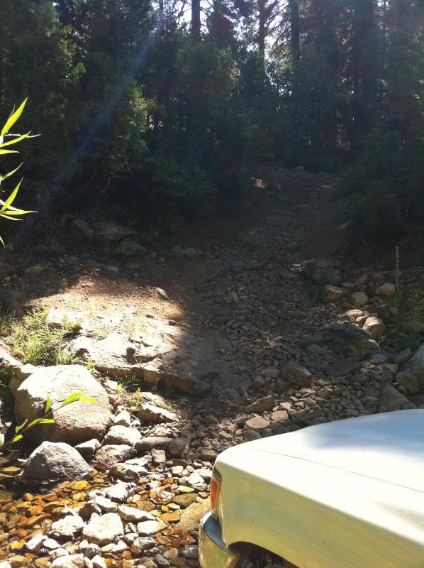
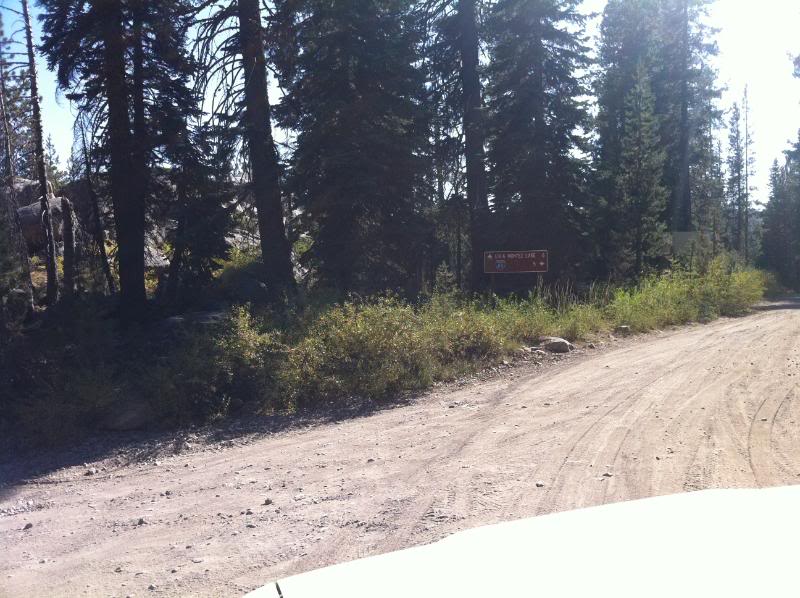
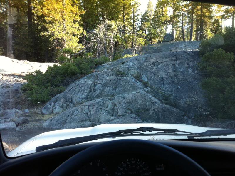
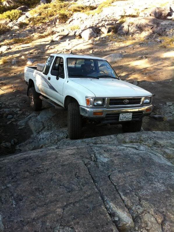
followed by a small creek crossing and a final rocky uphill section
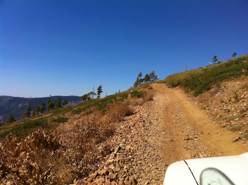
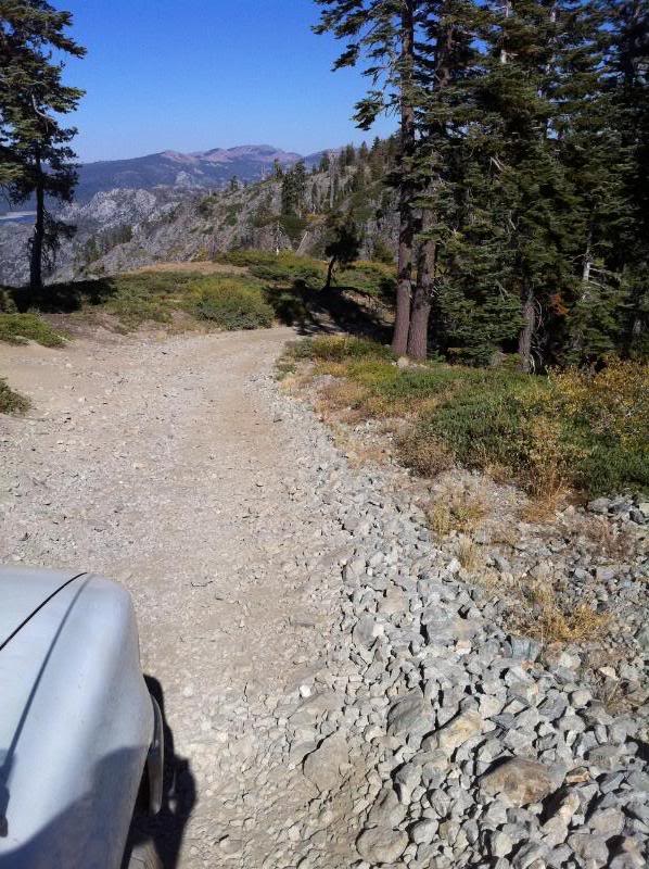
when you get to the top, the trail opens up into a nice meadowy section
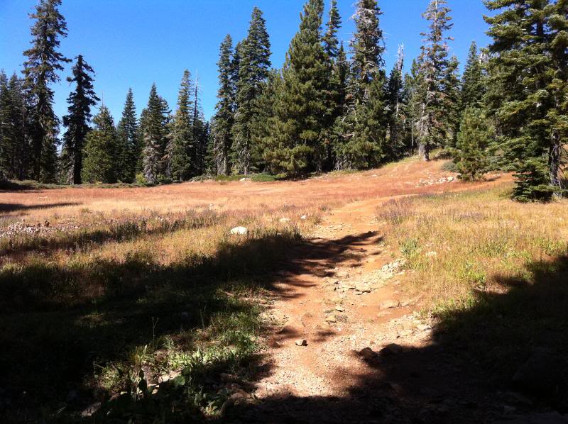
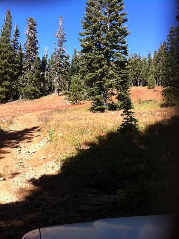
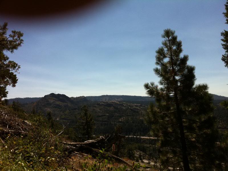
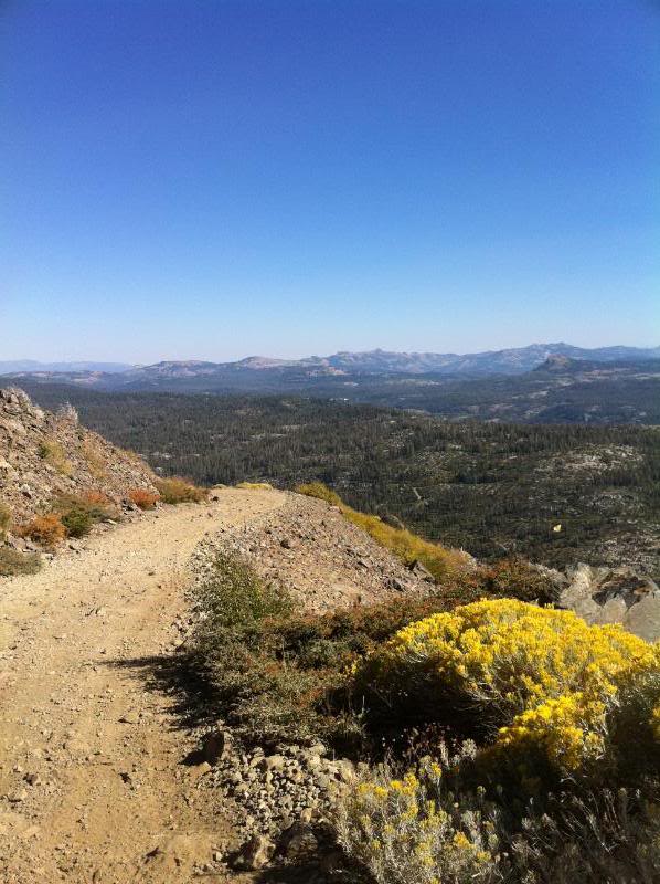
with some nice vistas on the trail
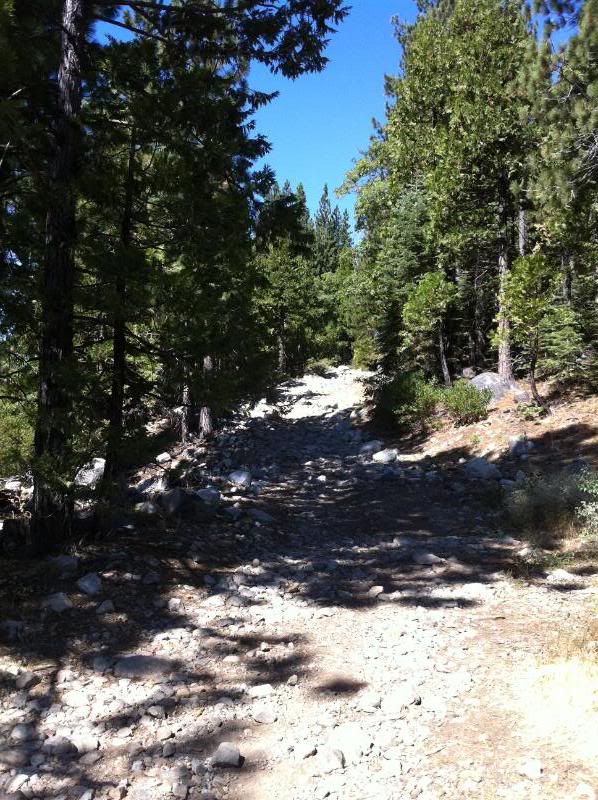
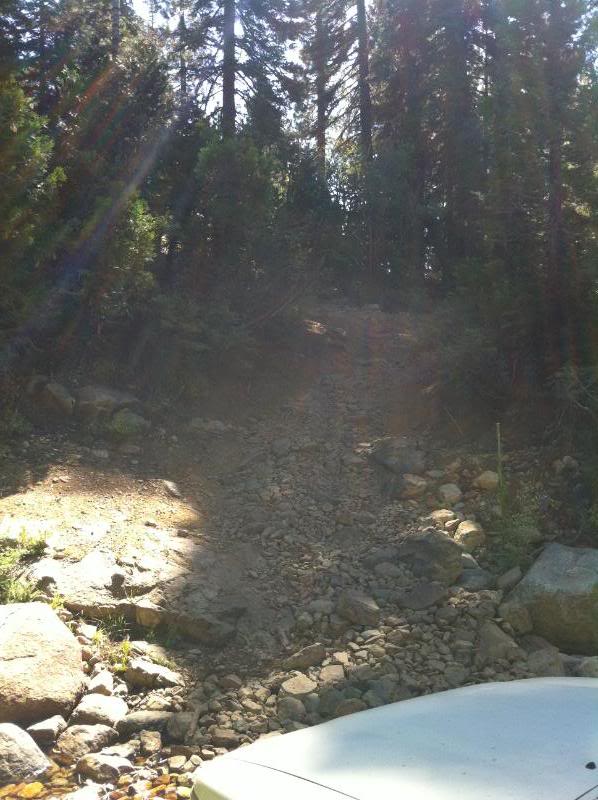
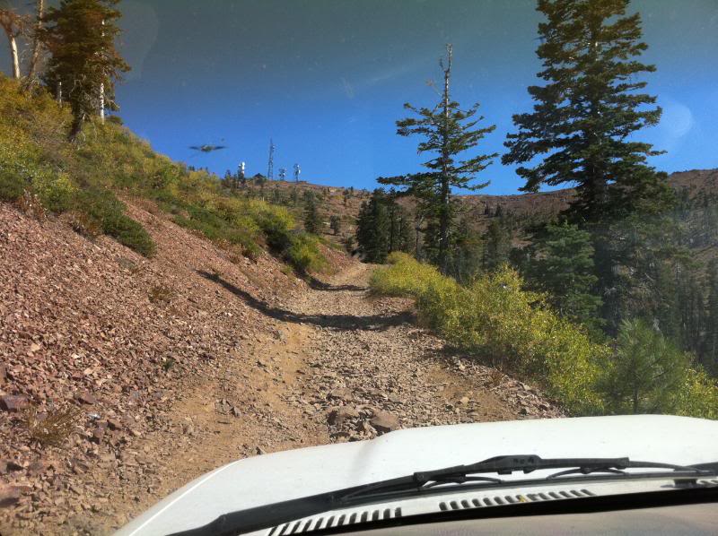
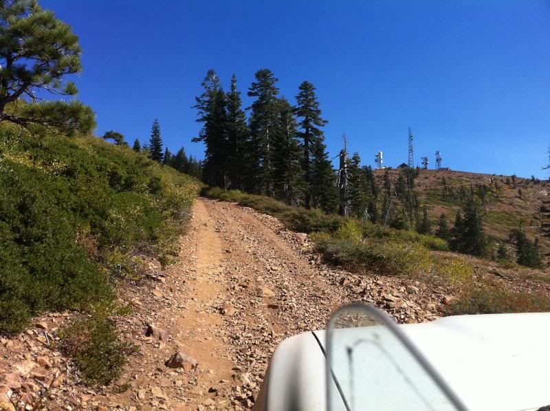
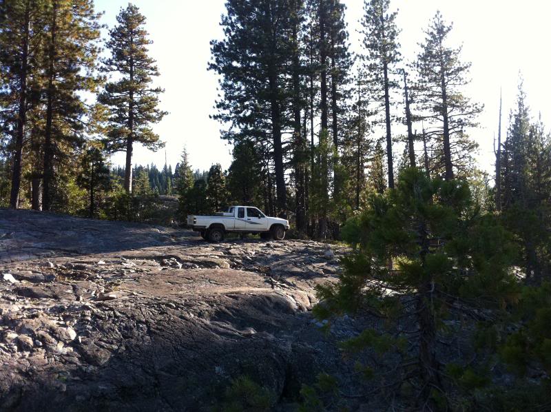
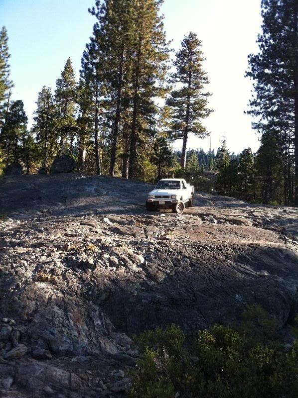
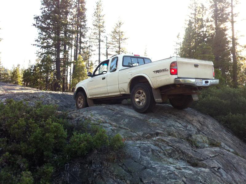
and the final ascent to the signal towers is some loose-ish rock that a Rav4 could do - pretty much like this the whole way back out to the Cisco Grove exit
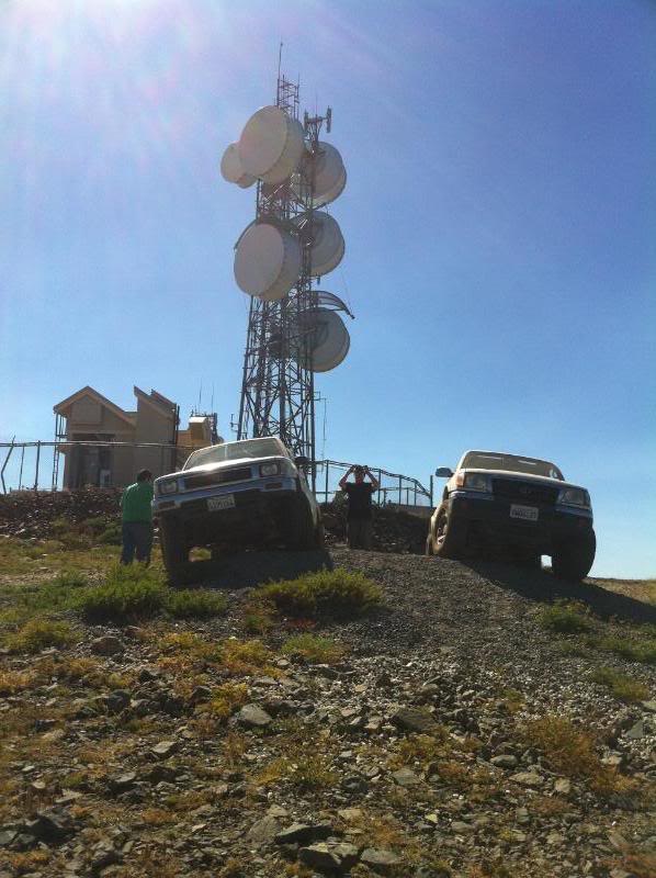
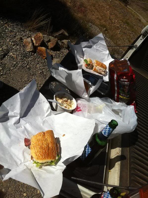
stopped to have us some lunch up top of the mtn. Newcastle Cheese Shop "Rat Trap" sandwiches and Spaten Octoberfest
then we finished out the trail and headed back to the hwy (Cisco grove exit)
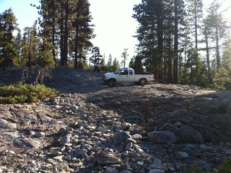
After all that wheeling we decided we didn't have enough, so we got back on the hwy and headed for the Pierce OHV area and decided to cross the creek and see where the trail goes. We went a couple miles into it and ended up playing around in a nice granite area before heading back home. Here are some pics from the Pierce OHV area:
and then the guys talked me into going up this
it was actually pretty easy so i did it twice and then i made chris take his tacoma up it. he got hung up on his tow hitch, but eventually made it
So that's it. If you're trying to figure out if you want to wheel this area and dunno if you can make it here is some pics of what the trail looks like. There's some nice camping spots out in the Pierce OHV area for those wishing to wheel over the weekend. Would be pretty nice to wheel Eagle Lakes one day, camp, then wheel Signal Peak and head out. I'll try to get those Eagle Lakes/Fordyce pics up asap. Peace.
Rig 1: 93 xcab 2" BJ spacer/OME lift, 4.88s locked rear 31s
Rig 2: 98 xcab stock with trd locker and 31s
First day out was 9/19 and we decided to go out and try to do the Eagle Lakes trail. Never been on the trail and thought it'd be a good choice since it's one of the closer "5-rated" trails to me. Went out down the trailhead and mistakenly went on the Pierce OHV area which was fun but we turned around when you get to the open area near the creek - was going to cross but there were campers on the other side and we'd have to go through their camp. headed back out to where i thought i saw the sign to Eagle lakes/Fordyce and got onto the actual trail. Ended up doing the bypass for what i'm assuming is driveshaft hill - perhaps with some sliders and some redbulls i might attempt going up that hill, you gotta be nuts to go up that in a stockish rig. With that being said about attempting rocks with stock rigs, we accidentally took a right at a split and ended up on the Fordyce trail. Now THAT was some tough wheeling. We actually ended up getting pretty far. I made it all the way to the top of Sunrise Hill (?) and my buddy made it about 3/4 the way up and turned around at this nice flat spot that people obviously used to camp at that had a nice view. Didn't take any damage somehow until we were coming back. Since I continued up further than Chris, I ended up tagging a nice boulder coming back down the obstacle that he didn't want to attempt (thinking I was in reverse) on the driver's corner of my front bumper and pushed it up enough to put a small crease in my fender and pop out my turn signal. Chris ended up taking a hit on a random boulder when we got closer to where the Eagle Lakes trail branches off - said he slid into it sideways and ended up denting his rocker panel under the xcab section. After taking a breather at the split we decided to at least go down the eagle lakes trail for a bit although it was getting later in the afternoon. decided to turn around and head back after the 1st lake.
(i'll have to add the pics in from this day later)
Second weekend, 9/26, we decided to go back out and wheel Signal Peak thinking it would be much easier and chris wouldn't have to worry about not having sliders again. We went up the Signal Peak trail, starting at the Eagle lakes staging area/bathrooms. There wasn't too much info regarding this trail when I searched, especially regarding the rocky uphill section that I had been worried about. Well, now I know why there aren't too many pics and if you see them, they don't do any justice as to how high you climb during that ascent.
The first section is a fairly easy ascent with some good size boulders that you have to navigate around
the first ascent ends with a boulder that you have to creep past and then you make a hard right hand switchback and begin a steeper uphill section similar to the first:
near the top of this section is a boulder in the middle of the trail with a fat rock on one side and a nice drop off on the other side. Either way, you've gotta put your tires on the middle boulder in order to get past it. I went on the inside (req more clearance) and chris went on the outside:
after that is a nice little rock garden:
followed by an increasingly steep uphill section that has a nasty metal bar that crosses it (assuming it's to keep from eroding the already difficult section) - let's just say that that bar is quite shiny from all the tires slipping on it and if you don't hit it just right you're not gonna make it, mostly because the hill is already a 45* angle before the hiccup. I didn't think much of it and went right up and didn't get any pics, but waited at the top for chris only to find that he needed some spotting after several failed attempts. at the next flat spot there is a nice view of the hwy
followed by a small creek crossing and a final rocky uphill section
when you get to the top, the trail opens up into a nice meadowy section
with some nice vistas on the trail
and the final ascent to the signal towers is some loose-ish rock that a Rav4 could do - pretty much like this the whole way back out to the Cisco Grove exit
stopped to have us some lunch up top of the mtn. Newcastle Cheese Shop "Rat Trap" sandwiches and Spaten Octoberfest
then we finished out the trail and headed back to the hwy (Cisco grove exit)
After all that wheeling we decided we didn't have enough, so we got back on the hwy and headed for the Pierce OHV area and decided to cross the creek and see where the trail goes. We went a couple miles into it and ended up playing around in a nice granite area before heading back home. Here are some pics from the Pierce OHV area:
and then the guys talked me into going up this
it was actually pretty easy so i did it twice and then i made chris take his tacoma up it. he got hung up on his tow hitch, but eventually made it
So that's it. If you're trying to figure out if you want to wheel this area and dunno if you can make it here is some pics of what the trail looks like. There's some nice camping spots out in the Pierce OHV area for those wishing to wheel over the weekend. Would be pretty nice to wheel Eagle Lakes one day, camp, then wheel Signal Peak and head out. I'll try to get those Eagle Lakes/Fordyce pics up asap. Peace.
 09-28-2010, 11:06 AM
#3
aha! i have those pics on my laptop. i'll post them later. i ended up being able to pop the turn signal back in, kinda. was able to get the bumper back down to level by standing on it and got it to flex back. the fender i was able to bend back with a piece of wood and a clamp. as for the valence, i ended up bending it somewhat into shape and then took the grinder to it and gave it a better shape. i actually like it better now. i was just bummed on the fender because i put a hard crease in it instead of just a dent. guess it's time to fab up a front bumper...but sliders are first! i actually tagged a good size rock with my useless nerf bar thingies and since they're useless they flexed up and put a nice hemisphere-shaped dent in my pinch weld and somehow didn't keep going into the rocker panel - but that's because the wall of the nerf bar started to cave in.
yeah, i wanted to get some pics of signal peak on the net because there aren't any pics, esp of the rocky section. now there are.
yeah, i wanted to get some pics of signal peak on the net because there aren't any pics, esp of the rocky section. now there are.


Thread
Thread Starter
Forum
Replies
Last Post
kawazx636
The Classifieds GraveYard
34
10-06-2021 03:03 PM
Scotttekoch
General Electrical & Lighting Related Topics
5
09-28-2015 10:30 PM
Boomer8404
86-95 Trucks & 4Runners
0
09-24-2015 01:12 PM
sonorn67
84-85 Trucks & 4Runners
3
09-19-2015 05:39 PM
WTB[PacNorWest]: 84 4Runner brake booster/brake master cylinder
user 82300
Items Wanted
2
09-17-2015 10:41 AM


