Charouleau Gap, AZ with new bonus GPS route!!
 04-28-2007, 08:49 PM
#1
Contributing Member
Thread Starter
Charouleau Gap, AZ with new bonus GPS route!!
Six rigs conquered the Charouleau Gap trail starting at the southern end near Tucson and finishing in Oracle. Was a scenic trail with a few harder obstacles. All had bypasses, one was completely optional.
Our group had one 2nd Gen 4Runner, three 3rd Gen 4Runners and two FJs.
Bonus this time for fellow YT'rs is that I made a *.kmz TOPO file that can be viewed in Google Earth to see exactly where the trail goes. PM me for the file if you are interested. It's pretty slick and you can even make the image 3-D to see valleys and other features.
Download Google Earth for free: http://earth.google.com/ (Warning, it's very addictive )
)
On to the pics....
Sschaefer3 trying the alternate line... just a little to tight:
Showing how it's done:
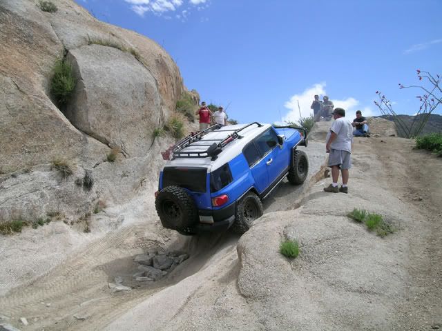
FJ on 35's and dual locked representing what Toyota should be offering from the showroom :
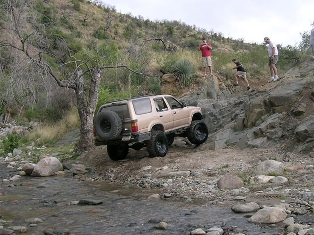
AZ4ME cruises up with his IFS holdout 3rd Gen :
:
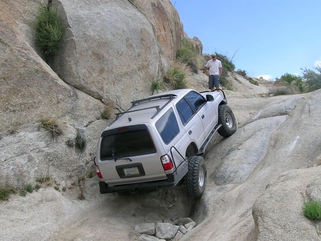
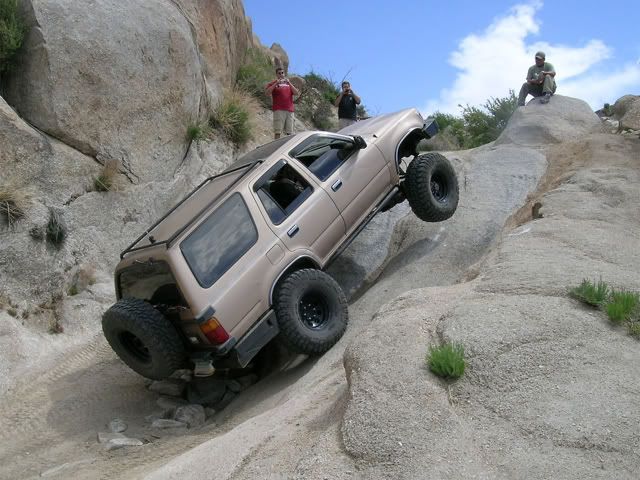
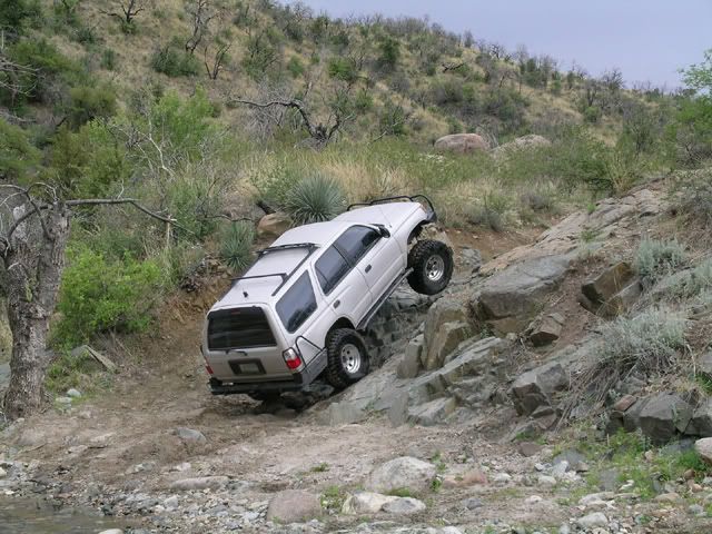
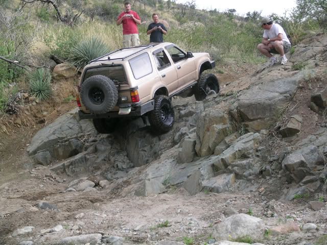
This just doesn't feel like Schaefer's line:
For scale:
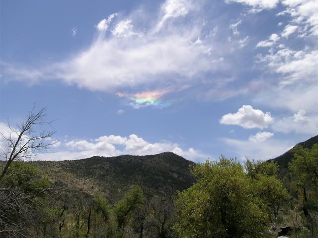
Crazy clouds... John mentions something about ice crystals in the air:
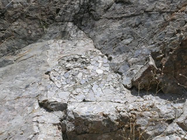
For the YT geophites. This rock showed no evidence of being tampered, cut or modified by man... yet all the river rocks are "glued" into the main rock, and then sheared off flat:
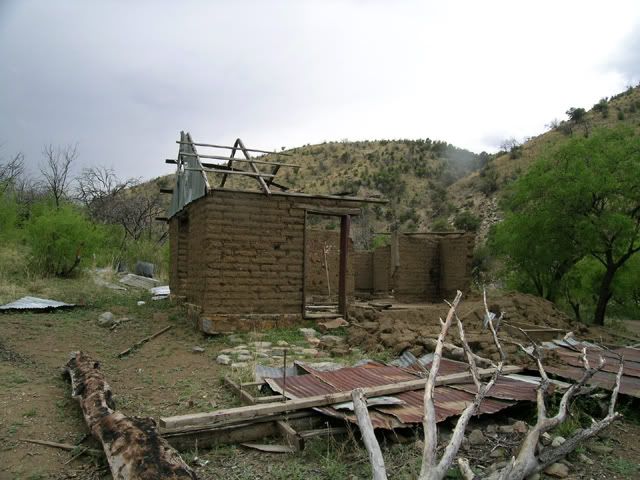
Cabin constructed from real adobe bricks:
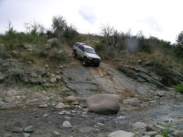
Approach to "The Step" (made sure tires are nice and wet):
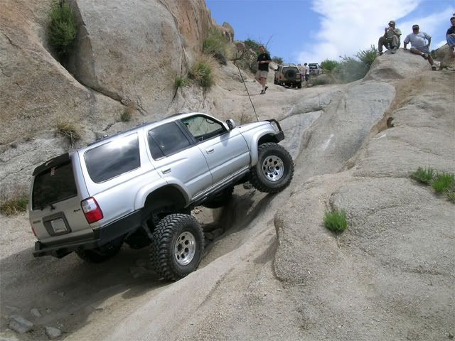
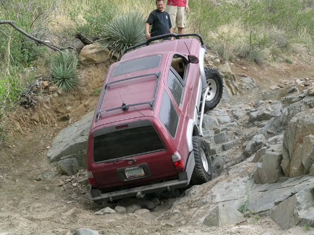
Schaefer must have sold his soul to the rock gods to keep making everything look so easy :
:
One of the very few times I have seen Wongo be denied:
Elvota decides the skinny pedal was put there for a reason :
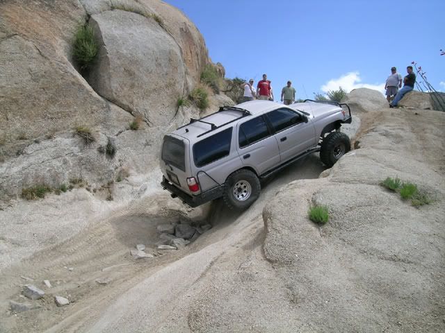
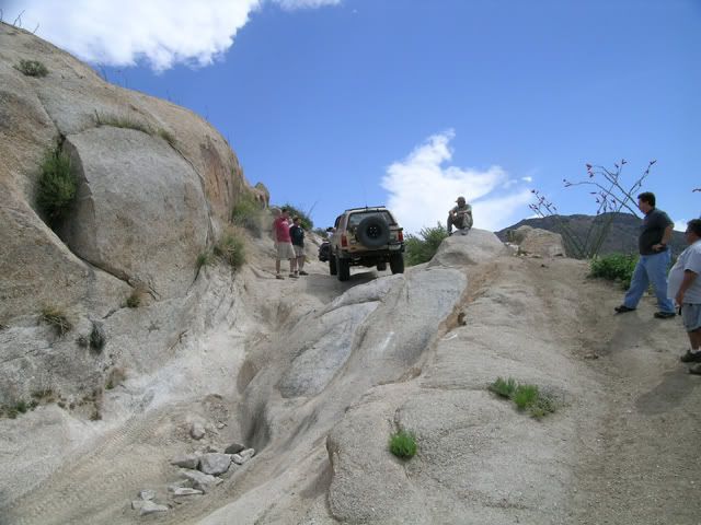
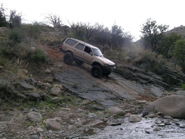
Entering the "Boat Ramp":
I didn't know that a crawler means you wont even use your brakes on something like this :
Someone must be going the wrong way :
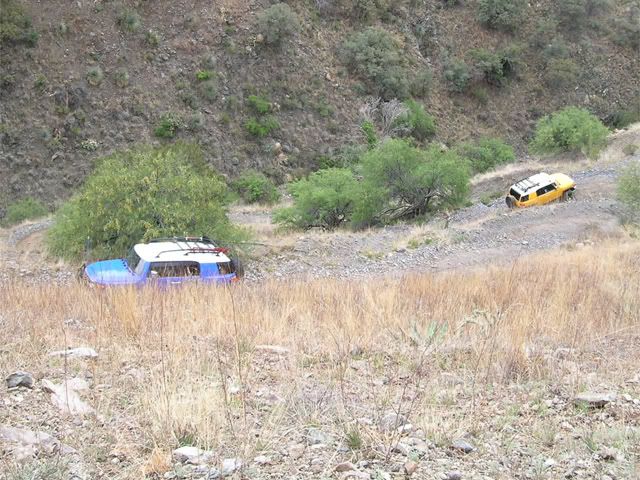
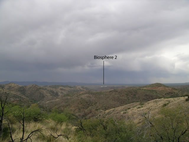
View from one of the ridge lines on the way out:
We got some rain, but made good time overall. For locals, I'd compare this run to the Crown King backroad as far as difficulty and scenery. Either direction would be doable and probably offer a good day regardless.
Our group had one 2nd Gen 4Runner, three 3rd Gen 4Runners and two FJs.
Bonus this time for fellow YT'rs is that I made a *.kmz TOPO file that can be viewed in Google Earth to see exactly where the trail goes. PM me for the file if you are interested. It's pretty slick and you can even make the image 3-D to see valleys and other features.
Download Google Earth for free: http://earth.google.com/ (Warning, it's very addictive
)On to the pics....
Sschaefer3 trying the alternate line... just a little to tight:
Showing how it's done:
FJ on 35's and dual locked representing what Toyota should be offering from the showroom
:AZ4ME cruises up with his IFS holdout 3rd Gen
:This just doesn't feel like Schaefer's line:
For scale:
Crazy clouds... John mentions something about ice crystals in the air:
For the YT geophites. This rock showed no evidence of being tampered, cut or modified by man... yet all the river rocks are "glued" into the main rock, and then sheared off flat:
Cabin constructed from real adobe bricks:
Approach to "The Step" (made sure tires are nice and wet):
Schaefer must have sold his soul to the rock gods to keep making everything look so easy
:One of the very few times I have seen Wongo be denied:
Elvota decides the skinny pedal was put there for a reason
:Entering the "Boat Ramp":
I didn't know that a crawler means you wont even use your brakes on something like this
:Someone must be going the wrong way
:View from one of the ridge lines on the way out:
We got some rain, but made good time overall. For locals, I'd compare this run to the Crown King backroad as far as difficulty and scenery. Either direction would be doable and probably offer a good day regardless.
Last edited by Elvota; 04-28-2007 at 09:17 PM.
 04-28-2007, 11:29 PM
#3
Registered User
Great pics! Did you guys post this ride?? I'm heading out there next weekend (for the first time) with the CSC guys and there is a Hummer (1,2,3) group going too. Hit me up next time you guys are going... I have yet to get out with any other 'runners. PM sent for the file.


Trending Topics
 05-04-2007, 10:00 PM
#9
Contributing Member
Join Date: Apr 2003
Location: Albuquerque, NM
Posts: 2,549
Likes: 0
Received 0 Likes
on
0 Posts
 05-05-2007, 11:08 AM
#10
Registered User
Join Date: Jun 2003
Location: Chandler, AZ
Posts: 115
Likes: 0
Received 0 Likes
on
0 Posts


 07-30-2008, 11:27 AM
#15
Registered User
Join Date: Jul 2008
Location: Burbank Ca.
Posts: 5
Likes: 0
Received 0 Likes
on
0 Posts
Hi guys, 
& what brought me here was this trail.
I took a portion of this trail two years ago while visiting my Mom in Oro Valley.
I took it in a rental.
& plan to visit again this X-Mas & was wondering, do you guy think I could run the whole trail in a rental 4x4?
Thanks guys for any input.
Oh yeah, I should probably mention I am an experienced Off Roader & own a couple of rigs.
Its just that I'm not taking them with me to AZ.
Last edited by Blanco; 07-30-2008 at 11:44 AM.

Thread
Thread Starter
Forum
Replies
Last Post
charlie_fong
General Vehicle Related Topics (Non Year Related)
0
09-27-2015 10:06 PM
anniesball
95.5-2004 Tacomas & 96-2002 4Runners
3
09-07-2015 11:20 AM


