Skyline Drive/Great Western Trail – Tucker to Salina, Utah 120 miles of dirt roads.
 08-10-2009, 04:00 PM
#1
Registered User
Thread Starter
Join Date: Aug 2006
Location: Colorado Springs, Co
Posts: 1,691
Likes: 0
Received 0 Likes
on
0 Posts
Skyline Drive/Great Western Trail – Tucker to Salina, Utah 120 miles of dirt roads.
This took place at the beinging of the month
Having run the Northern portion of Skyline Drive up here in Bountiful I decided it was time to run the central portion of the trail system that runs from Tucker rest area to Salina, Utah. I wouldn't have known that this portion or the very southern portion of this trail system existed if it wasn't for some fellow members of this forum and others for the help.
The original plan was to leave at 5am to catch the start of the trail just as the sun was rising but work though a wrench into those plans and I was unable to leave till 1030 and was at the trail head at 1230 pm (which was okay since I need the $$)by the time I got back to pavement it was 820pm.
The trail system I found was broken up into 3 sections divided by a US 31. Access to the southern portion could've been taken by asphalt or dirt (still had to hit asphalt for a few miles to reach the dirt). I opted for the dirt.
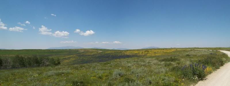
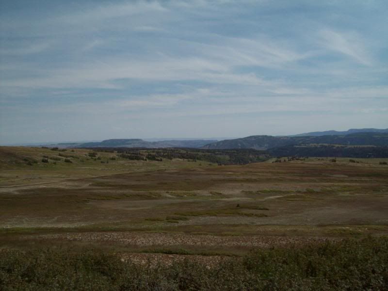
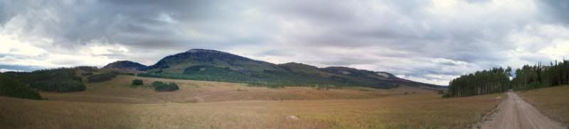
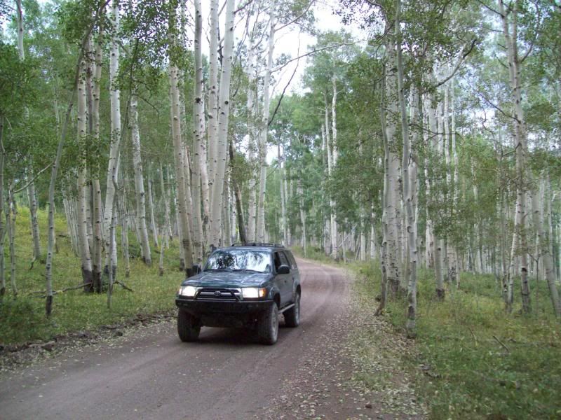
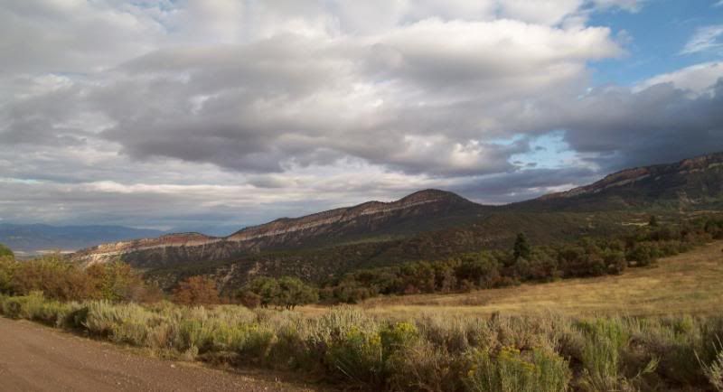
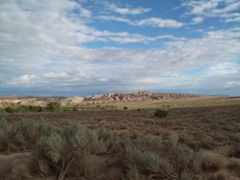
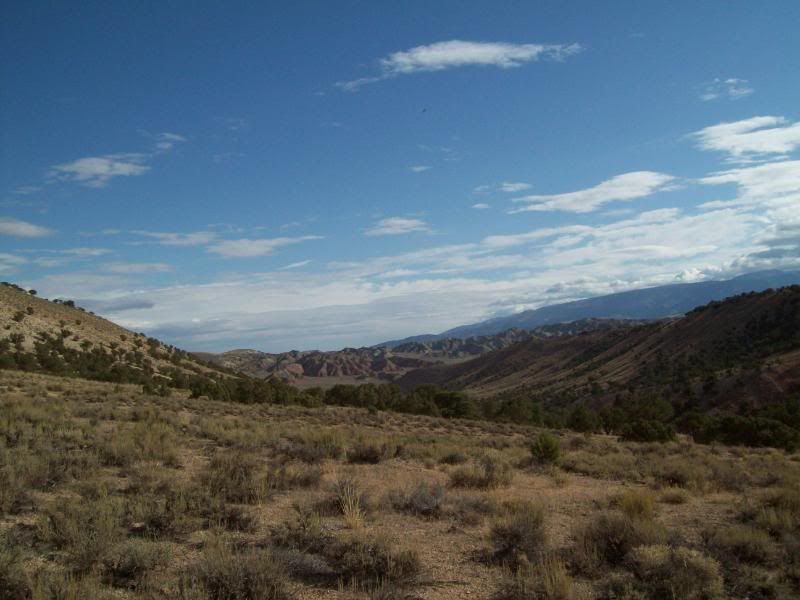
The northern portion of the trail starts at the former Tucker rest stop which has been taken over by hwy construction equipment and trailers. The scenery along this stretch was great, the first section winded though pines and aspens along a dirt road that eventually turned into a gravel road though grass lands and forest as you progressed higher. The grasslands were filled with purple and yellow flowers more than what you see along the Northern trail system. ATV and vehicle was scattered along the way and what I assume to be hunting campsites were setup or in the progress of being setup. As you got closer to US 31 traffic picked up some.
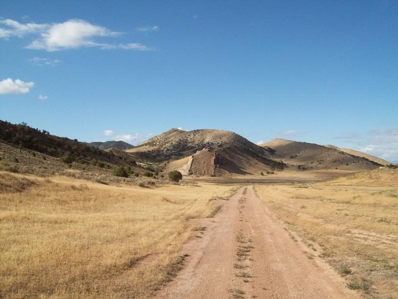
The central section was a bit confusing as a wrong turned lead me to Fairview Lake. A quick turn around lead me back up a rutted dirt stretch of road then to a short gravel section before hitting US 31 once again and a quick mile jaunt down the asphalt to Southern portion of the trail.
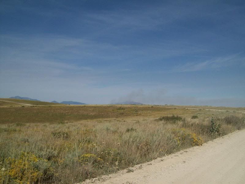
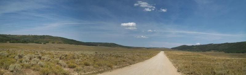
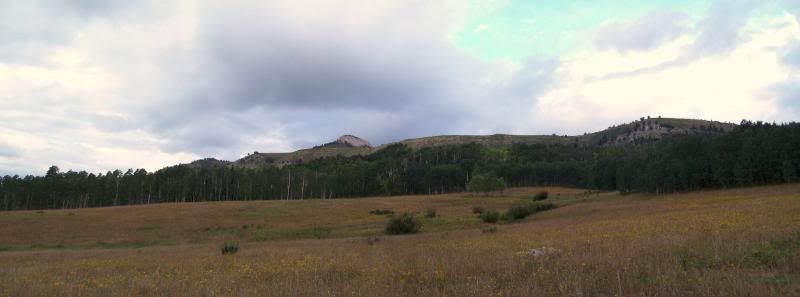
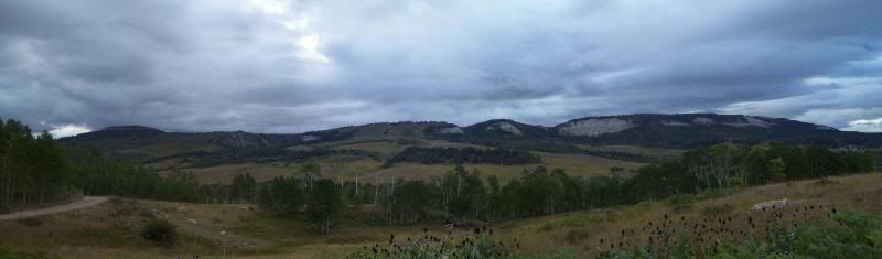
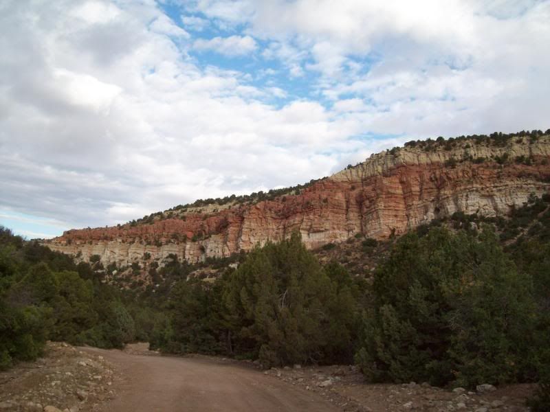
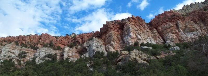
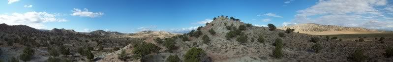
The southern portion of the trail system was the longest stretch of trail. The first two you could easily maintain a good click this section not so. The first portion of this is more less maintained as a sign down the way indicates that the trail isn't maintained past this point which helped to deter a minivan and a Mitsubishi Mirage. The sections following where a mix of dirt, rocky areas and gravel roads (mainly where the trail lead to a city). Along the way you past though forest, boulder strewn sections of roads, grasslands and self-roads that provided views as far as you could see but would be a pain in the rain.
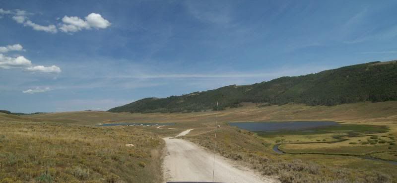
ATV tracks and side trails filled this area which lead down to resivors/ponds or down to established campgrounds. Avoid venturing off the ATV tracks even if they are wide enough for a vehicle or you might find yourself tipping on three wheels in a mud hole.
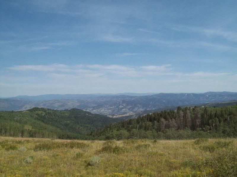
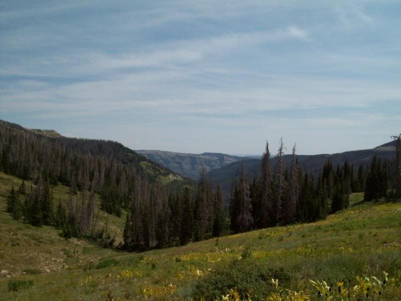
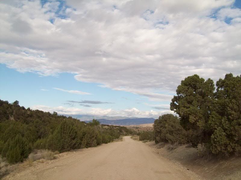
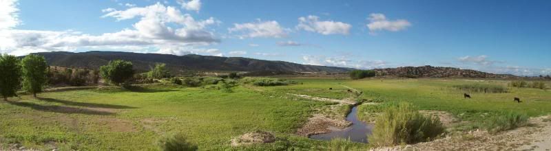
Unfortunately, do to a time constraint that I had the portion of the trail past the 12 Mile Canyon Campground required some Baja speed on my part to get back to hwy to get an prior arrangement I had so I was unable to enjoy the scenery like I had been. The final miles back to main road wound though aspen trees, grasslands, lakes/ponds and red rock outcroppings.
Overall, this trip is going to require a extended say to explore some of the side roads and visiting the lakes scattered throughout.
One close call occurred on this trip: coming around a single lane blind corner (S type turn)myself and a olive color Defender 90 about collided head on. There was just enough room that he went to one side and I went to another only to bend the stupid retractable radio antenna on my 4runner.
Slideshow: sorry no tunes
http://www.youtube.com/watch?v=d_zQ5m0YnS4
Having run the Northern portion of Skyline Drive up here in Bountiful I decided it was time to run the central portion of the trail system that runs from Tucker rest area to Salina, Utah. I wouldn't have known that this portion or the very southern portion of this trail system existed if it wasn't for some fellow members of this forum and others for the help.
The original plan was to leave at 5am to catch the start of the trail just as the sun was rising but work though a wrench into those plans and I was unable to leave till 1030 and was at the trail head at 1230 pm (which was okay since I need the $$)by the time I got back to pavement it was 820pm.
The trail system I found was broken up into 3 sections divided by a US 31. Access to the southern portion could've been taken by asphalt or dirt (still had to hit asphalt for a few miles to reach the dirt). I opted for the dirt.
The northern portion of the trail starts at the former Tucker rest stop which has been taken over by hwy construction equipment and trailers. The scenery along this stretch was great, the first section winded though pines and aspens along a dirt road that eventually turned into a gravel road though grass lands and forest as you progressed higher. The grasslands were filled with purple and yellow flowers more than what you see along the Northern trail system. ATV and vehicle was scattered along the way and what I assume to be hunting campsites were setup or in the progress of being setup. As you got closer to US 31 traffic picked up some.
The central section was a bit confusing as a wrong turned lead me to Fairview Lake. A quick turn around lead me back up a rutted dirt stretch of road then to a short gravel section before hitting US 31 once again and a quick mile jaunt down the asphalt to Southern portion of the trail.
The southern portion of the trail system was the longest stretch of trail. The first two you could easily maintain a good click this section not so. The first portion of this is more less maintained as a sign down the way indicates that the trail isn't maintained past this point which helped to deter a minivan and a Mitsubishi Mirage. The sections following where a mix of dirt, rocky areas and gravel roads (mainly where the trail lead to a city). Along the way you past though forest, boulder strewn sections of roads, grasslands and self-roads that provided views as far as you could see but would be a pain in the rain.
ATV tracks and side trails filled this area which lead down to resivors/ponds or down to established campgrounds. Avoid venturing off the ATV tracks even if they are wide enough for a vehicle or you might find yourself tipping on three wheels in a mud hole.
Unfortunately, do to a time constraint that I had the portion of the trail past the 12 Mile Canyon Campground required some Baja speed on my part to get back to hwy to get an prior arrangement I had so I was unable to enjoy the scenery like I had been. The final miles back to main road wound though aspen trees, grasslands, lakes/ponds and red rock outcroppings.
Overall, this trip is going to require a extended say to explore some of the side roads and visiting the lakes scattered throughout.
One close call occurred on this trip: coming around a single lane blind corner (S type turn)myself and a olive color Defender 90 about collided head on. There was just enough room that he went to one side and I went to another only to bend the stupid retractable radio antenna on my 4runner.
Slideshow: sorry no tunes
http://www.youtube.com/watch?v=d_zQ5m0YnS4
 08-23-2009, 01:41 PM
#2
Registered User
Thread Starter
Join Date: Aug 2006
Location: Colorado Springs, Co
Posts: 1,691
Likes: 0
Received 0 Likes
on
0 Posts
Update: Camping Trip 8/23/09
At the beginning of the month I ran central portion of Skyline Drive between Tucker and Salina, Utah (see above post) but due to a time constant (had to meet my mother before she flew back home) and the loom of night I opted for baja speed to make it back. Leaving the southern portion of the trail undocumented (for my sake)and thus a camping trip was in order to photograph the rest of the area. I already had an area in mind to spend the night of said trip a little lake near the end of the trail.
As luck would have it (I fiqured it might happen, partly due to an error on my part)the dispatcher for my work had forgotten that I wasn't going to here this weekend and I had to remind her that I wasn't going to be. Needless, to say I got my butt chewed a little but I didn't really care since there was some information left out when I was hired on about time off (namely being married to my cell phone/work 24/7: schedule issue, etc.). Ultimately, I was still able to get off and the trip was still on (got to love last minute issues).
Saturday, I headed out the door to Tucker (felt kind of bad since dispatch needed me to work and someone had to give up their weekend. We've been busy at work – had about a 15+ hour of O/T). Along the the way I thought about skipping Skyline and to head to the Moab area instead (Arches) but I hadn't budgeted gas money or planned for it. So I stuck to the orginal plan.
Since I was last at the Tucker rest stop a lot had changed (lots of earthwork done) and new route had been temporaryliy built to access Skyline Drive. For the first two sections of this trail I really didn't take too many photo's since I had done so in my first trip but I did manage to explore down to ridge lines (one with off-camber and nasty in the mud, the other had ups and downs to being then head back down the canyon). The number of hunters/atv's had nearly doubled since I was here last and the road had grown extremely dusty in some area's.
The difference a little less than a month can make:
Before
After
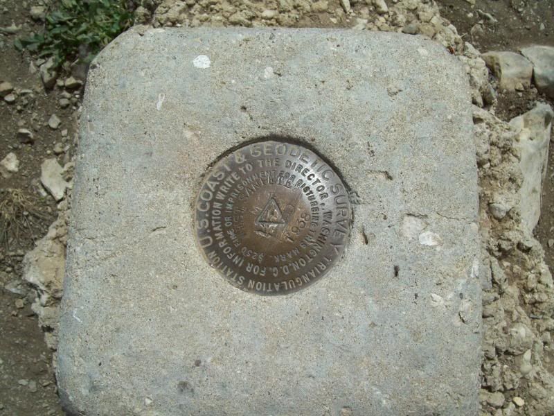
Garret Ridge
Johnson Ridge (a little off-camber and would nasty in the mud)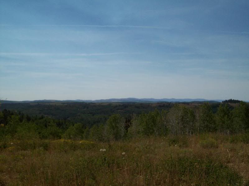
Gooseberry Reservoir (pardon the CB antenna)
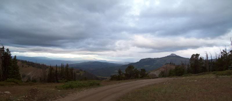
The third and final section the vehicle traffic/number of people had die off, except where there was an access road to a city, which made traveling a little easier. The goal was to reach the lake by 5:00 pm. Again, I didn't take too much time to stop and take photo's since I had done so previously but I did manage to hit a side trail or two that I didn't the first time around. I ended up reaching the lake a little after 5 and after a little exploring I found my camp for the night.
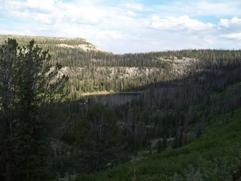
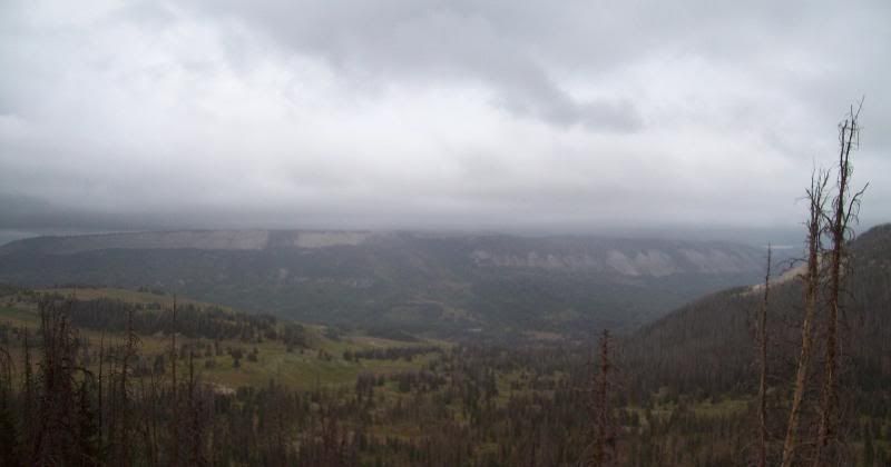
Horseshoe Flats
-Taken from an overlook on Horseshoe Flats. There's a hiking trail just right past where I took the photo.
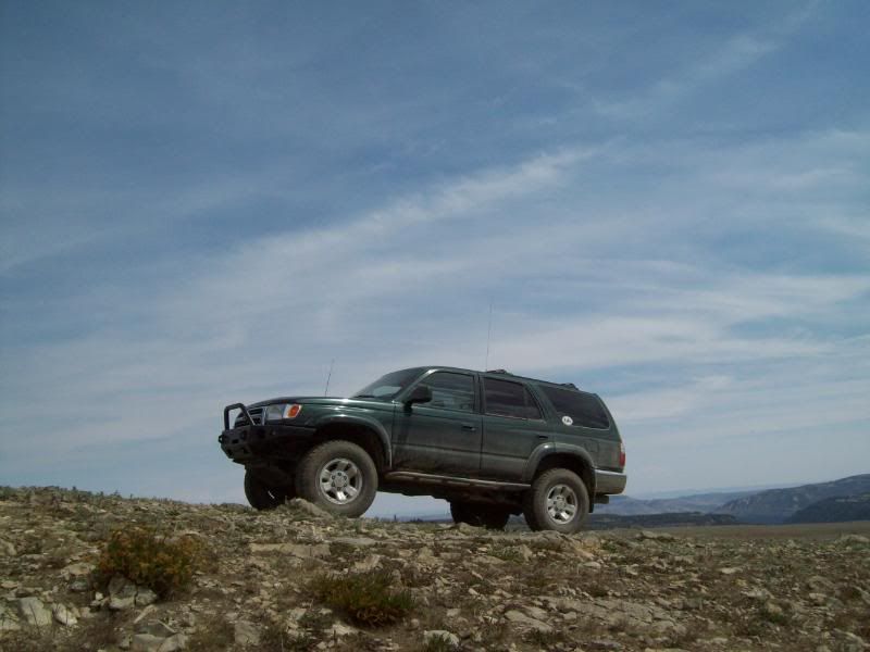
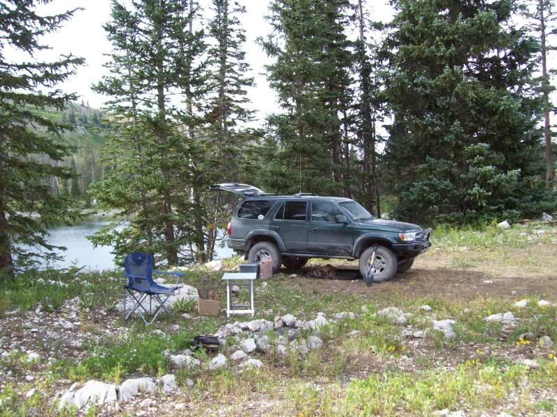
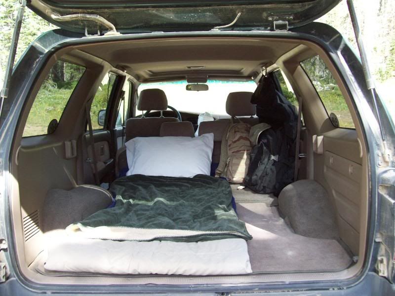
Shameless vehicle plug
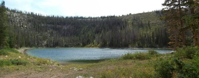
The lake I saw on my first trip around that just called to be camped at:
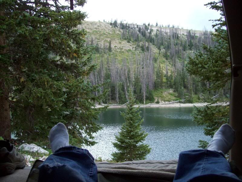
Camp for the night (the lake from close up)
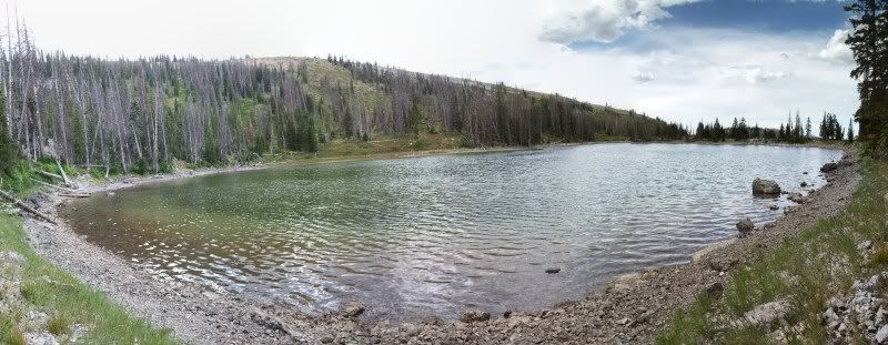
My view of the lake from here
Found this little guy while cleaning out the fire pit – any idea what type of Salamander he is?
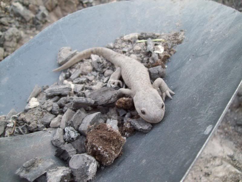
Don't worry he wasn't harmed. He was taken about 50' from my camp and place in the grass.
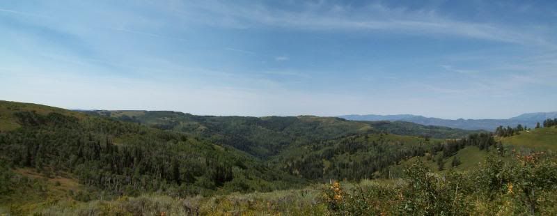
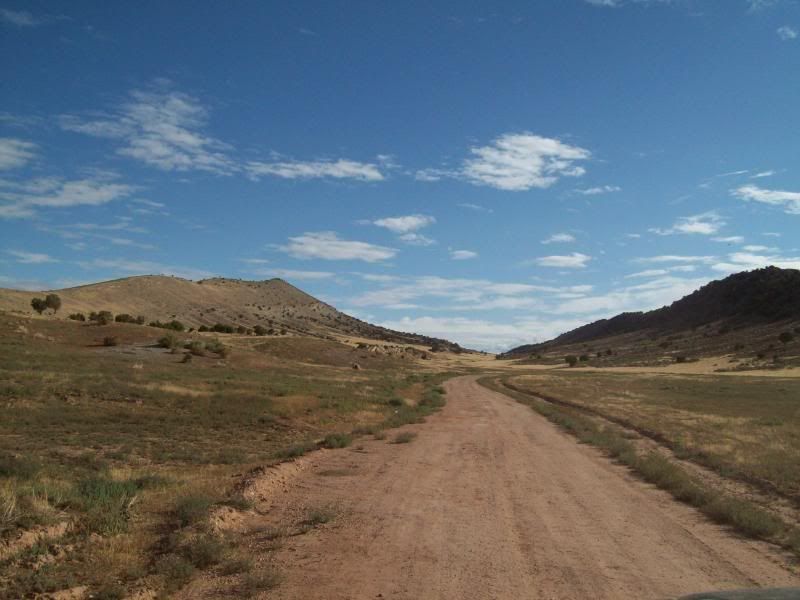
With a nice 6am wake up call (went to bed about 830pm the night before being exhausted from work and driving), I was packed and back on the trail about 700 am. During the night storm clouds had rolled and was littley sprinkling when I had reached the main trail. Luckily, that all it was and it didn't last long. The final stretch of the trail wounded back though the aspens, open field then back down into cedar/juniper trees before hitting the main stretch of road back home.
Island Lake
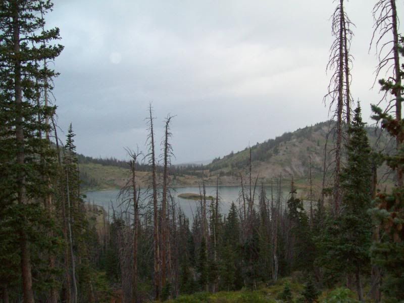
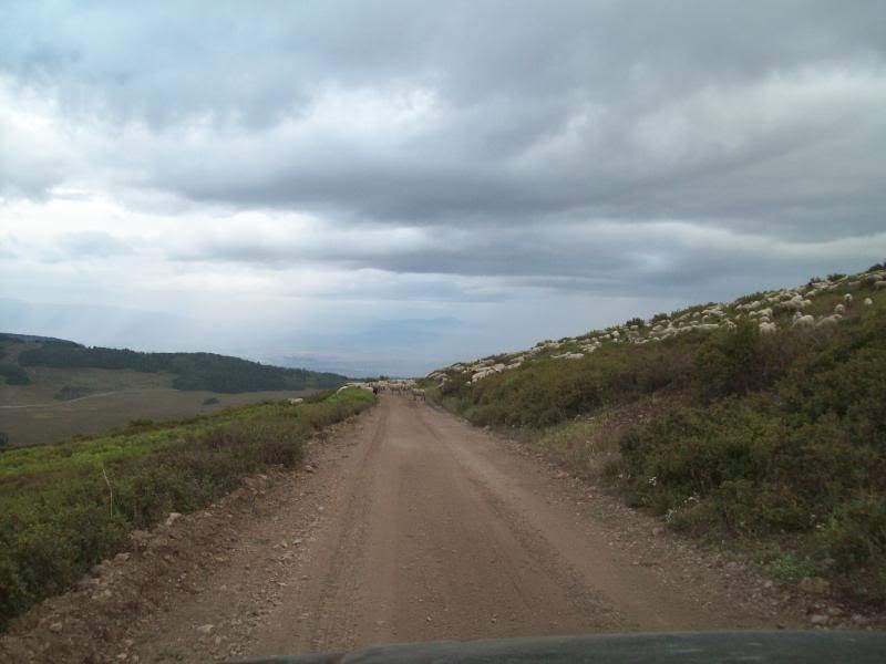
Ended up becoming a sheep herder you a few hundred feet. Tons of sheep to right of the photo.
Another shameless vehicle plug. The section though the aspens and back to the main road would be a blast in a rally car.
Detour #1 -
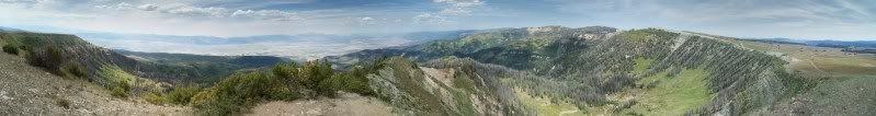
Detour #2 (tried to get a fully 360* view but a small portion of the photos came out to dark to stich together) -
Detour #3 -
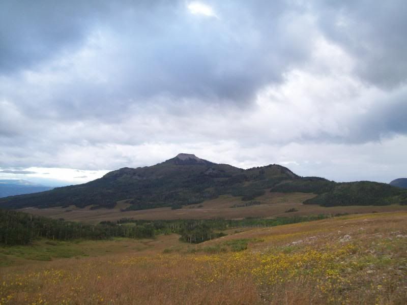
Rock formation that caught my eye -
In the end it was a great trip and sorely over due. A future trip will be in the works but when I don't know and where I will have to see. What I do know is that I hope I don't come across groups of ATV riders/hunters stopping in the middle of the trail or coming around the corners at crazy speeds or seeing people dropping trees across the roadway to chop up for fire wood.
Hopefully, next time I'll some company. People give you weird looks when you talk to yourself “Wilson!!!!!!”.
Rest of the photos can be found here: http://s162.photobucket.com/albums/t...amping%20Trip/
As luck would have it (I fiqured it might happen, partly due to an error on my part)the dispatcher for my work had forgotten that I wasn't going to here this weekend and I had to remind her that I wasn't going to be. Needless, to say I got my butt chewed a little but I didn't really care since there was some information left out when I was hired on about time off (namely being married to my cell phone/work 24/7: schedule issue, etc.). Ultimately, I was still able to get off and the trip was still on (got to love last minute issues).
Saturday, I headed out the door to Tucker (felt kind of bad since dispatch needed me to work and someone had to give up their weekend. We've been busy at work – had about a 15+ hour of O/T). Along the the way I thought about skipping Skyline and to head to the Moab area instead (Arches) but I hadn't budgeted gas money or planned for it. So I stuck to the orginal plan.
Since I was last at the Tucker rest stop a lot had changed (lots of earthwork done) and new route had been temporaryliy built to access Skyline Drive. For the first two sections of this trail I really didn't take too many photo's since I had done so in my first trip but I did manage to explore down to ridge lines (one with off-camber and nasty in the mud, the other had ups and downs to being then head back down the canyon). The number of hunters/atv's had nearly doubled since I was here last and the road had grown extremely dusty in some area's.
The difference a little less than a month can make:
Before
After
Garret Ridge
Johnson Ridge (a little off-camber and would nasty in the mud)
Gooseberry Reservoir (pardon the CB antenna)
The third and final section the vehicle traffic/number of people had die off, except where there was an access road to a city, which made traveling a little easier. The goal was to reach the lake by 5:00 pm. Again, I didn't take too much time to stop and take photo's since I had done so previously but I did manage to hit a side trail or two that I didn't the first time around. I ended up reaching the lake a little after 5 and after a little exploring I found my camp for the night.
Horseshoe Flats
-Taken from an overlook on Horseshoe Flats. There's a hiking trail just right past where I took the photo.
Shameless vehicle plug
The lake I saw on my first trip around that just called to be camped at:
Camp for the night (the lake from close up)
My view of the lake from here
Found this little guy while cleaning out the fire pit – any idea what type of Salamander he is?
Don't worry he wasn't harmed. He was taken about 50' from my camp and place in the grass.
With a nice 6am wake up call (went to bed about 830pm the night before being exhausted from work and driving), I was packed and back on the trail about 700 am. During the night storm clouds had rolled and was littley sprinkling when I had reached the main trail. Luckily, that all it was and it didn't last long. The final stretch of the trail wounded back though the aspens, open field then back down into cedar/juniper trees before hitting the main stretch of road back home.
Island Lake
Ended up becoming a sheep herder you a few hundred feet. Tons of sheep to right of the photo.
Another shameless vehicle plug. The section though the aspens and back to the main road would be a blast in a rally car.
Detour #1 -
Detour #2 (tried to get a fully 360* view but a small portion of the photos came out to dark to stich together) -
Detour #3 -
Rock formation that caught my eye -
In the end it was a great trip and sorely over due. A future trip will be in the works but when I don't know and where I will have to see. What I do know is that I hope I don't come across groups of ATV riders/hunters stopping in the middle of the trail or coming around the corners at crazy speeds or seeing people dropping trees across the roadway to chop up for fire wood.
Hopefully, next time I'll some company. People give you weird looks when you talk to yourself “Wilson!!!!!!”.
Rest of the photos can be found here: http://s162.photobucket.com/albums/t...amping%20Trip/
Last edited by wormhole; 08-23-2009 at 01:43 PM.


Thread
Thread Starter
Forum
Replies
Last Post
the1998sr5
95.5-2004 Tacomas & 96-2002 4Runners
15
07-14-2020 08:35 PM
nanhodges2733
86-95 Trucks & 4Runners
16
05-29-2020 03:28 PM
v_man
86-95 Trucks & 4Runners
14
07-23-2015 04:01 PM


