Pony Express Trail Run 9-11-09
 09-13-2009, 06:32 PM
#1
Registered User
Thread Starter
Join Date: Aug 2006
Location: Colorado Springs, Co
Posts: 1,691
Likes: 0
Received 0 Likes
on
0 Posts
Pony Express Trail Run 9-11-09
Thanks to a screw up on my part I had requested an extra day off from work that I didn't intend to take but since I had it I wasn't going to waste it (caught a few days before hand). Not being too familiar with Utah and it's trails I was originally planning to hit a national park in the area that I know: Bryce Canyon, Zions NP, Moab � Arches NP,F Flaming Gorge and Grand Teton NP all came to mind) and do some hiking or mountain biking.
Cruiseroutfitter (from ih8mud and expeditionportal) had recommend that I hit up a portion of the Pony Express Trail system here in Utah. I had known about the trail since seeing a sign for it while out at 5-Mile Pass R.A. but had completely forgotten the trail. After some consideration I decided to run the trail since it was closer than the above mentioned areas and it was an area I hadn't been before. So after a late start (had to take care of something with my new employer)I was headed out.
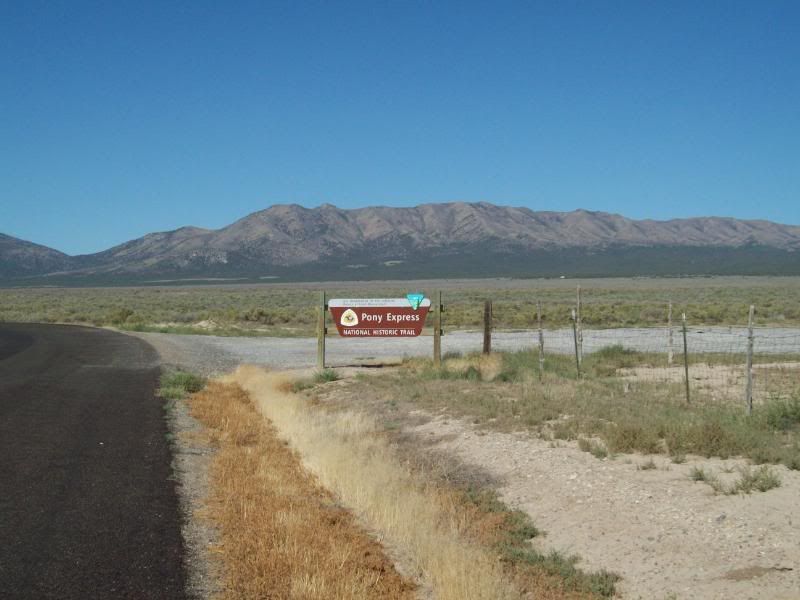
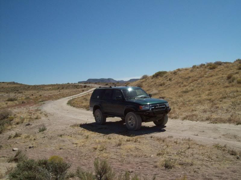
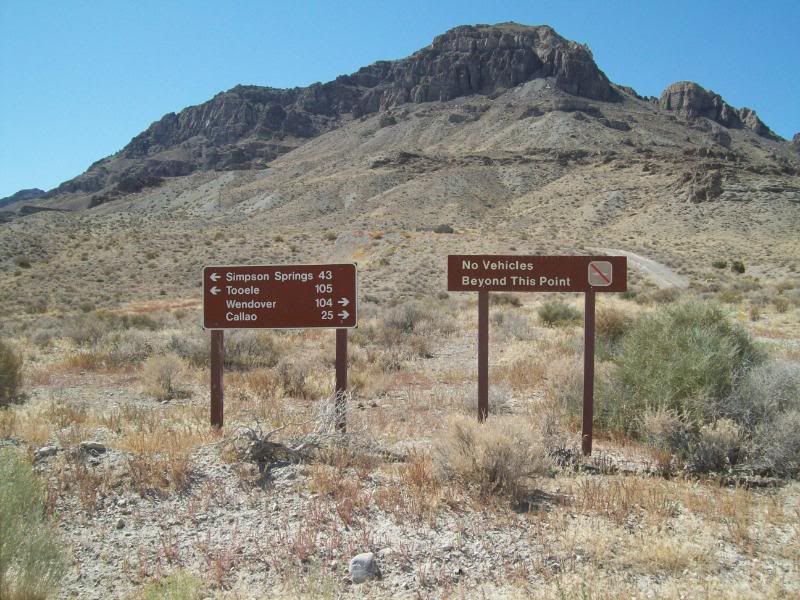
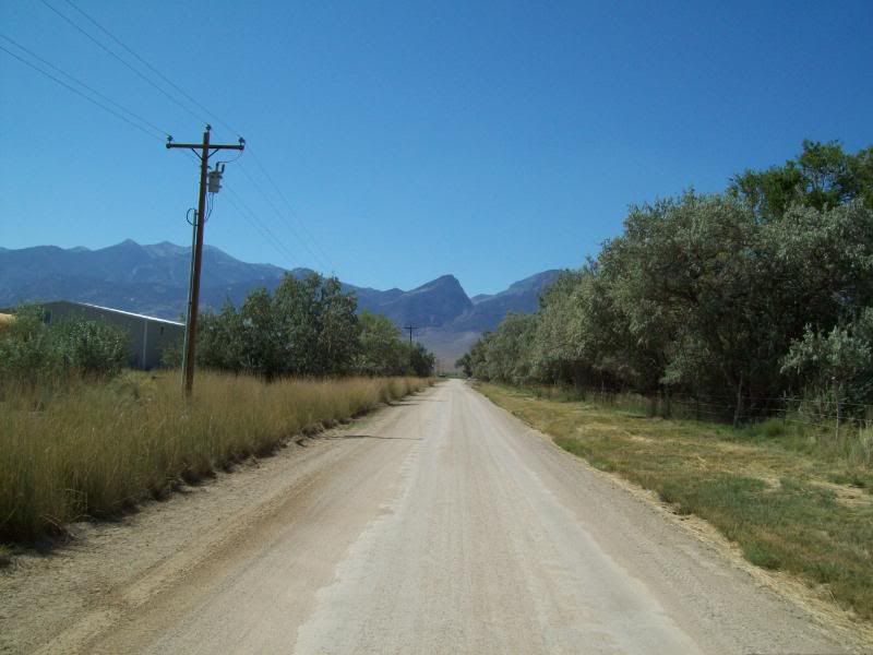
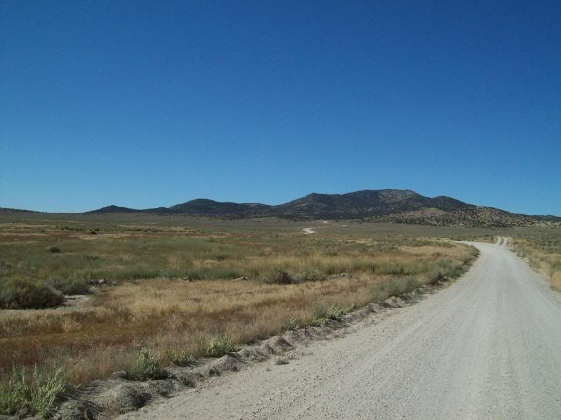
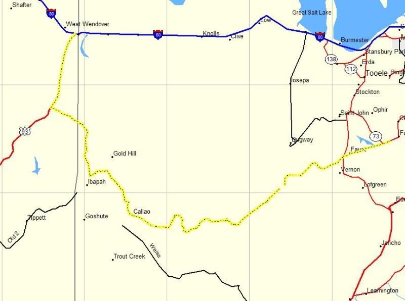
The trail can either be accessed just north of Ibapah, Utah or by taking the turn-off at the 5-Mile Pass RA. Unless, your coming from the Nevada side I'd recommend that you start at Fish Creek/Vernon area just west of 5-Mile Pass. There are other turnoffs to access portions of the trail though-out but they are kind of remote. I opted to start at the Fish Creek/Vernon Area. The first marker for the Pony Express trail is located at the intersection of HWY 36 and Faust Road then after a quick jaunt just south of it the trail itself beings and the adventure begins.
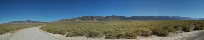
This time around I wanted to try something a little different when documenting my trip. The plan was to mark way points (highlighted in yellow) on my GPS as I traveled and when I came to a road intersection, a point of interest or a Pony Express Trail marker I would mark the point and then take a photo of the area. My intention was to give a sense of the area from those locations instead of taking random photo's along the way and then trying to describe where those were at.
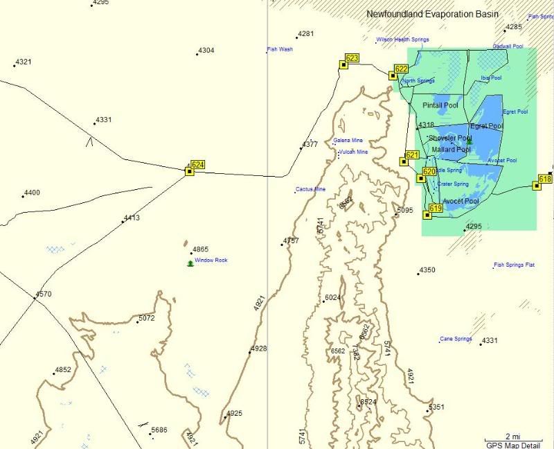
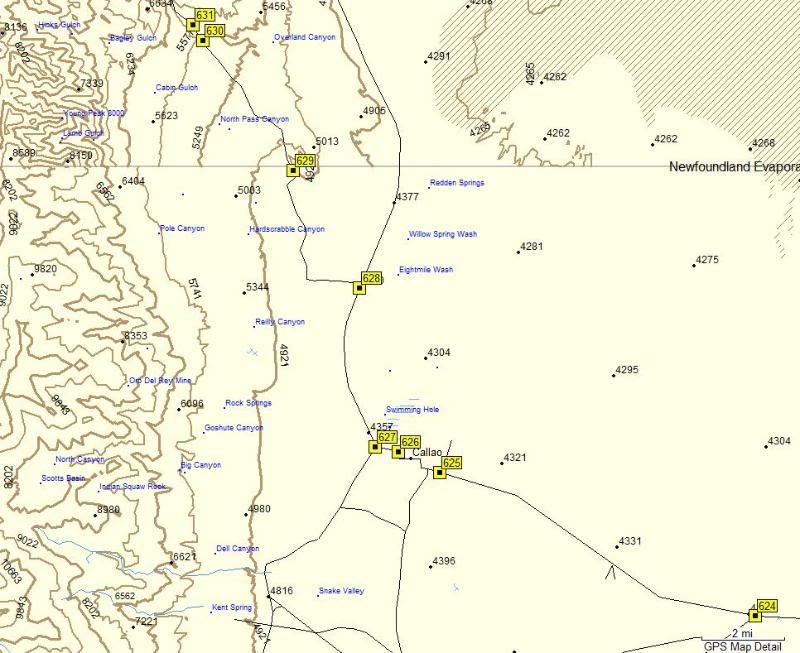
Broke out my GPS map into separate maps for ease of viewing:
Map 1
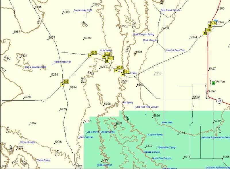
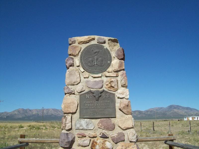
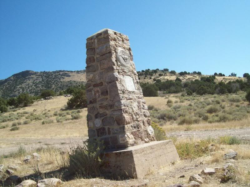
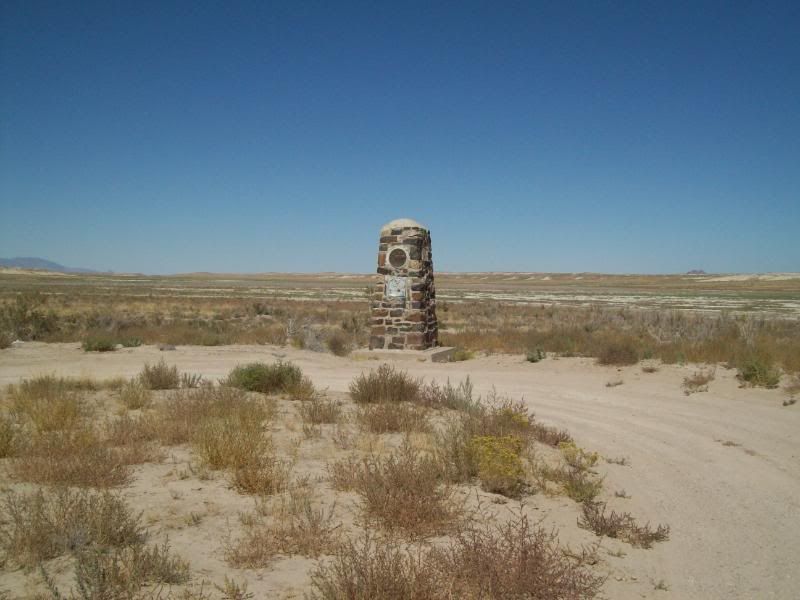
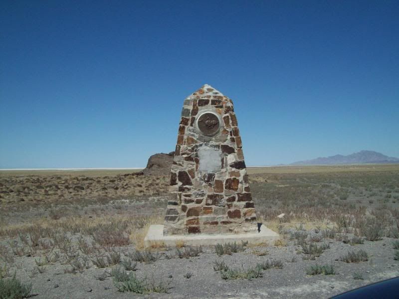
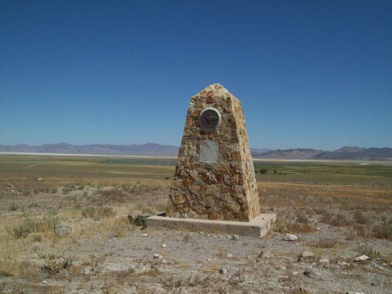
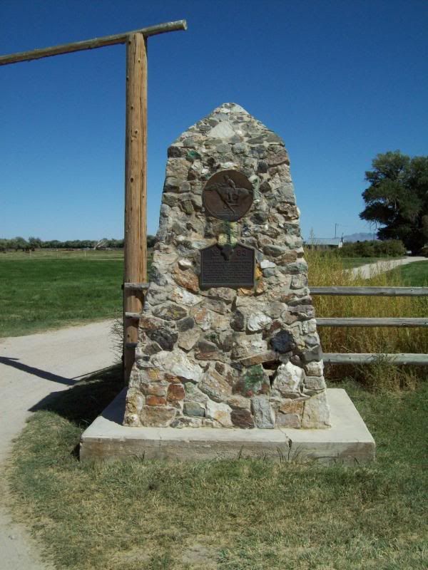
598 � First Pony Express Marker: No. 53 Faust Station
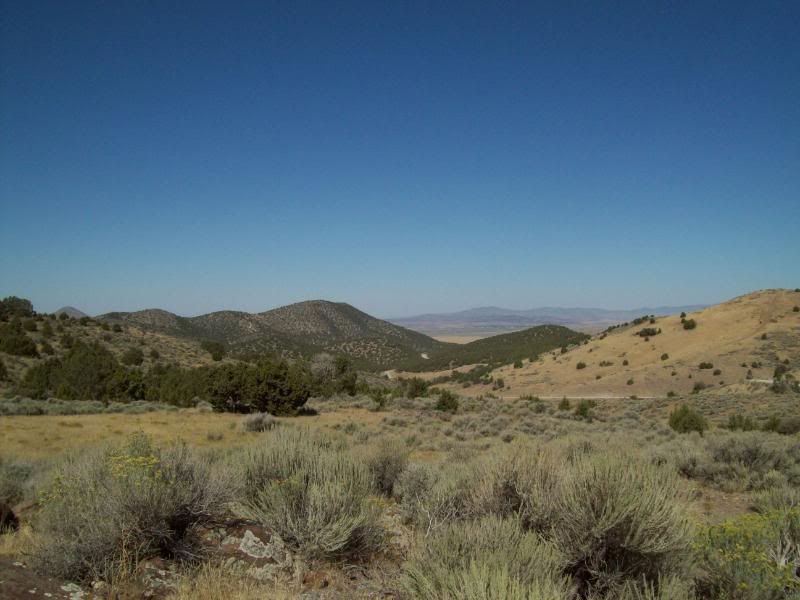
600 � Trail Starts
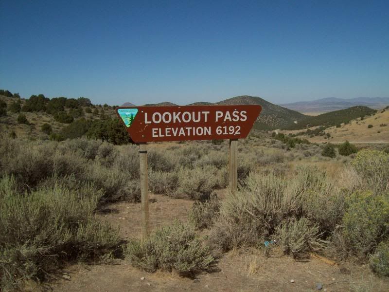
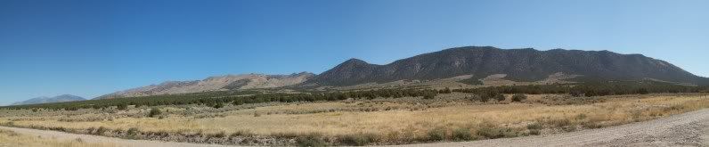
601 - Lookout Pass
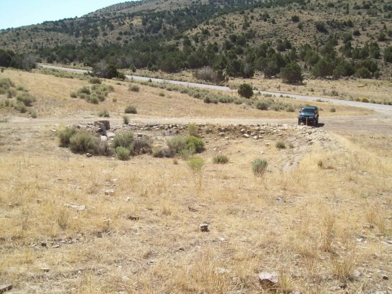
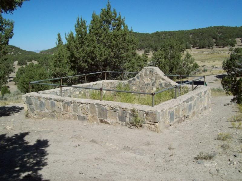
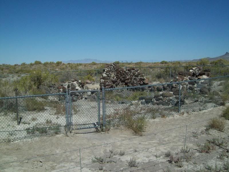
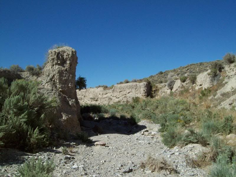
602 � Lookout Pass Station and Cemetery
Remains of the building once here:
The cemetery � a dog a few people are buried here (correct me if I'm wrong)
603 � Little Valley Turnoff
604 � Terra and Simpson Springs/Pony Express Trail Junction
605 � Dugway and Simpson Springs/Pony Express Trail Junction
606 � Dugway and Erickson/Pony Express Trail Junction
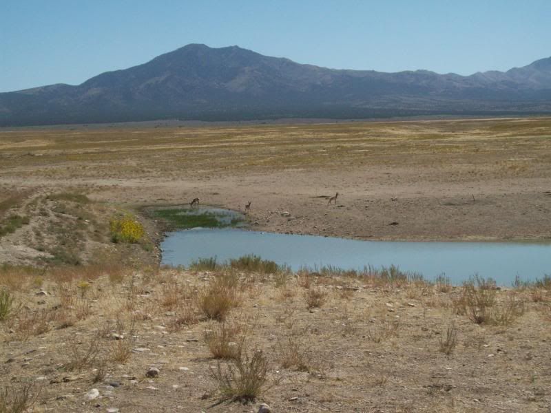
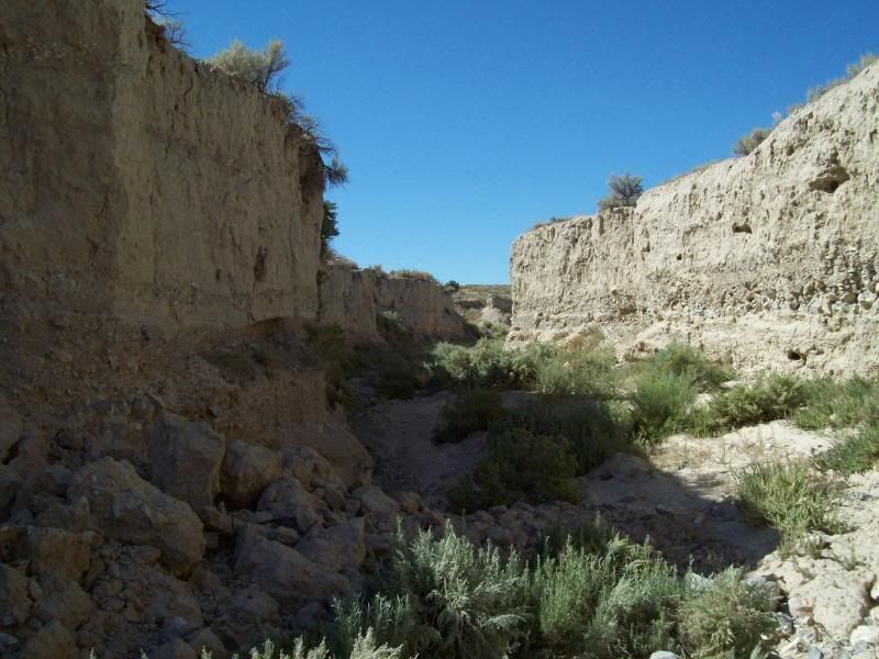
Between waypoints 603 and 607
Saw these little fellows at the water hole � counted about 6 of them scattered around the area
Map 2
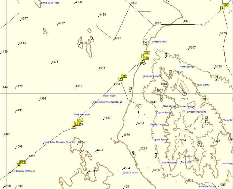
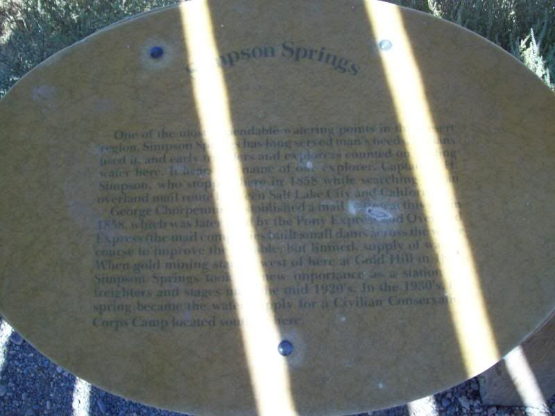
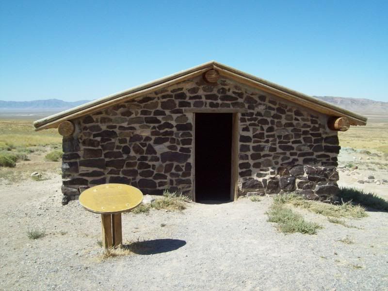
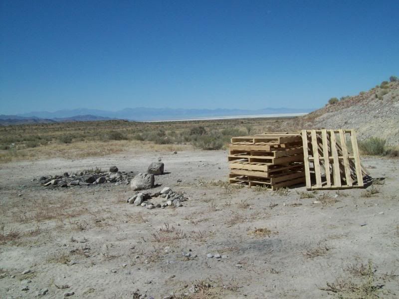
607 � Simpson Springs Recreation Area with a campground located nearby.
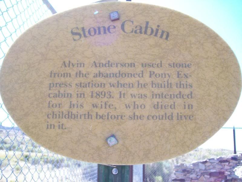
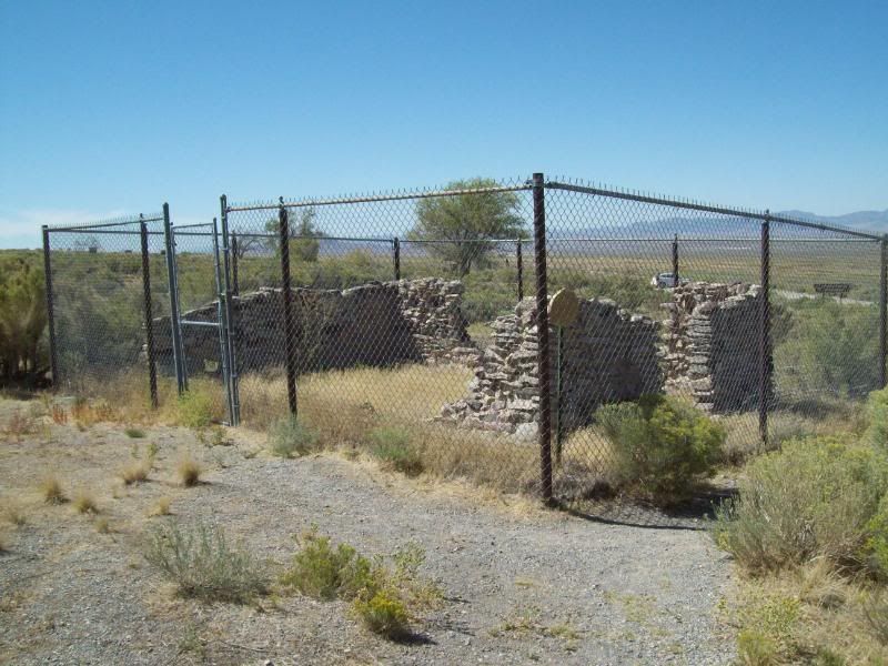
Remains of the stone cabin
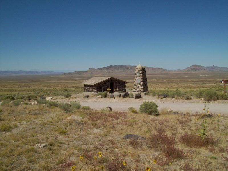
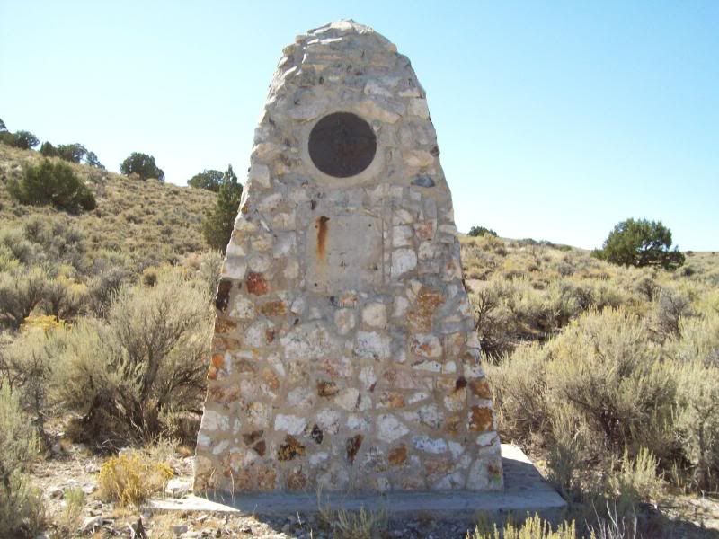
Other cabin and Pony Express Trail Marker: No 87, Simpson Springs
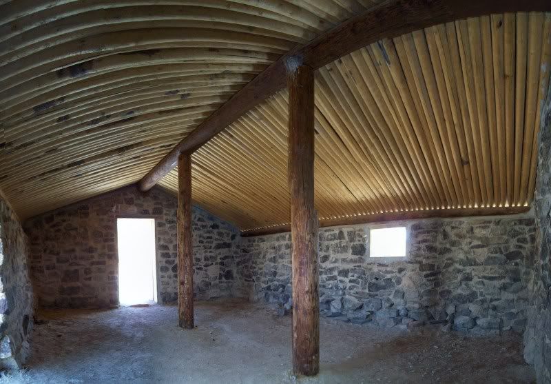
Inside the cabin. Gotten attacked by nats or some other flying insect while trying to take the photo.
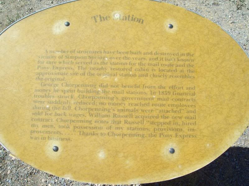
608 � Historic Maker (no photo for this one ???)
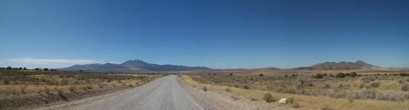
609 � Pony Express/Dugway Geo Beds and Indian Springs/Death Canyon Junction
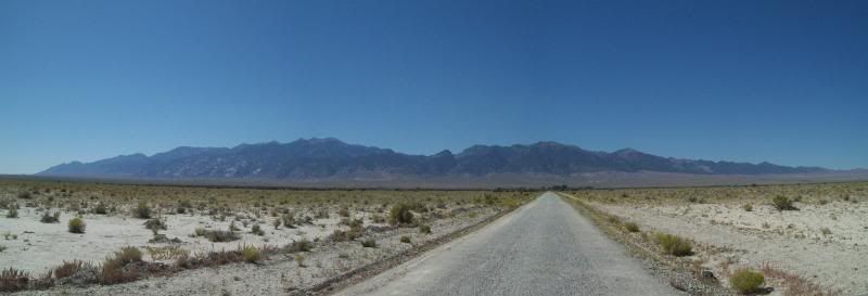
Taken somewhere between 607 and 610: A long road to somewhere
610 � Pony Express Trail/Fish Springs and Weiss Highway/Little Sahara Junction Turnoff
611 � Pony Express Trail Marker: Non. unknown
Taken somewhere between 611 and 614
Map 3
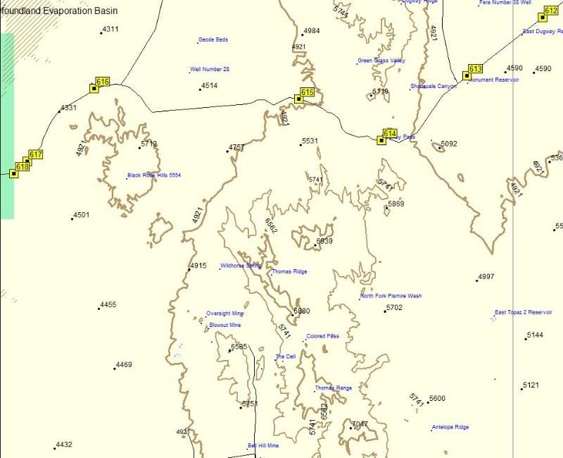
613 � Kane Springs/Wiess Hwy/Delta and Pony Express Trail Junction
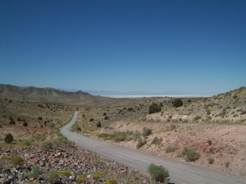
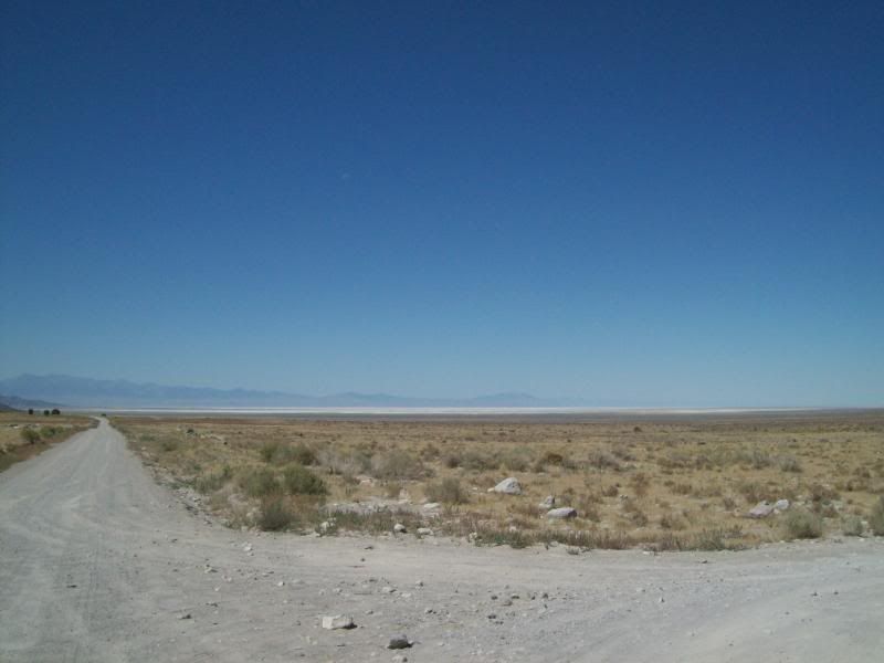
614 � Top of Pass
Looking back:
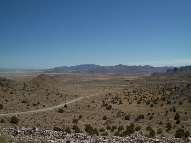
Looking ahead:
615 � Dugway Geo Beds Turnoff
Someone is planning a fire out there
616 � Pony Express Trail marker: No. Unknown
617 � Dugway Geo Beds/Simpson Springs/Hwy 36 and Brush Wellman Nine/Topan Mtn./Delta Junction
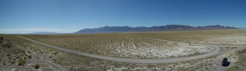
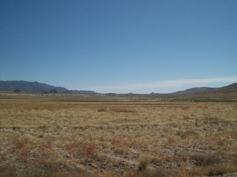
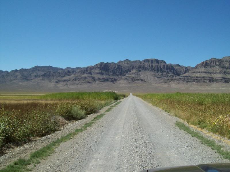
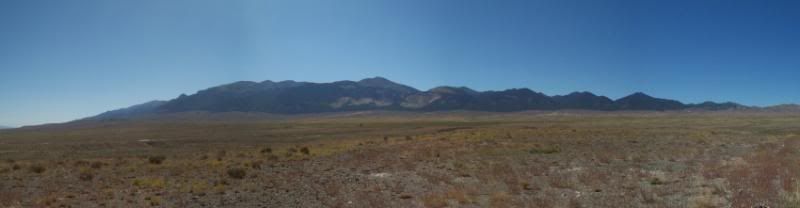
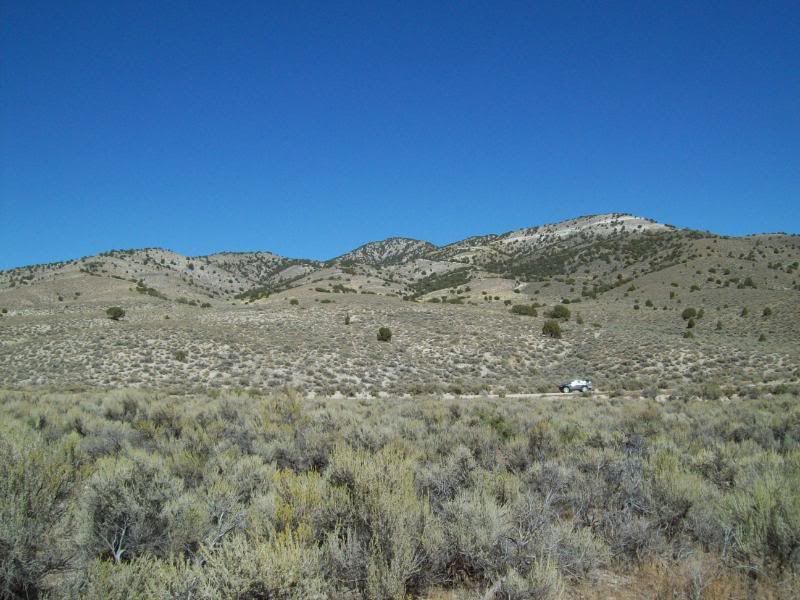
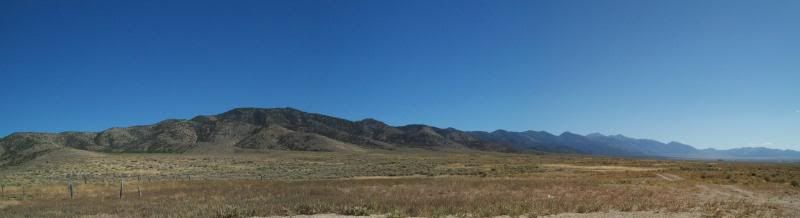
618 � Fish Springs National Wildlife Refuge. Coming in from this location is barren then vegetation begins.
Map 4
619 � Sand Pass and Callao Junction
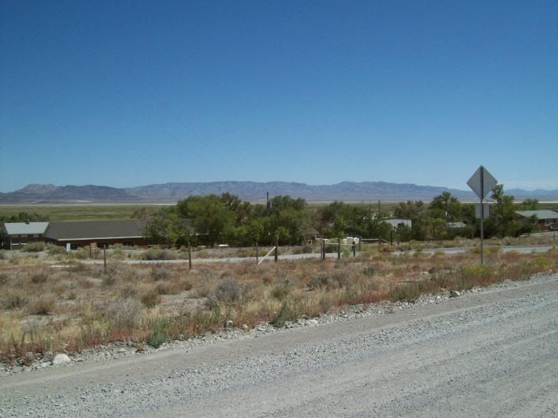
620 � Fish Springs Headquarters
Along way to go till Wendover and I-80
621 � Pony Express Station: No. unknown
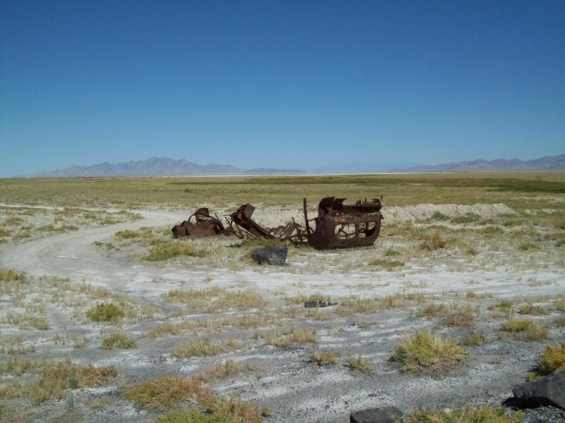
Taken somewhere between 621 and 622

Old flipped/rolled over bus
622 � Leaving Fish Springs NWR. Beware of a sharp corner right before the exit.
623 � Top of Pass/Blind hill when coming over
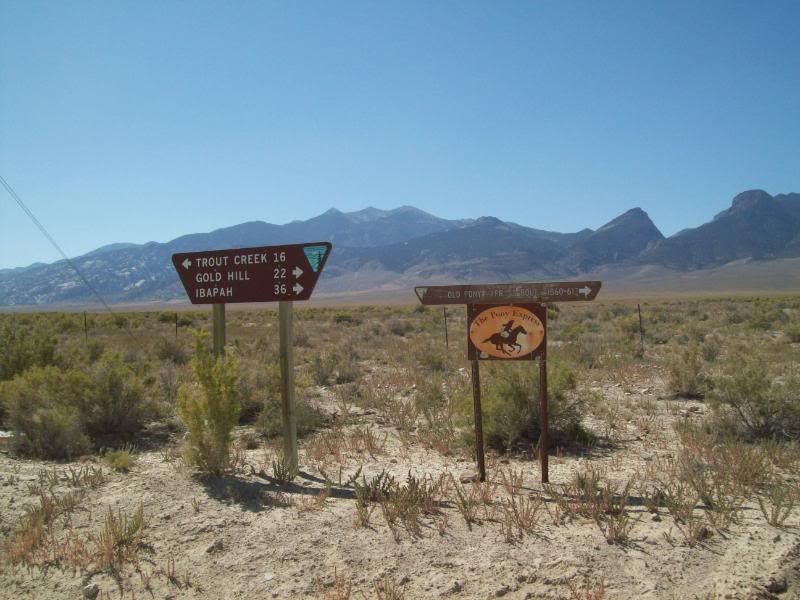
624 � Callao and Trout Creek/Partoun/US 50-6 Junction.
Boyd Pony Express Station at this location
Heading to Callao
Map 5
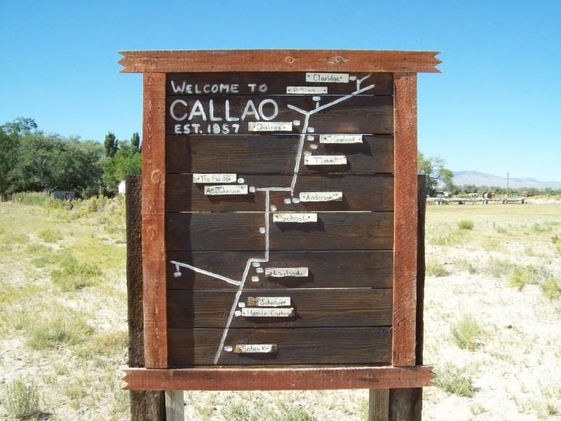
625 � Callao. Surprising the map pretty much matches the town
Okay, now who's going to do that or is my mind just in the gutter?
626 � Pony Express Station:No. 83 Willow Springs
627 � Trout Creek and Gold Hill/Ibapah Junction
628 � Gold Hill and Ibapah/Overland Canyon/Pony Express Junction
629 � Random
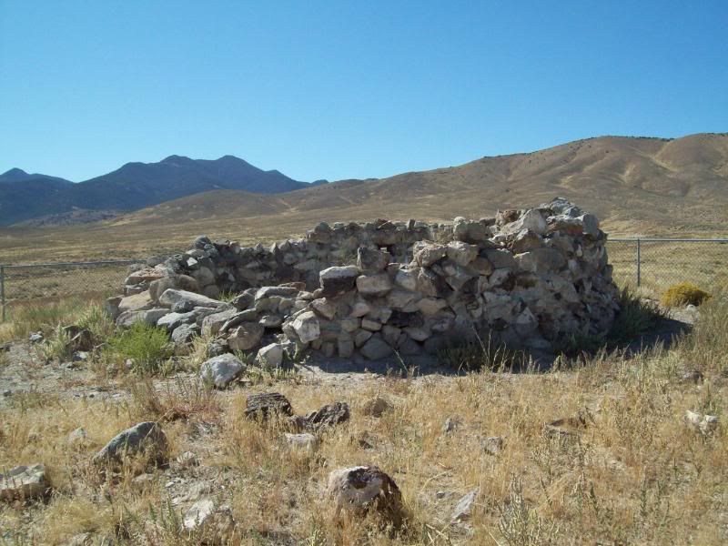
630 � Canyon Station
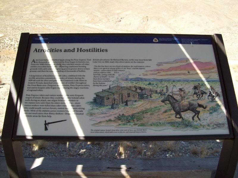
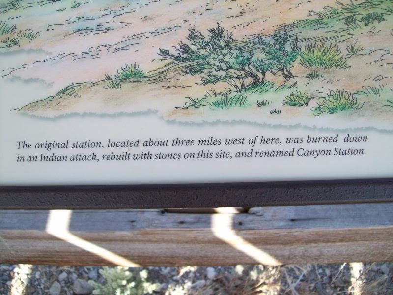
Ruins
Map 6
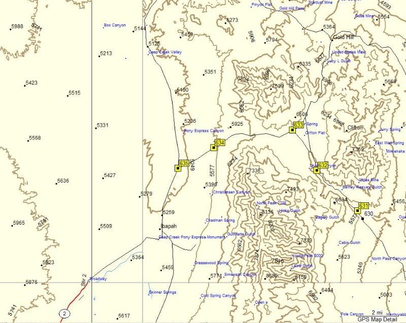
631 � Overland Canyon Sign
632 � Pony Express Trail Station: No. unknown
Now how do I get over there with this wash in the way? I know I climb down into then back up. Hopefully, if doesn't ran. HeHeHaHa!!
The unknown station and little did I know that there was a road that lead here just a little ways down from where I had parked.
Between 632 and 633
633 � Gold Hill Junction
634 � Deep Creek Wilderness Study Area turnoff
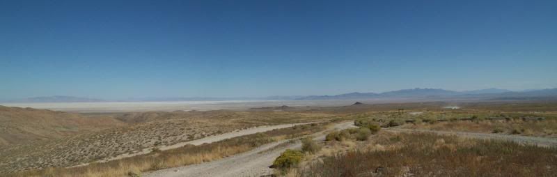
635 � At the trails end
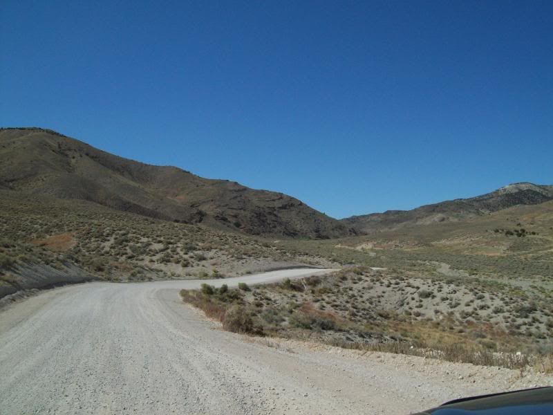
Well, the trail was about 133 miles of gravel road that is somewhat maintained. You just have to watch out for potholes that span the the entire width of the road and some pretty bad washboard areas. It's accessible by car but I don't know if I would drive it in a car after a rain though. Other vehicle traffic on this trail is few and far between so heed the warning at the beginning of the trail to have extra supplies just in case (water/gas, etc.).
The road back from Ibapah to Wendover is on a paved road and is pretty much desolate as well. There is a house or two at the end of the trail but after that your pretty much on your own. Overall, it was a long but good day. I would love to hit this area back up in the spring time when every is green.
One recommendation that I have is that you fill-up your gas tank in Wendover and don't risk trying to get back to SLC or Tooele. I took a chance and about ran out of gas. The next gas station after Wendover is in Delle about 66 miles aways and you can expect to pay about $3.00 a gallon for gas, $.40 to $.50 more than in SLC or Tooele. I made it from Bountiful to Delle on a tank, avg about 17 mpg.
Here's the track/route I took.
Rest of the photo's can be found here:
http://s162.photobucket.com/albums/t...ail%209-11-09/
Cruiseroutfitter (from ih8mud and expeditionportal) had recommend that I hit up a portion of the Pony Express Trail system here in Utah. I had known about the trail since seeing a sign for it while out at 5-Mile Pass R.A. but had completely forgotten the trail. After some consideration I decided to run the trail since it was closer than the above mentioned areas and it was an area I hadn't been before. So after a late start (had to take care of something with my new employer)I was headed out.
The trail can either be accessed just north of Ibapah, Utah or by taking the turn-off at the 5-Mile Pass RA. Unless, your coming from the Nevada side I'd recommend that you start at Fish Creek/Vernon area just west of 5-Mile Pass. There are other turnoffs to access portions of the trail though-out but they are kind of remote. I opted to start at the Fish Creek/Vernon Area. The first marker for the Pony Express trail is located at the intersection of HWY 36 and Faust Road then after a quick jaunt just south of it the trail itself beings and the adventure begins.
This time around I wanted to try something a little different when documenting my trip. The plan was to mark way points (highlighted in yellow) on my GPS as I traveled and when I came to a road intersection, a point of interest or a Pony Express Trail marker I would mark the point and then take a photo of the area. My intention was to give a sense of the area from those locations instead of taking random photo's along the way and then trying to describe where those were at.
Broke out my GPS map into separate maps for ease of viewing:
Map 1
598 � First Pony Express Marker: No. 53 Faust Station
600 � Trail Starts
601 - Lookout Pass
602 � Lookout Pass Station and Cemetery
Remains of the building once here:
The cemetery � a dog a few people are buried here (correct me if I'm wrong)
603 � Little Valley Turnoff
604 � Terra and Simpson Springs/Pony Express Trail Junction
605 � Dugway and Simpson Springs/Pony Express Trail Junction
606 � Dugway and Erickson/Pony Express Trail Junction
Between waypoints 603 and 607
Saw these little fellows at the water hole � counted about 6 of them scattered around the area
Map 2
607 � Simpson Springs Recreation Area with a campground located nearby.
Remains of the stone cabin
Other cabin and Pony Express Trail Marker: No 87, Simpson Springs
Inside the cabin. Gotten attacked by nats or some other flying insect while trying to take the photo.
608 � Historic Maker (no photo for this one ???)
609 � Pony Express/Dugway Geo Beds and Indian Springs/Death Canyon Junction
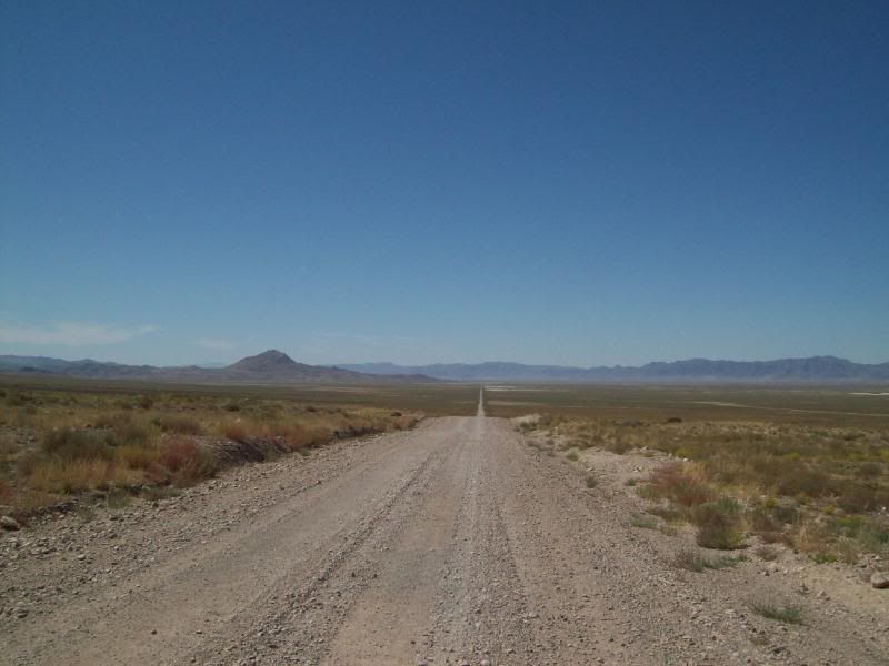
Taken somewhere between 607 and 610: A long road to somewhere
610 � Pony Express Trail/Fish Springs and Weiss Highway/Little Sahara Junction Turnoff
611 � Pony Express Trail Marker: Non. unknown
Taken somewhere between 611 and 614
Map 3
613 � Kane Springs/Wiess Hwy/Delta and Pony Express Trail Junction
614 � Top of Pass
Looking back:
Looking ahead:
615 � Dugway Geo Beds Turnoff
Someone is planning a fire out there
616 � Pony Express Trail marker: No. Unknown
617 � Dugway Geo Beds/Simpson Springs/Hwy 36 and Brush Wellman Nine/Topan Mtn./Delta Junction
618 � Fish Springs National Wildlife Refuge. Coming in from this location is barren then vegetation begins.
Map 4
619 � Sand Pass and Callao Junction
620 � Fish Springs Headquarters
Along way to go till Wendover and I-80
621 � Pony Express Station: No. unknown
Taken somewhere between 621 and 622
Old flipped/rolled over bus
622 � Leaving Fish Springs NWR. Beware of a sharp corner right before the exit.
623 � Top of Pass/Blind hill when coming over
624 � Callao and Trout Creek/Partoun/US 50-6 Junction.
Boyd Pony Express Station at this location
Heading to Callao
Map 5
625 � Callao. Surprising the map pretty much matches the town
Okay, now who's going to do that or is my mind just in the gutter?
626 � Pony Express Station:No. 83 Willow Springs
627 � Trout Creek and Gold Hill/Ibapah Junction
628 � Gold Hill and Ibapah/Overland Canyon/Pony Express Junction
629 � Random
630 � Canyon Station
Ruins
Map 6
631 � Overland Canyon Sign
632 � Pony Express Trail Station: No. unknown
Now how do I get over there with this wash in the way? I know I climb down into then back up. Hopefully, if doesn't ran. HeHeHaHa!!
The unknown station and little did I know that there was a road that lead here just a little ways down from where I had parked.
Between 632 and 633
633 � Gold Hill Junction
634 � Deep Creek Wilderness Study Area turnoff
635 � At the trails end
Well, the trail was about 133 miles of gravel road that is somewhat maintained. You just have to watch out for potholes that span the the entire width of the road and some pretty bad washboard areas. It's accessible by car but I don't know if I would drive it in a car after a rain though. Other vehicle traffic on this trail is few and far between so heed the warning at the beginning of the trail to have extra supplies just in case (water/gas, etc.).
The road back from Ibapah to Wendover is on a paved road and is pretty much desolate as well. There is a house or two at the end of the trail but after that your pretty much on your own. Overall, it was a long but good day. I would love to hit this area back up in the spring time when every is green.
One recommendation that I have is that you fill-up your gas tank in Wendover and don't risk trying to get back to SLC or Tooele. I took a chance and about ran out of gas. The next gas station after Wendover is in Delle about 66 miles aways and you can expect to pay about $3.00 a gallon for gas, $.40 to $.50 more than in SLC or Tooele. I made it from Bountiful to Delle on a tank, avg about 17 mpg.
Here's the track/route I took.
Rest of the photo's can be found here:
http://s162.photobucket.com/albums/t...ail%209-11-09/


Thread
Thread Starter
Forum
Replies
Last Post
Flying91
86-95 Trucks & 4Runners (Build-Up Section)
45
04-11-2024 04:39 PM
RedRunner_87
95.5-2004 Tacomas & 96-2002 4Runners (Build-Up Section)
84
06-01-2021 01:51 PM
the1998sr5
95.5-2004 Tacomas & 96-2002 4Runners
15
07-14-2020 08:35 PM
XtraCab
Solid Axle Swaps, All Years
18
04-12-2020 05:25 AM


