NW Jersey Off Road
 05-02-2014, 05:27 AM
#1
NW Jersey Off Road
It's going to be a long week as I'm counting the hours until the end of the day when I'll be heading up to the Kittattinny Mountains for a weekend of camping with some old friends I haven't seen in quite a while. For those of you who aren't familiar, the Delaware Water Gap is located in the northwest corner of the state where the Delaware River slowly cut a through an Appalachian ridge over the course of 450 million years:
http://tinyurl.com/Delaware-Water-Gap
The Gap is a 72,000 acre National Recreation Area run by the National Park Service on both sides of the river. On the New Jersey side it's bordered by an additional 40,000 acres of public land, so it's one of the least populated and most wild parts of the state. The interesting thing about the region its also one of the longest settled parts of the state. The Dutch made their way out to the Water Gap area in the early 1600s in search of copper, among other things, and ended up building the Old Mine Road (said to be one of the oldest established roads in America), paralleling the Delaware north to New York. Over the years various plans had been made to dam the Delaware for flood control and water supply reasons, with a growing New York City, Philadelphia, and Northern NJ region all vying for water in the late 1800s to 1930s. This finally culminated in the proposed Tocks Island Dam project, which was authorized by Congress in 1962. The dam would have created a 12,500 acre lake 30 miles long, a 1/2 mile wide, and about 140' deep by flooding the Walpack and Minisink Valleys. The dam was never built for a variety of reasons, and the project died, but not before thousands were forced off of land and family farms that had been in the same hands for generations, and whole towns (Parhaquarra, NJ and Walpack, NJ and towns on the PA side) had been moved out.
After the project died because of environmental concerns, public outcry over government land grabs, the lack of funds due to the Vietnam War raging, and questions surrounding the suitability of the geology of the area supporting a huge dam holding billions of cubic feet of water, the Army Corps of Engineers/National Park Service was left with 72,000 acres of land with vacant homes and farmsteads dotting the hills and valleys. They eventually turned the entire area into a park, preserving the land forever and keeping the Delaware one of the longest undammed rivers in the U.S., but, there's still quite a bit of bitterness by locals living in the surrounding area who were forced from their homes. Still, it's a beautiful place and there's nothing else like it in NJ. We'll be doing some exploring of old farmsteads, a complex of lakes which was once a collection of vacation camps, as well as the abandoned town of Walpack in between catching up and having a few cold ones around the fire. Here are a few of the places we'll drop by that I've been to before:
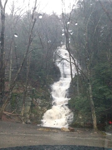
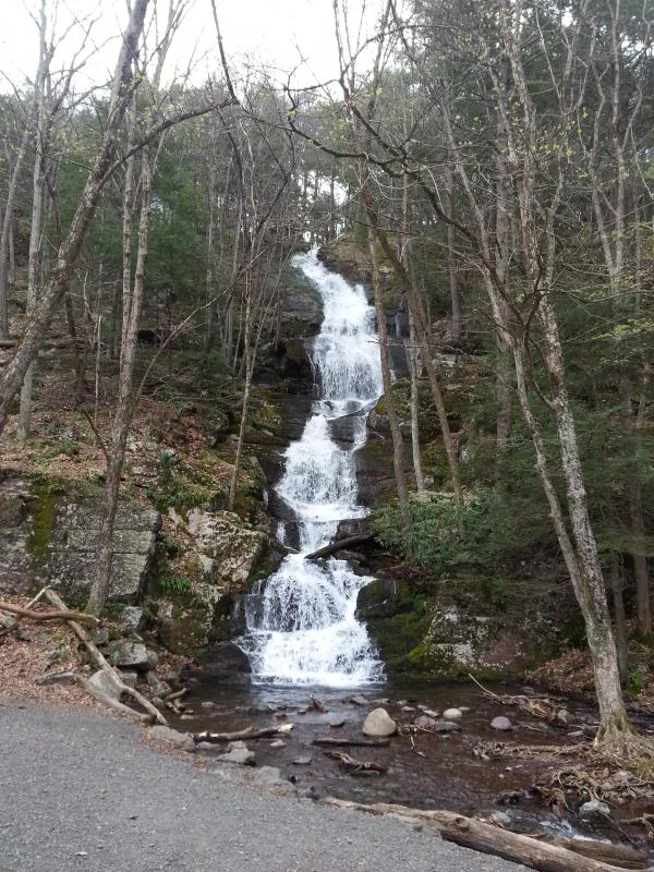
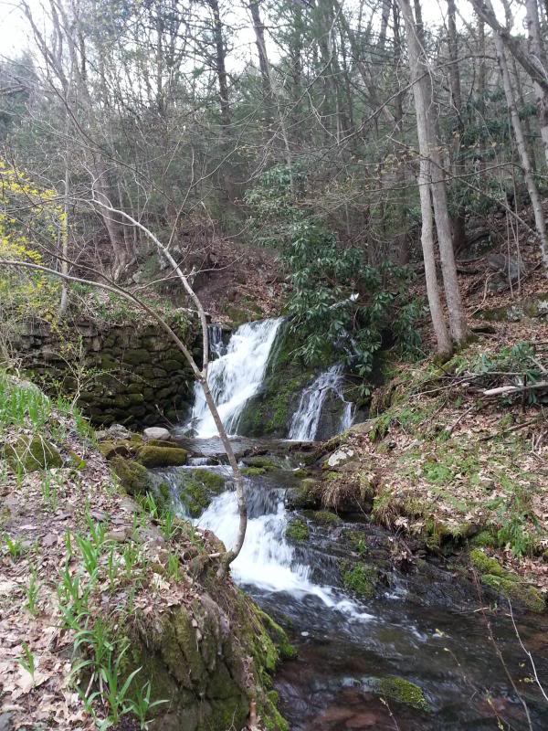
Buttermilk Falls-highest waterfall in NJ:
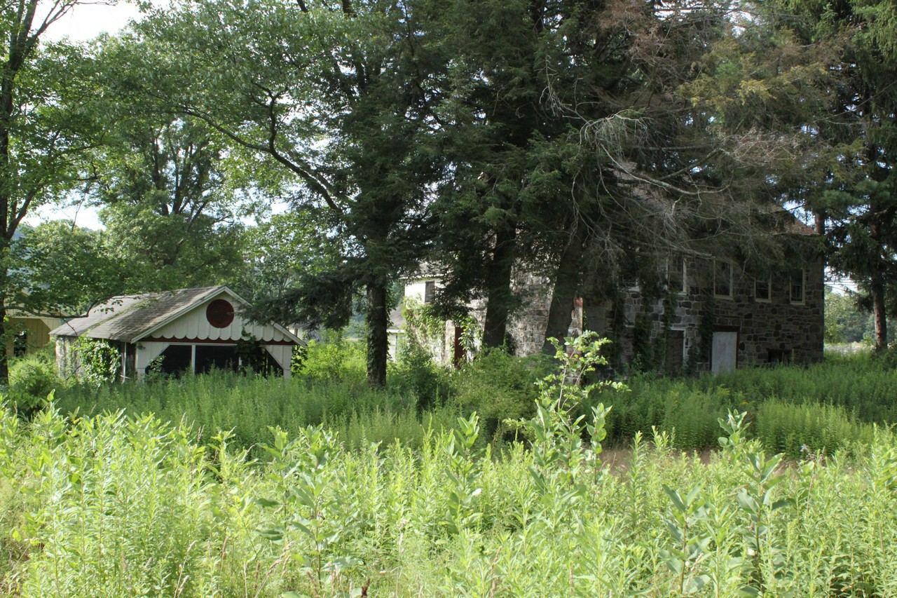
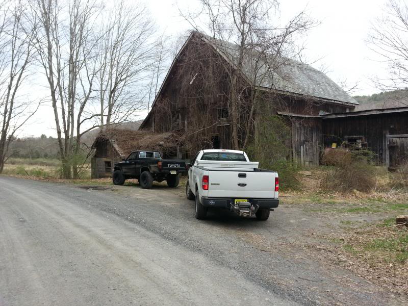
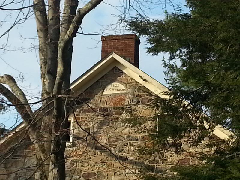
The Shoemaker Farm-established 1822, abandoned sometime in the late '70s:

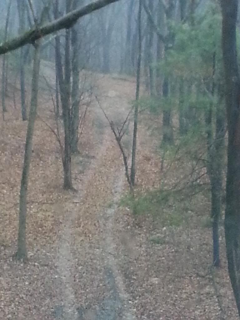
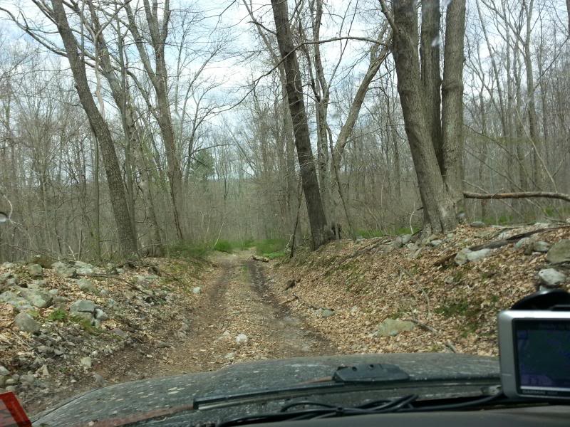
Road we found on the last trip that hasn't appeared on a map in 50 years:
http://tinyurl.com/Delaware-Water-Gap
The Gap is a 72,000 acre National Recreation Area run by the National Park Service on both sides of the river. On the New Jersey side it's bordered by an additional 40,000 acres of public land, so it's one of the least populated and most wild parts of the state. The interesting thing about the region its also one of the longest settled parts of the state. The Dutch made their way out to the Water Gap area in the early 1600s in search of copper, among other things, and ended up building the Old Mine Road (said to be one of the oldest established roads in America), paralleling the Delaware north to New York. Over the years various plans had been made to dam the Delaware for flood control and water supply reasons, with a growing New York City, Philadelphia, and Northern NJ region all vying for water in the late 1800s to 1930s. This finally culminated in the proposed Tocks Island Dam project, which was authorized by Congress in 1962. The dam would have created a 12,500 acre lake 30 miles long, a 1/2 mile wide, and about 140' deep by flooding the Walpack and Minisink Valleys. The dam was never built for a variety of reasons, and the project died, but not before thousands were forced off of land and family farms that had been in the same hands for generations, and whole towns (Parhaquarra, NJ and Walpack, NJ and towns on the PA side) had been moved out.
After the project died because of environmental concerns, public outcry over government land grabs, the lack of funds due to the Vietnam War raging, and questions surrounding the suitability of the geology of the area supporting a huge dam holding billions of cubic feet of water, the Army Corps of Engineers/National Park Service was left with 72,000 acres of land with vacant homes and farmsteads dotting the hills and valleys. They eventually turned the entire area into a park, preserving the land forever and keeping the Delaware one of the longest undammed rivers in the U.S., but, there's still quite a bit of bitterness by locals living in the surrounding area who were forced from their homes. Still, it's a beautiful place and there's nothing else like it in NJ. We'll be doing some exploring of old farmsteads, a complex of lakes which was once a collection of vacation camps, as well as the abandoned town of Walpack in between catching up and having a few cold ones around the fire. Here are a few of the places we'll drop by that I've been to before:
Buttermilk Falls-highest waterfall in NJ:
The Shoemaker Farm-established 1822, abandoned sometime in the late '70s:
Road we found on the last trip that hasn't appeared on a map in 50 years:
Last edited by Badfish740; 05-02-2014 at 05:33 AM.
 05-05-2014, 06:17 AM
#2
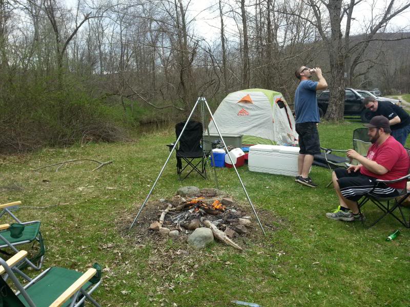
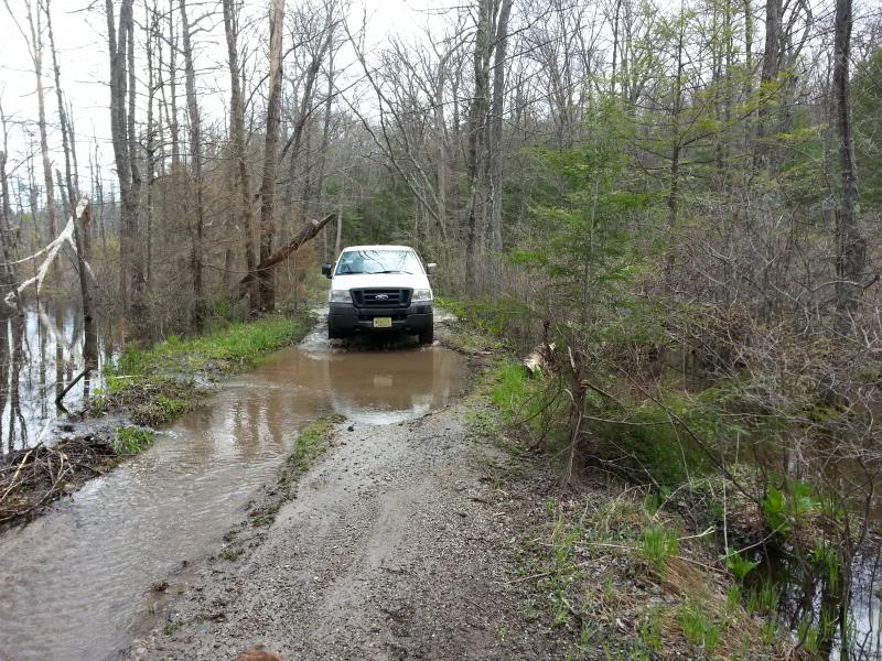
We got to the campground around 11:00 but we had to wait for the owner to get back because the Wednesday rainstorm flooded out a lot of the wooded campsites along the Flatbrook. He showed us where we could set up-we made camp and got a little lunch going:
We hit Buttermilk Falls first because none of them had ever been there before:
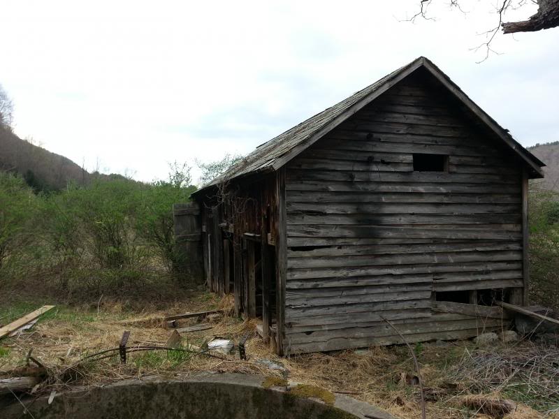
Then checked out an old cow barn across from the white house on Mountain Road-the Walpack valley used to be big dairy country:
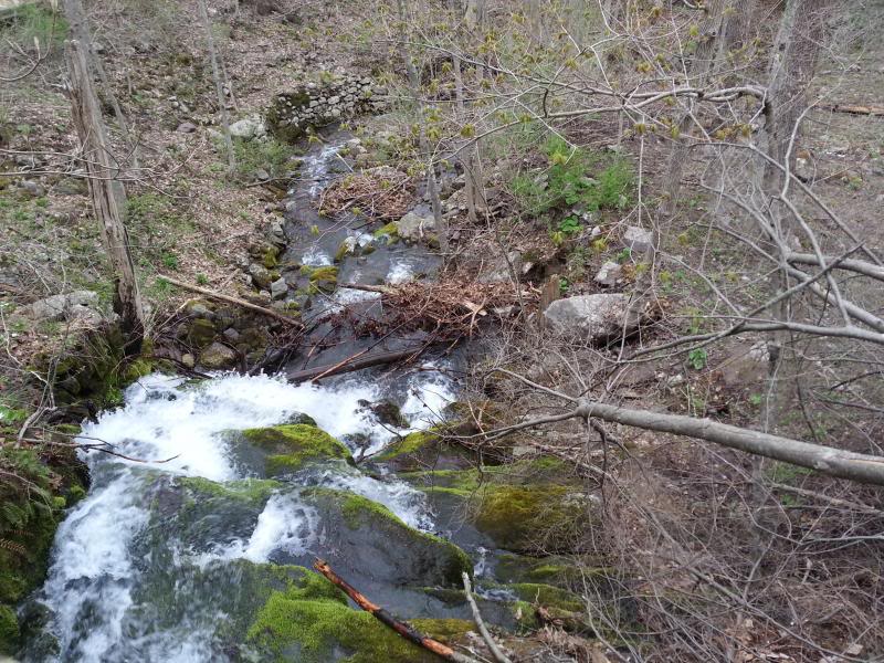
Small waterfall across the road beside the white house-it amazes me how much stonework was done to guide the flow of water and that it's still there after all these years of heavy runoff and flooding:
Then up to Skyline Drive:
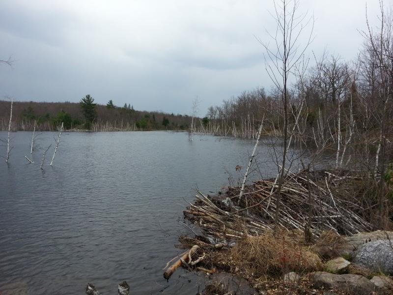
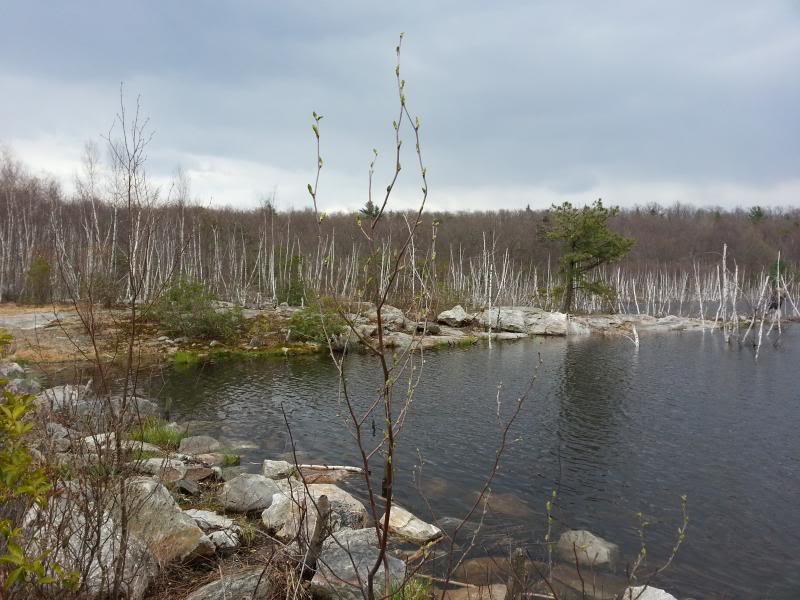
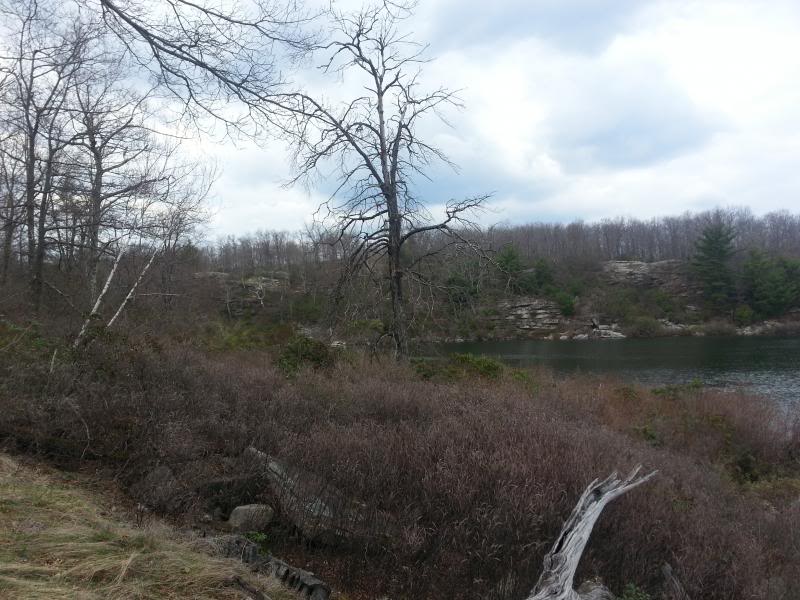
"Lake" Success (the first one you come to on Skyline on the way to Crater) is looking more like a lake again even though the NPS drained it sometime in the late '90s/early 2000s. Some beavers got to work and raised the water level about 6'. It was spilling over due to the heavy rains:
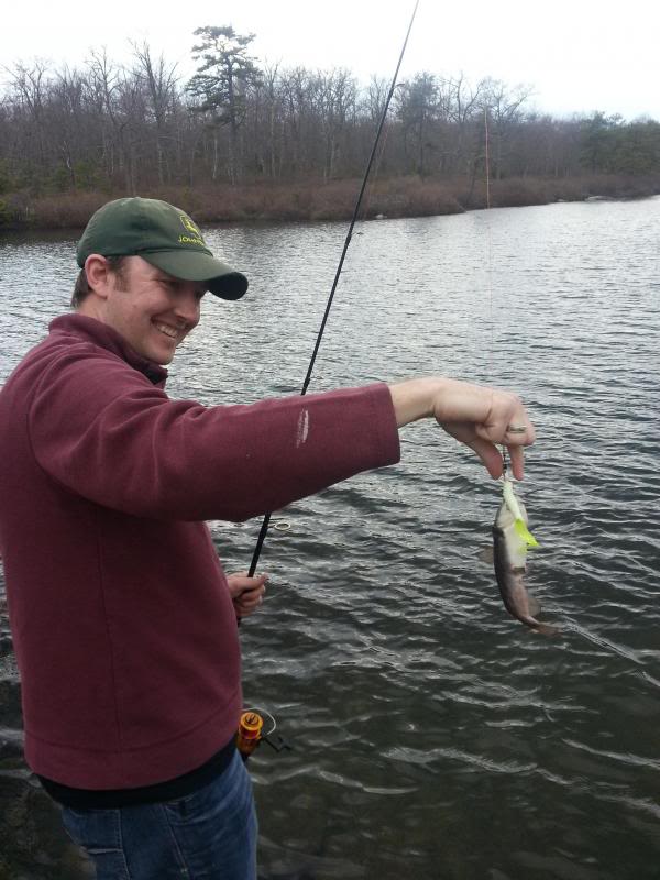
Caught dinner at Crater
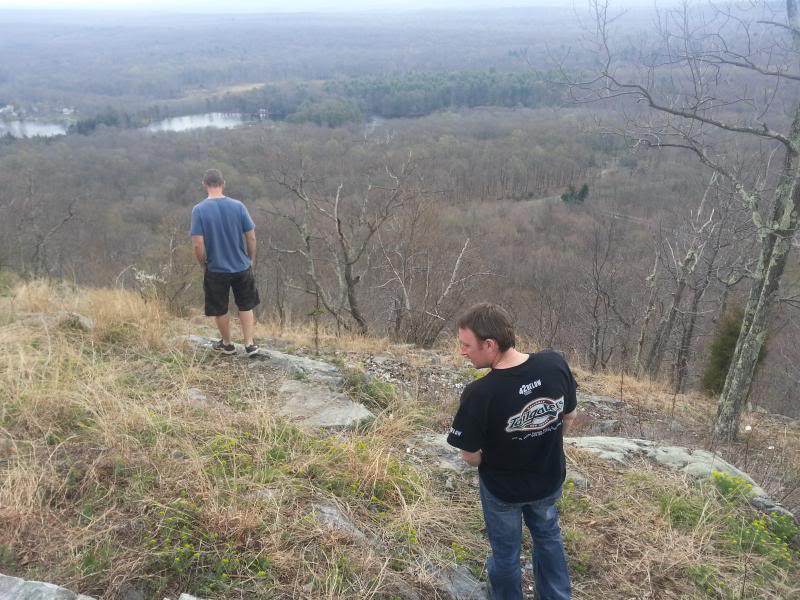
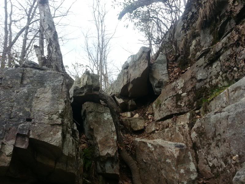
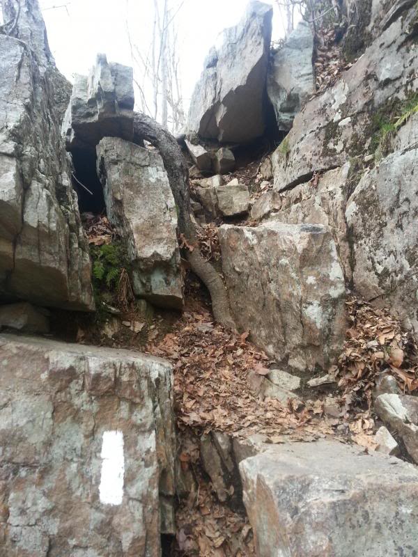
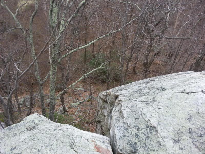
And then hiked around to the cliffs on the northeast side:
The rock face looks tough to climb but it's not:
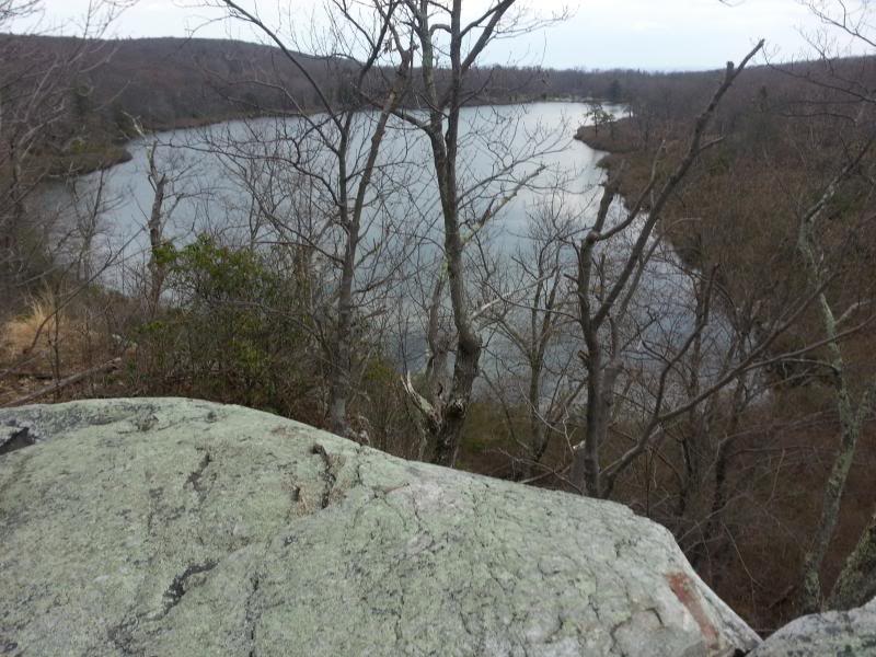
Nice view from the top:
Back down in the Valley to the Shoemaker Farm:
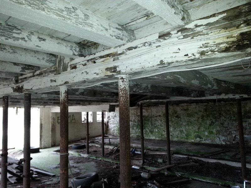
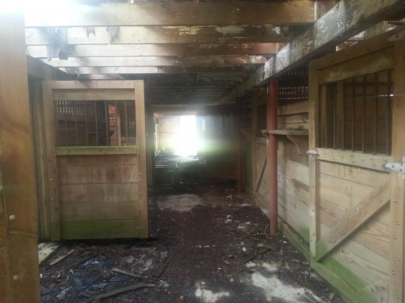
Someone was apparently renting the property from the NPS until about 2007 according to a friend of my wife's who lives in Stillwater, hence the fairly recent improvements to the horse barn:
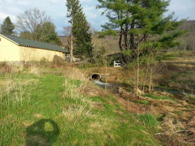
The outlet of the stream that tore up the lane going into the farm-this is the one that originates from the pond on top of the ridge where I was hoping to be able to drive through to but was stopped by the gate on Woods Road:
Took a small detour on the way back to camp to an area where the Flatbrook-Roy WMA and the Gap border each other. There's a decent hillclimb or two but it doesn't really go anywhere. Couldn't snap any pictures while I was driving:
Back to camp-mmmm...burgers, brats, and beer...
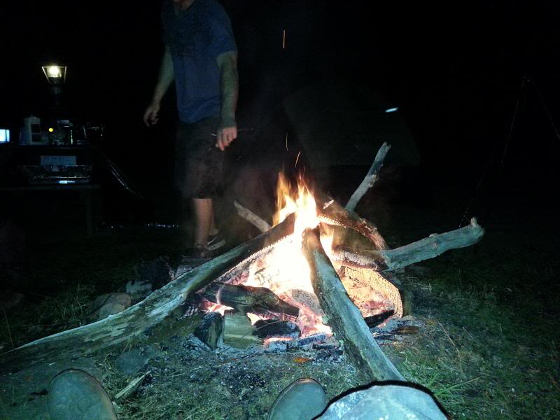
It rained a little which kind of sucked but it passed over before we really got soaked. I hit the sack first because I had been up since 5:00 a.m. and passed out. My buddies said they're pretty sure that if there were any bears in the area (we saw a big one at Crater) they probably cleared out because once I got to snoring I sounded like a big one It's nice having a four man tent all to yourself.
We hit Buttermilk Falls first because none of them had ever been there before:
Then checked out an old cow barn across from the white house on Mountain Road-the Walpack valley used to be big dairy country:
Small waterfall across the road beside the white house-it amazes me how much stonework was done to guide the flow of water and that it's still there after all these years of heavy runoff and flooding:
Then up to Skyline Drive:
"Lake" Success (the first one you come to on Skyline on the way to Crater) is looking more like a lake again even though the NPS drained it sometime in the late '90s/early 2000s. Some beavers got to work and raised the water level about 6'. It was spilling over due to the heavy rains:
Caught dinner at Crater
And then hiked around to the cliffs on the northeast side:
The rock face looks tough to climb but it's not:
Nice view from the top:
Back down in the Valley to the Shoemaker Farm:
Someone was apparently renting the property from the NPS until about 2007 according to a friend of my wife's who lives in Stillwater, hence the fairly recent improvements to the horse barn:
The outlet of the stream that tore up the lane going into the farm-this is the one that originates from the pond on top of the ridge where I was hoping to be able to drive through to but was stopped by the gate on Woods Road:
Took a small detour on the way back to camp to an area where the Flatbrook-Roy WMA and the Gap border each other. There's a decent hillclimb or two but it doesn't really go anywhere. Couldn't snap any pictures while I was driving:
Back to camp-mmmm...burgers, brats, and beer...
It rained a little which kind of sucked but it passed over before we really got soaked. I hit the sack first because I had been up since 5:00 a.m. and passed out. My buddies said they're pretty sure that if there were any bears in the area (we saw a big one at Crater) they probably cleared out because once I got to snoring I sounded like a big one
It's nice having a four man tent all to yourself.
05-05-2014, 06:19 AM
#3
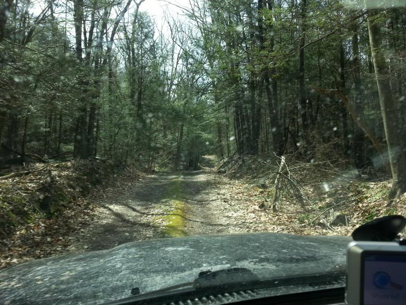
Day two-broke camp and headed out to Stokes State Forest-15,000 acres of adjoining state land:
After that we found what we ended calling the "Beaver Pond trail." Some beavers had raised the water level of a bog up over the roadway making the holes seem a lot worse than they were. A Jeep headed in the other direction did get stuck briefly. We hung around for a minute to see if he needed help but he was able to back out and get through on his own:
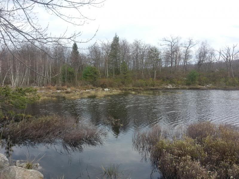
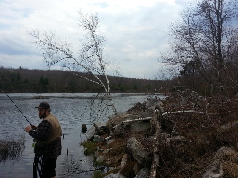
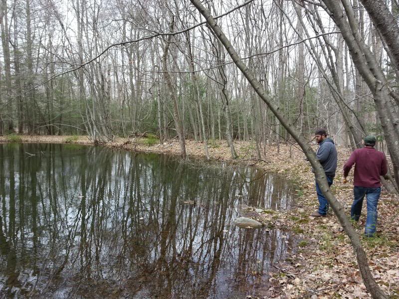
Stopped to wet a line in a small pond off of Shay Road:
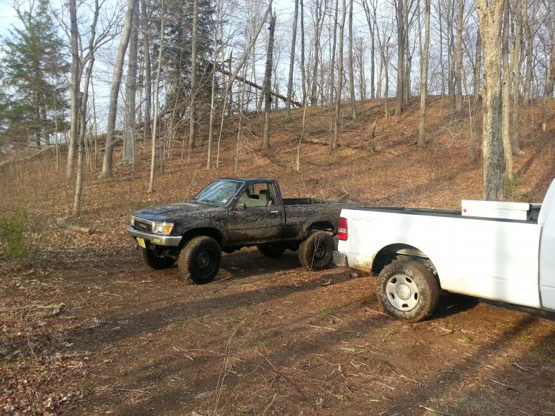
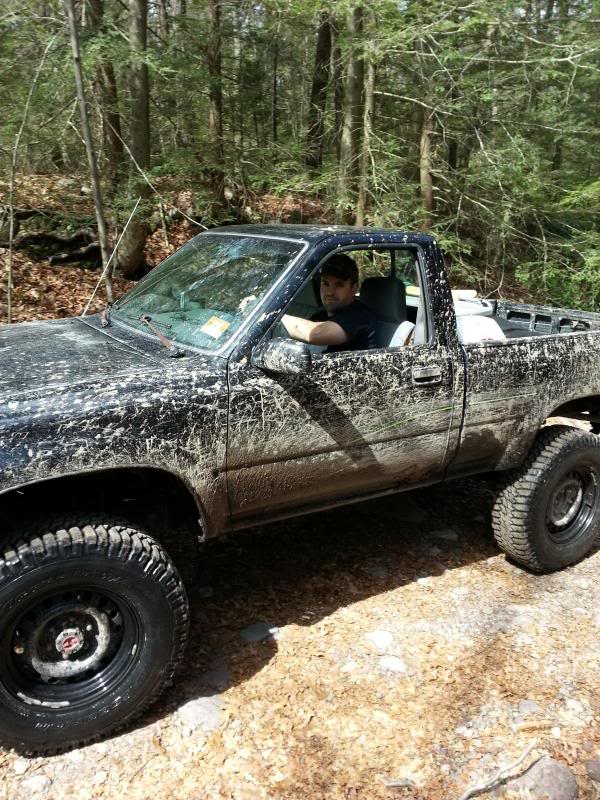
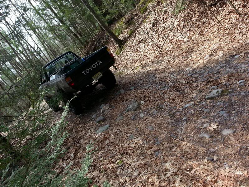
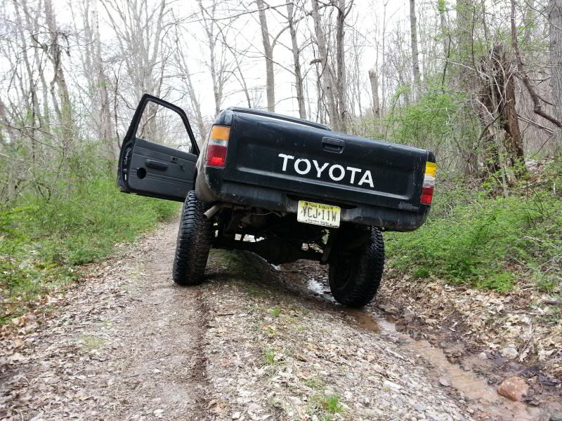
This was the roughest road by far-I idled through a lot of stuff in 1st/4LO just because it felt like the truck would rattle apart if I went any faster:
My heavy duty rear springs are great for hauling firewood-not so good for uneven terrain
Obviously none of this is hardcore off roading, but it was a great couple of days out in the woods.
After that we found what we ended calling the "Beaver Pond trail." Some beavers had raised the water level of a bog up over the roadway making the holes seem a lot worse than they were. A Jeep headed in the other direction did get stuck briefly. We hung around for a minute to see if he needed help but he was able to back out and get through on his own:
Stopped to wet a line in a small pond off of Shay Road:
This was the roughest road by far-I idled through a lot of stuff in 1st/4LO just because it felt like the truck would rattle apart if I went any faster:
My heavy duty rear springs are great for hauling firewood-not so good for uneven terrain
Obviously none of this is hardcore off roading, but it was a great couple of days out in the woods.
08-07-2014, 08:14 AM
#6
Yup-doesn't compare to what you can find in upper New England or out West, but it's definitely the best that NJ has to offer. The part that sucks is it seems the NPS/State finds a new road to close about every year. Some of the roads in the area pre-date the French and Indian Wars. Old Mine Road, the dirt road running around the Delaware River is the oldest continuously used road in the United States. I think next year we might find a good place to park the trucks off of the Appalachian Trail and hike in and make camp somewhere along it for real wilderness camping. The place we were was bare bones (just a site, porta-potty, and a water hydrant) but there were people all around us.
Last edited by Badfish740; 08-07-2014 at 08:18 AM.

Thread
Thread Starter
Forum
Replies
Last Post
Toys4parts
86-95 Trucks & 4Runners (Build-Up Section)
2
09-26-2015 01:56 PM
Badfish740
86-95 Trucks & 4Runners
4
09-04-2015 04:21 AM


