Dinosaur National Monument and then some
 09-12-2010, 09:00 PM
#1
Registered User
Thread Starter
Join Date: Aug 2006
Location: Colorado Springs, Co
Posts: 1,691
Likes: 0
Received 0 Likes
on
0 Posts
Dinosaur National Monument and then some
Day 1
With all the trips that I've done in the past few years this one had me the most nervous/apprehensive as to if I should even go. Why, I don't know.
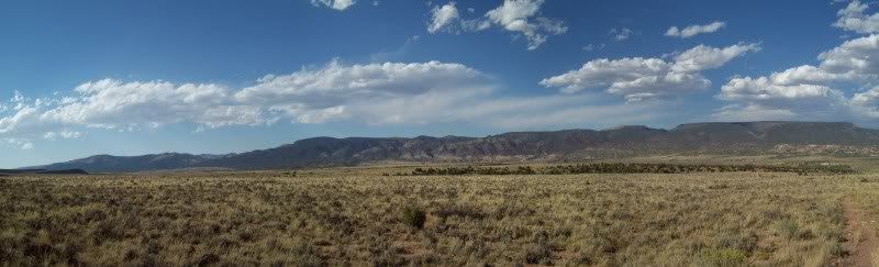
With in the past year I've seen a few trip reports on Dinosaur National Monument on the Utah/Colorado border and some of the surrounding areas. I had been to this area as a little kid while on vacation but we never stop into the park itself only at the visitors center (my mother had to tell me this since I had to memory of it, only after did I remember). So this past Labor Day I decided to pack up and head out of dodge to areas less visited. The original plan was to leave Friday night and camp some where once I got out but after working a full day and still needing to pack I decided against it and just to leave early in the morning. Early in the morning as in 4am. Unfortunately, for me I tend to wake up early when I have things planned the following day, so up at 3am I was (energy drink #1).
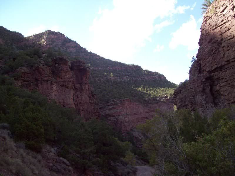
After finishing some quick last minute packing (cooler and some miscellaneous items) I was out the door on my way. Only, to get sick about 45 minutes into it (won't go into details) which made for a long drive into Vernal (energy drink #2 was consumed in Roosevelt). After, making into Vernal and filling up with gas+5 gallon jerry can. I was office to Visitor Center on the Utah side to grab a map of the area and to check the road conditions. I think I came off a little smug when the ranger was telling me about the road conditions when the area was wet and of the rocky trail on Yampa Bench Road. Only later would I understand what she meant about the wet roads (see day #2).
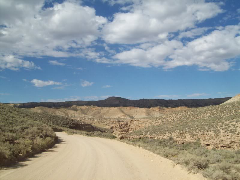
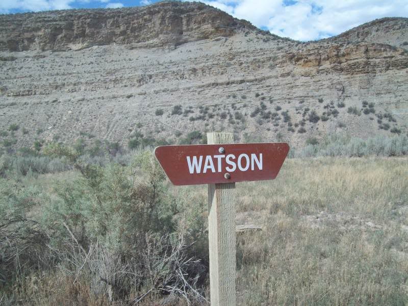
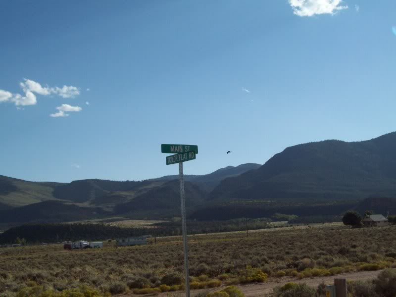
So after that I was headed on out to the first stop along the way �Watson, Utah� or what is left of it but not without a stop or two.
Along the �Old Bonanza Highway�
Stop number one was kind of unplanned only later would I learn the first behind it.
Ignatio Stage Stop/White River Crossing
The stop over would be to the old town site of �Watson, Utah� (ran into vehicle #1 on the way out here, some oil worker I'm assuming)
One of the few remaining structures at the site.
The two other remaining structures
Just past the Evacuation Creek crossing there are tow more structures. I just caught them out of the corner of my eye and had to back up to investigate some (vehicle #2 past me here).
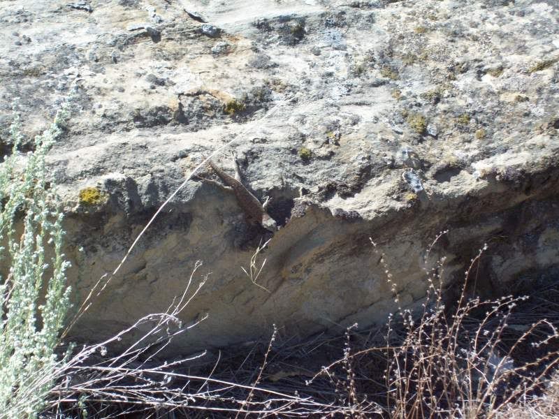
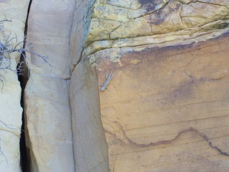
Lizard #1
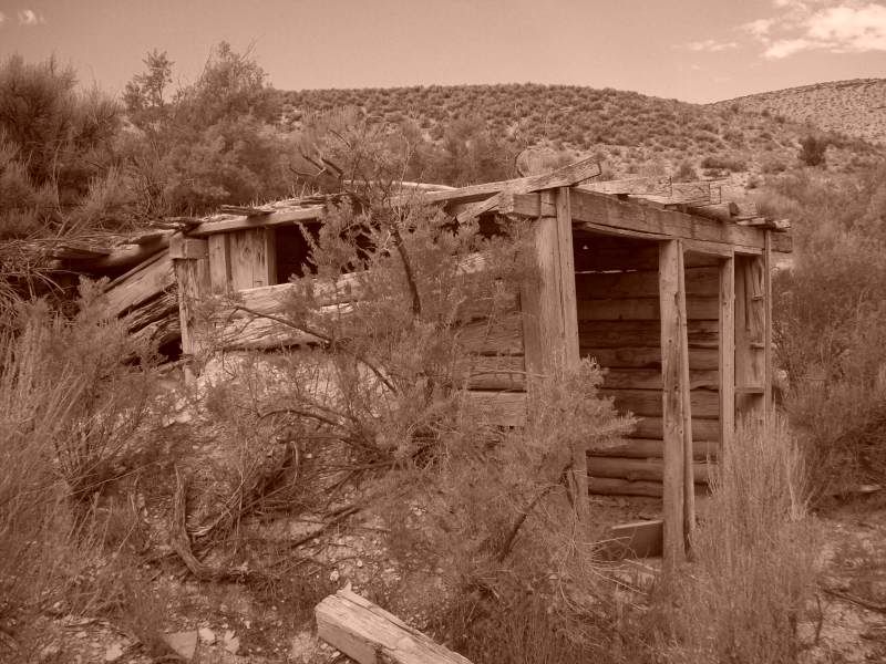
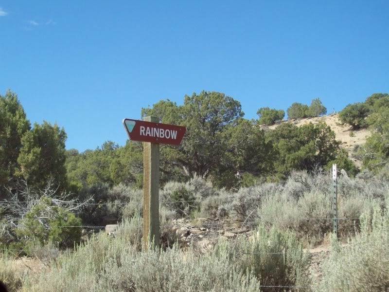
Next on stop on trip was the old mining site of �Rainbow�
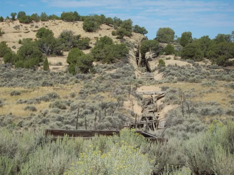

After I Rainbow I continued to follow the road on over to the �Three Mile Canyon� cutoff that would eventually take me to my next stop of �Dragon�.
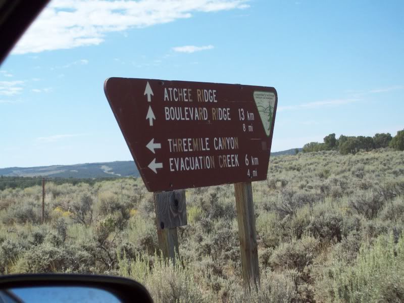
As luck would have it when I reached the road that lead down to �Dragon� I ended up missing the sign on the right hand side of the road and ended up 6 miles away on the Colorado border. Opps! Time to turn around.
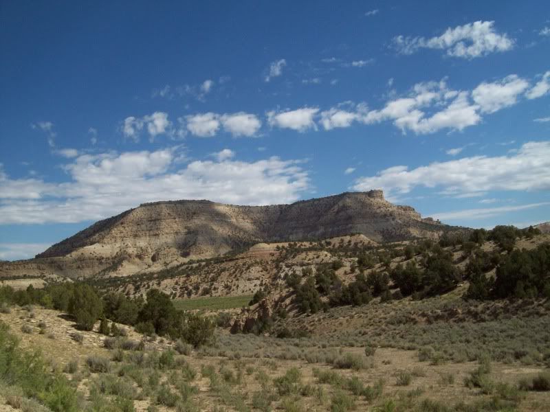
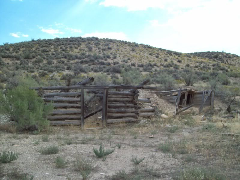
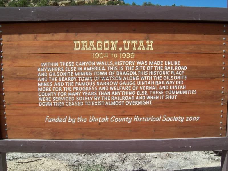
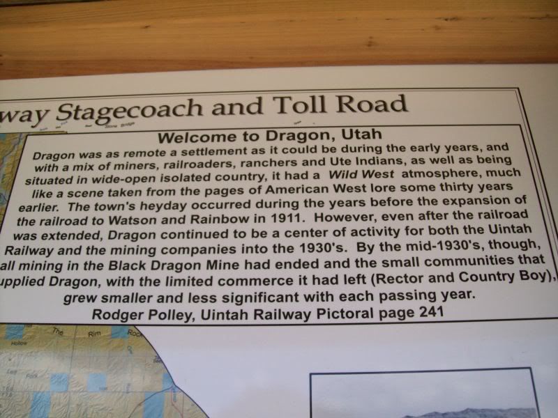
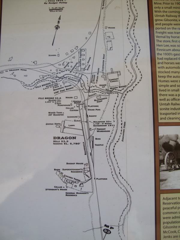
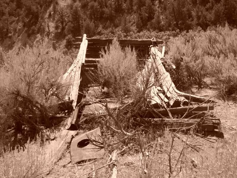
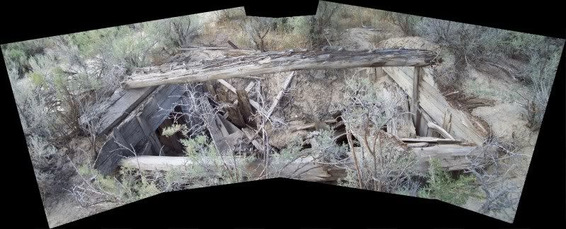
Town site of �Dragon, Utah�
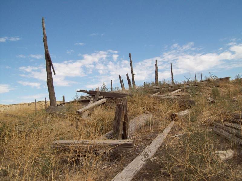
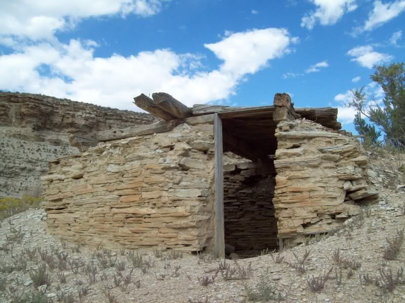
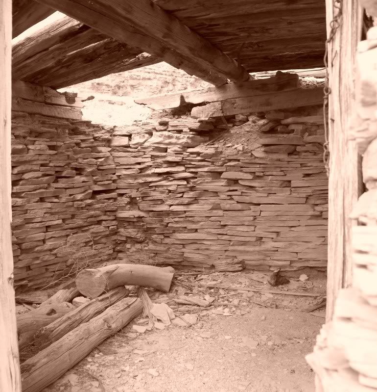
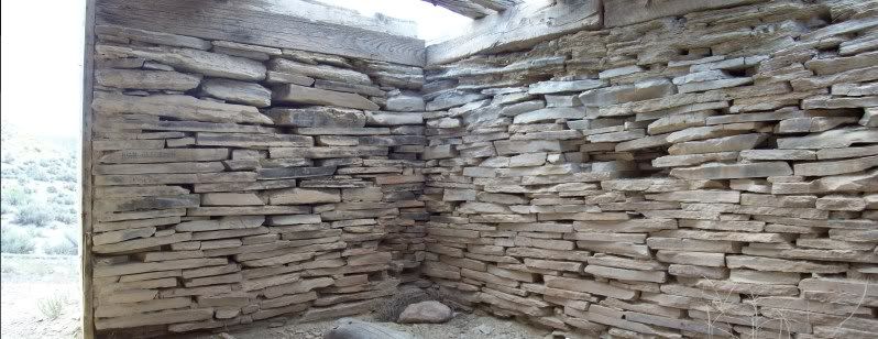
Building/Ruin #1
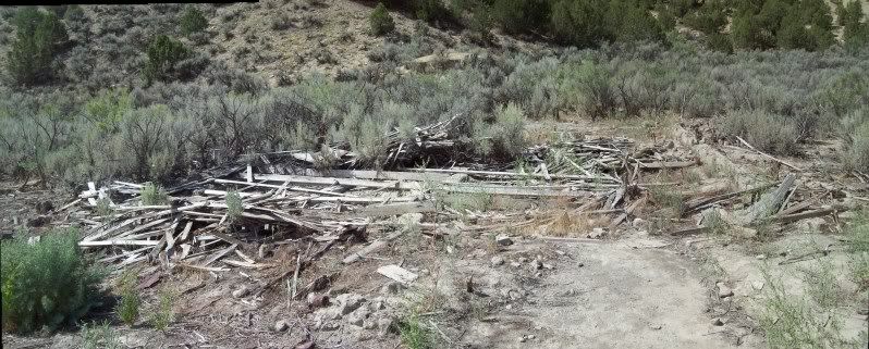
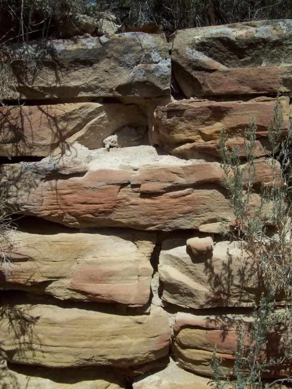
Building/Ruin #2 � I found it interesting that they just milled the one side of the long and smooth side for the interior of the building while leaving the bark and the unfinished edge on the outside
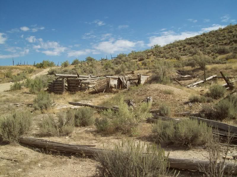
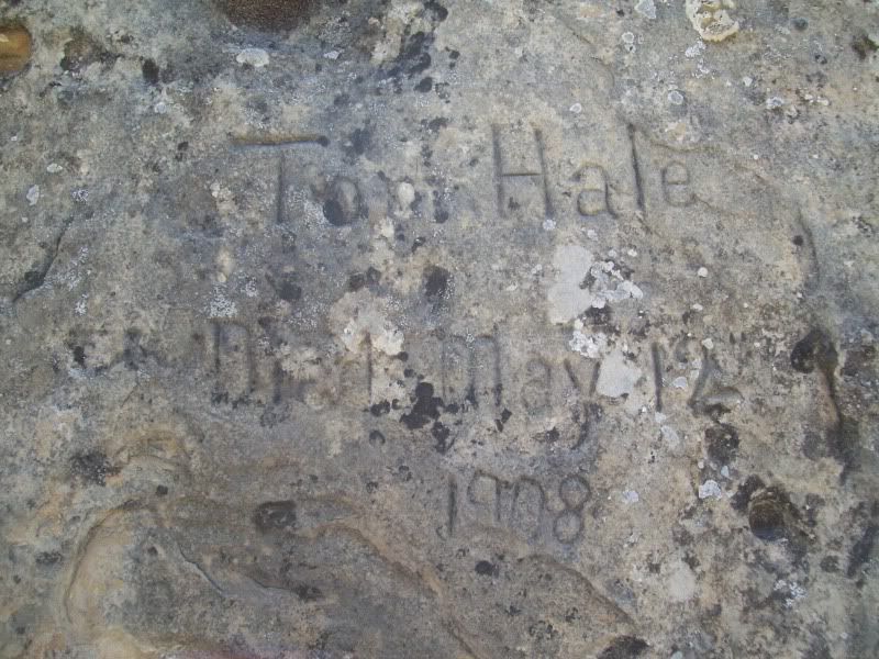
This photo just kind of seems a little creepy to me
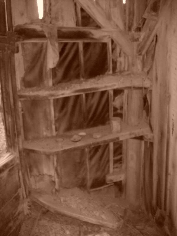
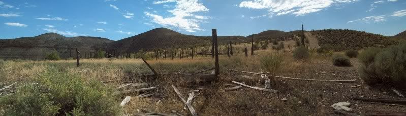
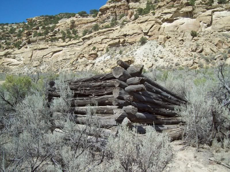
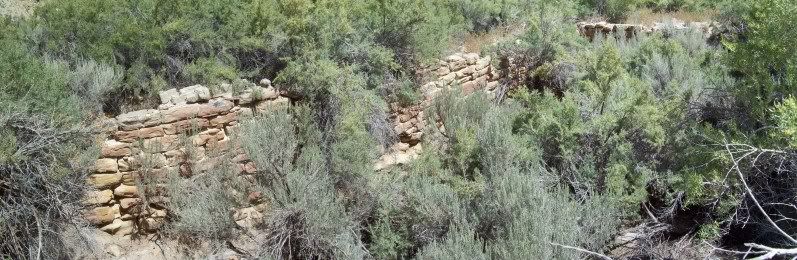
Other buildings/ruins that once were
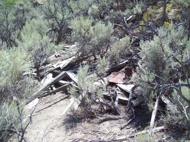
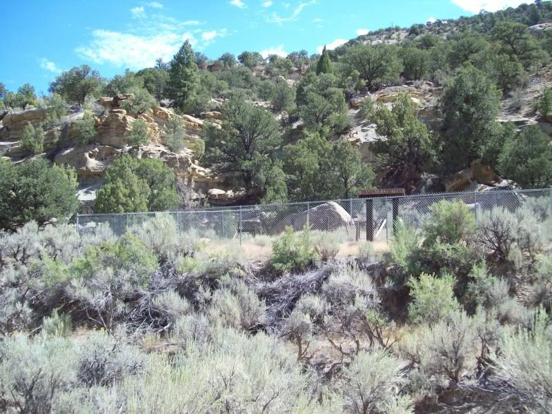
After tooling around here for a bit and trying not to get a nail in the foot (make sure your tetanus shot is up-to-date)I headed down the canyon to explore some more. Once you reach the old cemetery you have to turn around as the road enters private property.
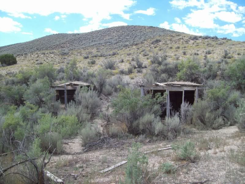
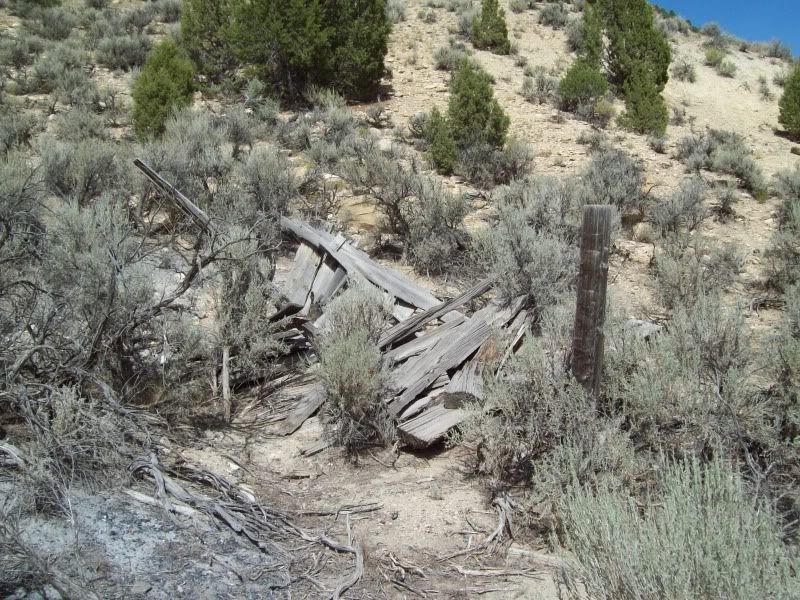
Building/Ruin #3
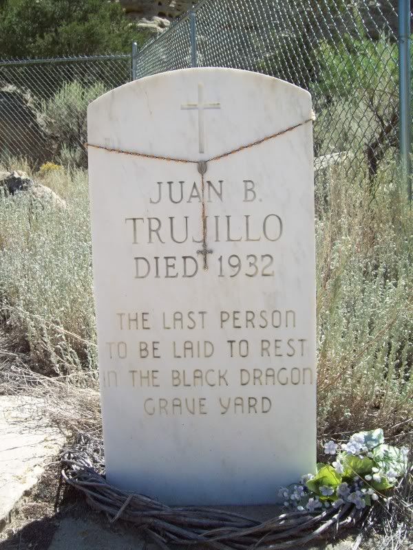
Dragon Cemetery
Lizard #2
As I was leaving the canyon I noticed a few other structures along the left hand side of the road that required some further investigation.
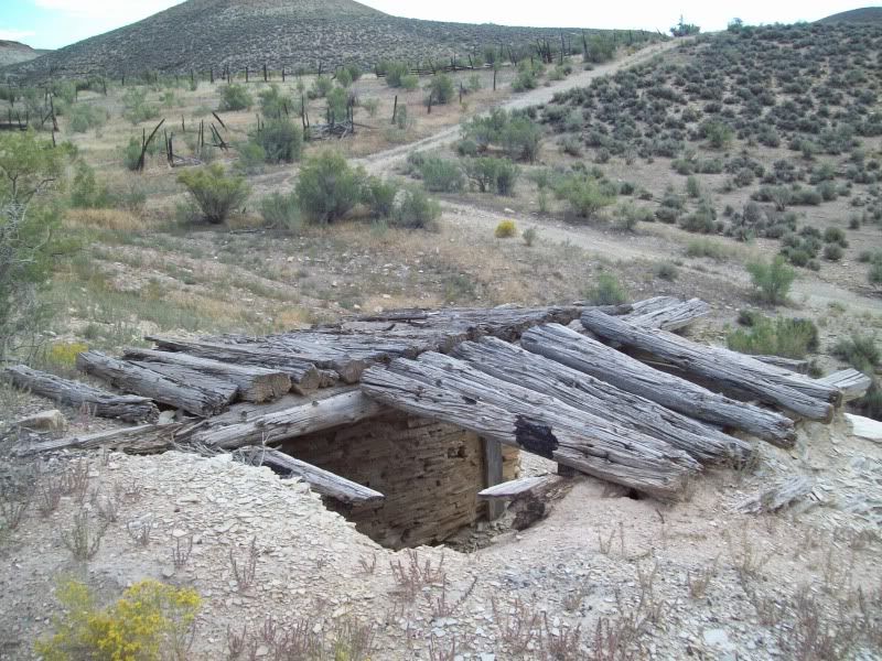
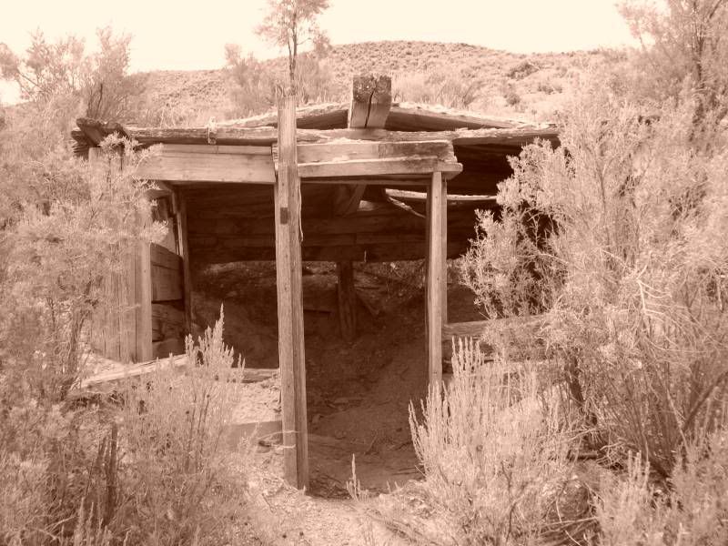
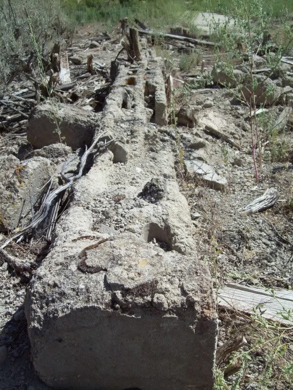
Old foundation � Building/Ruin #4
Building/Ruin #5
After my stop in Dragon it was time to head on up to the visitor center on the Colorado side of the park.
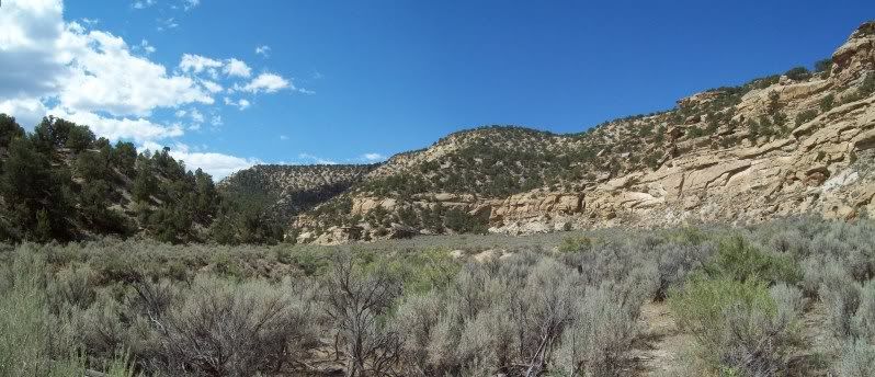
About two to three miles past this photo you run into a short sandy section of the road. I though I'd be smart and try to avoid the ruts in the sand created by other vehicles but low and behold I ended up sinking into the sand a but while at speed and ended up jumping my 4runner. Opps! The landing was such that it shot washer fluid out of the nozzles (never had this happen before). So I got out to check for damage only to find none. Whew! Grab a few photos before heading back out.
When I reached Colorado I stopped at the Welcome Center to check out the maps of the area over there (which they have a ton of) and to grab another energy drink (#3) since that 3am wake up was wearing on me. The ladies at the welcome center looked a little bored.
Made one other stop at the Visitor Center for a quick rest and to check in with my family before heading on in to the park.
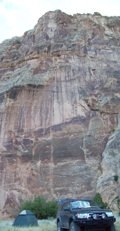
After a brief little stop (photo above) I decided to go ahead and head into camp for the night since seeing a number of vehicles entering the park while at the visitor center.
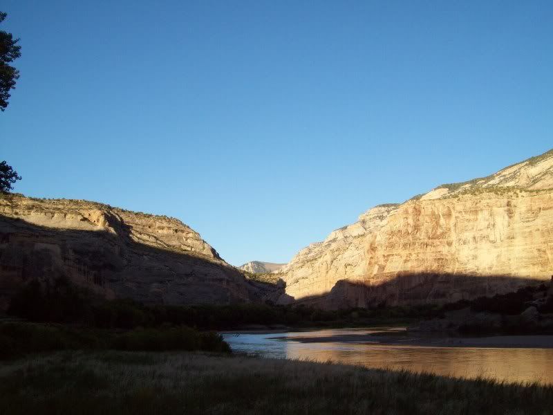
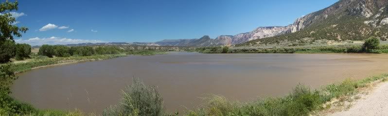
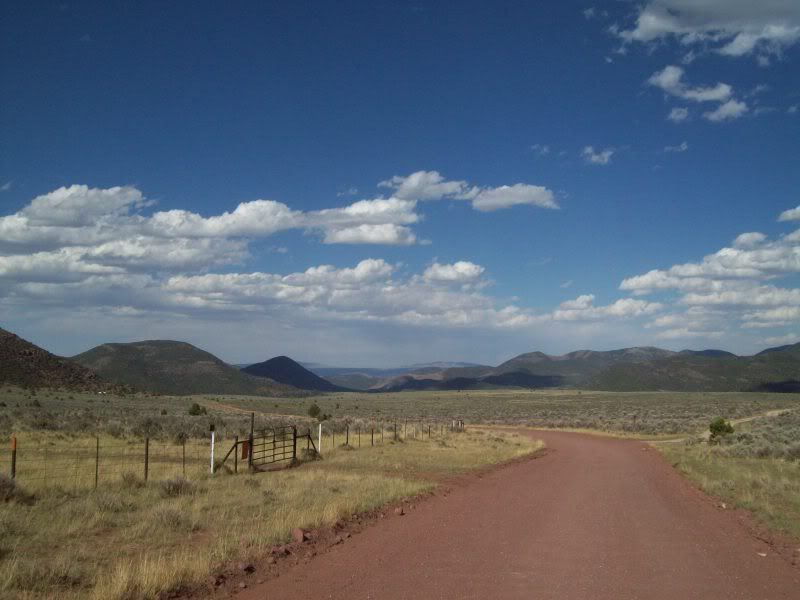
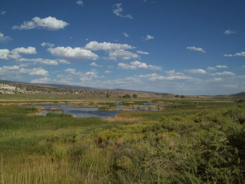
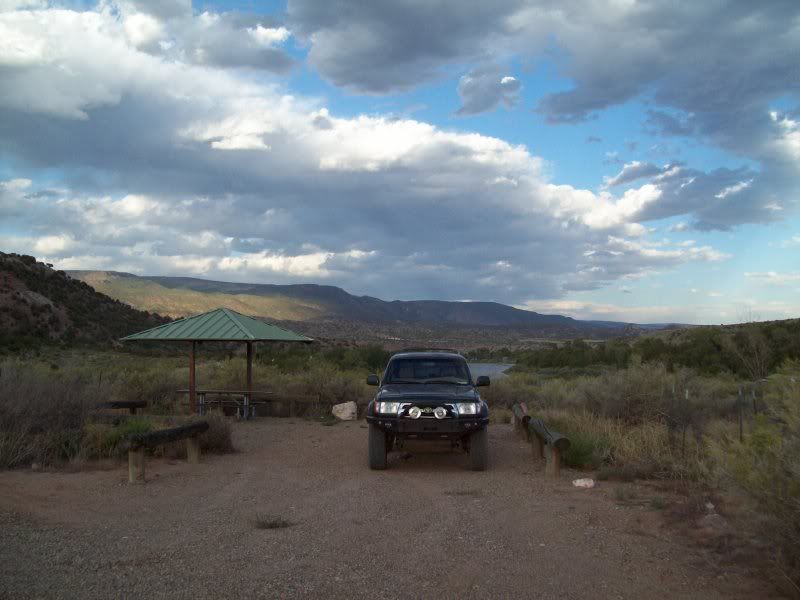
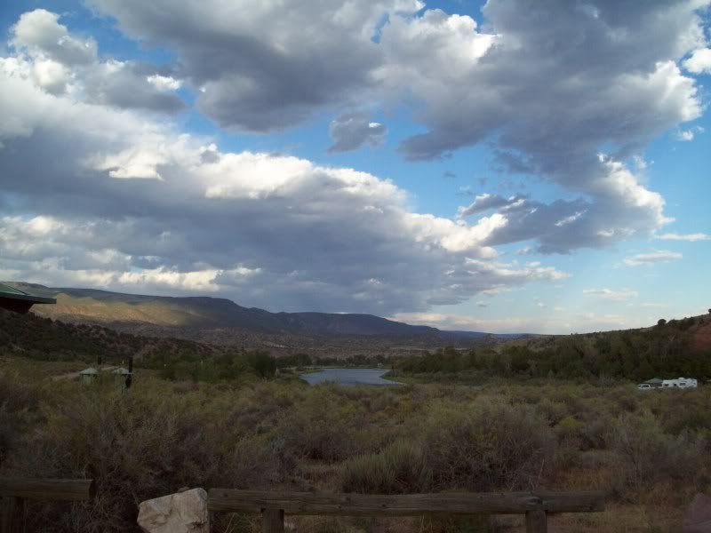
Camp for the night would be down in Echo Park down by the Yampa River. The campground normally has a fee but at this time of the year the fee is waived. Sweet!
The road down into Echo Park that I'd eventually take.
A few shots on the way down
Once I reached the campground I did a quick drive around to a camping spot since most of the 22 sites were already full. So I quickly set up my tent to claim my spot, then headed back up the road to complete the auto tour portion of the route and to do a little hiking.
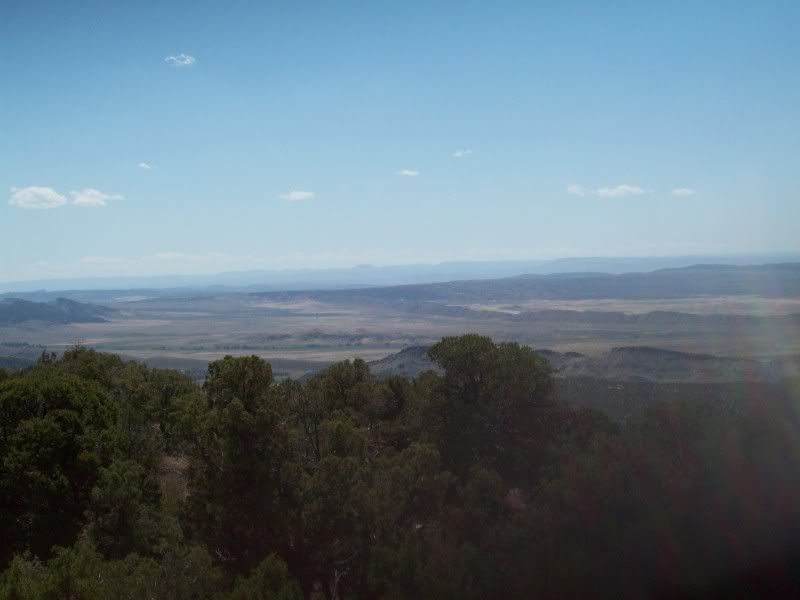
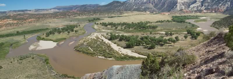
Island Park over look was the first stop. There's a hiking trail here that is a couple of miles long but due to the time of day and being tried I passed on it.
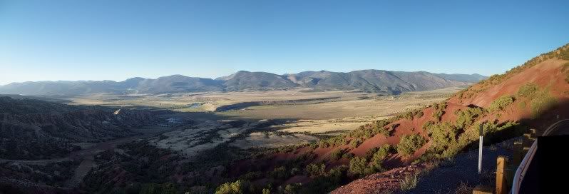
Iron Springs Bench Overlook was next
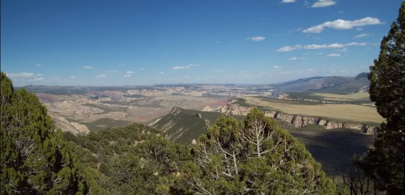
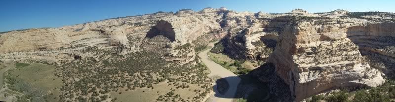
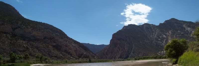
Followed by Echo Park Overlook
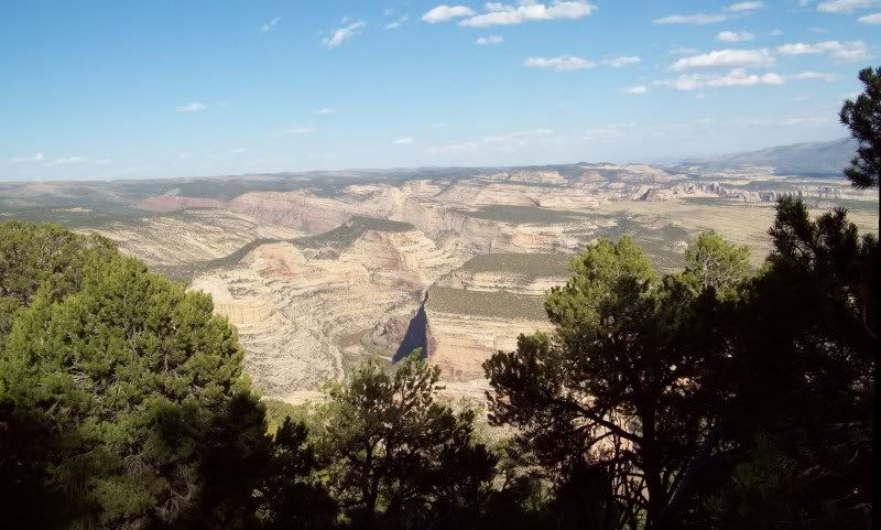
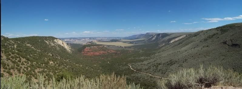
Can you spot the road in this picture??
Yep, there it is. That's the route down to camp.
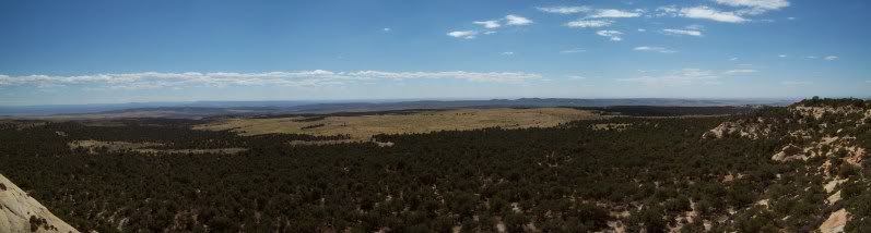
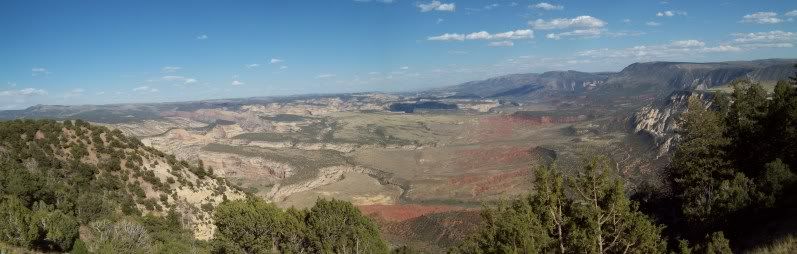
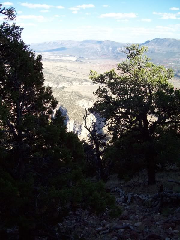
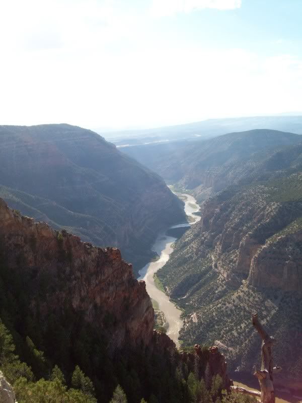
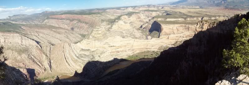
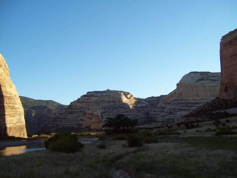
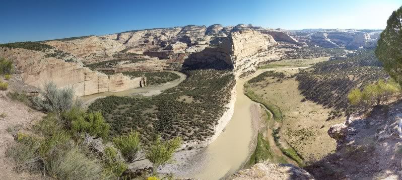
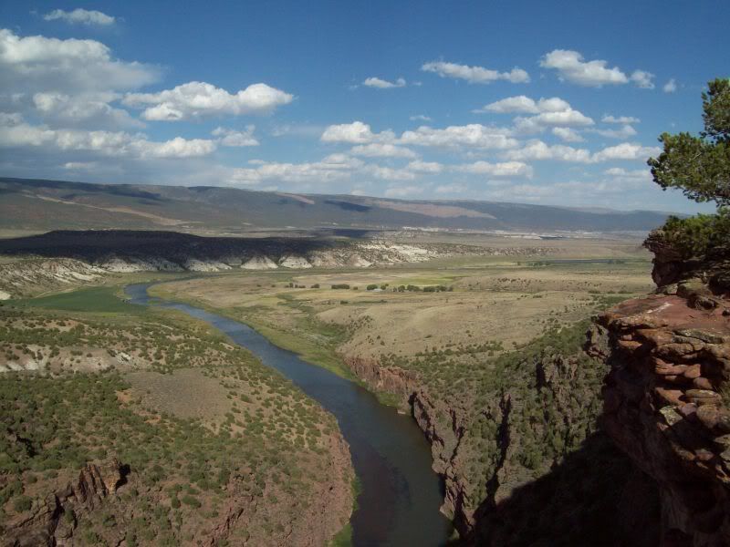
The last stop on the trip was Harper's Corner (end of the road anyways). I'd recommend taking the short hike at the end (mile in and a mile out)to get a good view of the surrounding area. The Geology here is crazy.
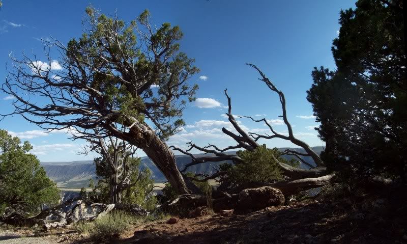
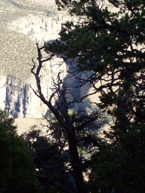
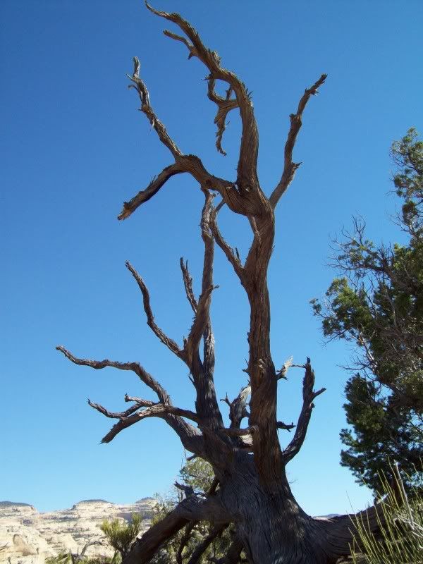
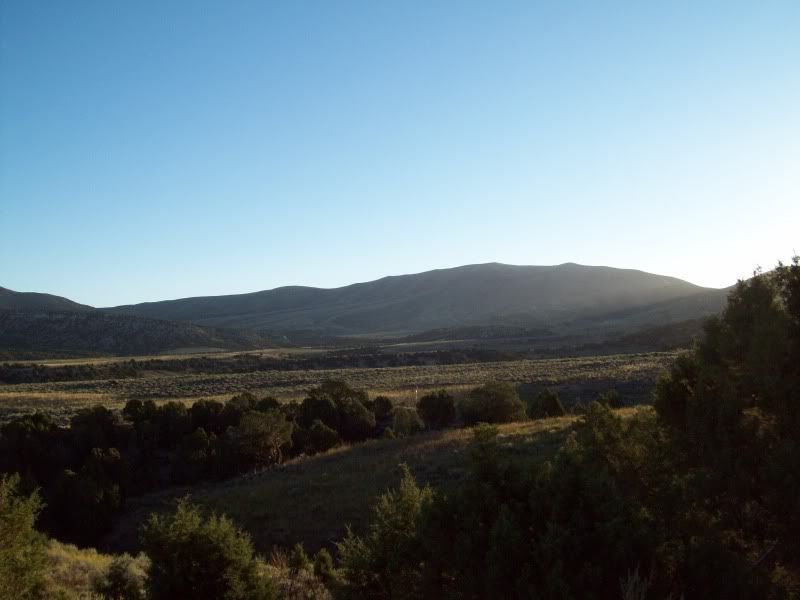
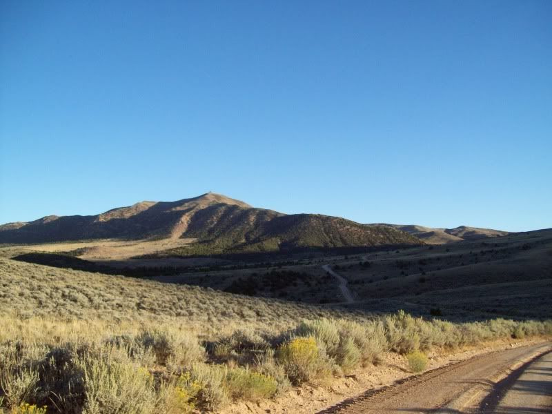
Couple of random photo's.
After the hike I was worn out even more so and hungry (you can only live off from Cheez-its and granola bars for so long). So I headed back into camp for the night with a stop or two along the way.
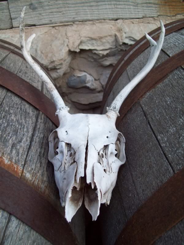
Can you spot the face?
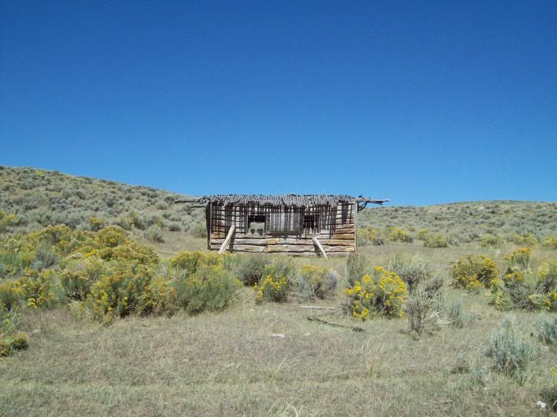
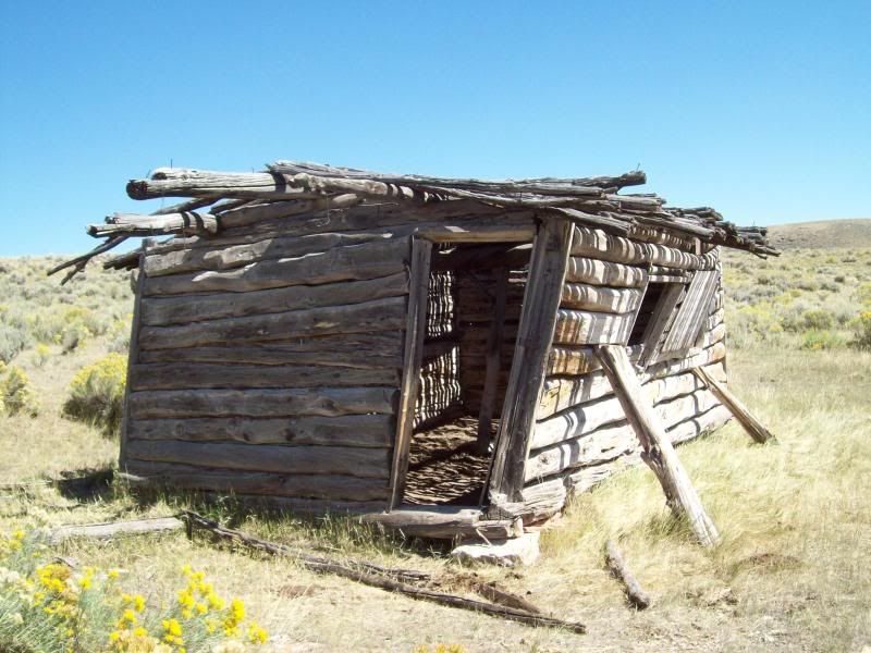
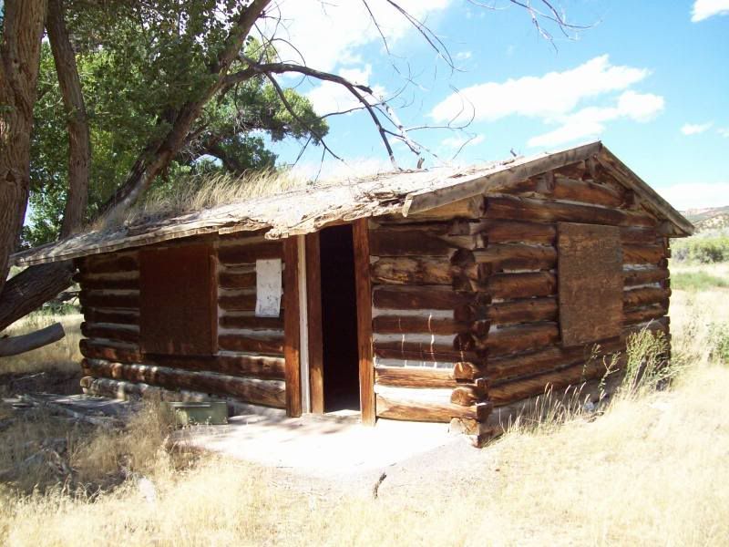
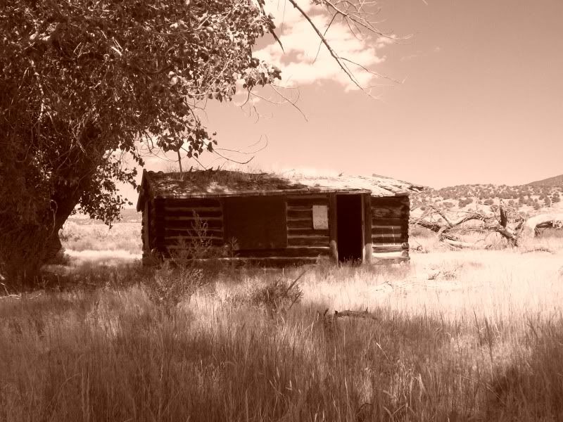
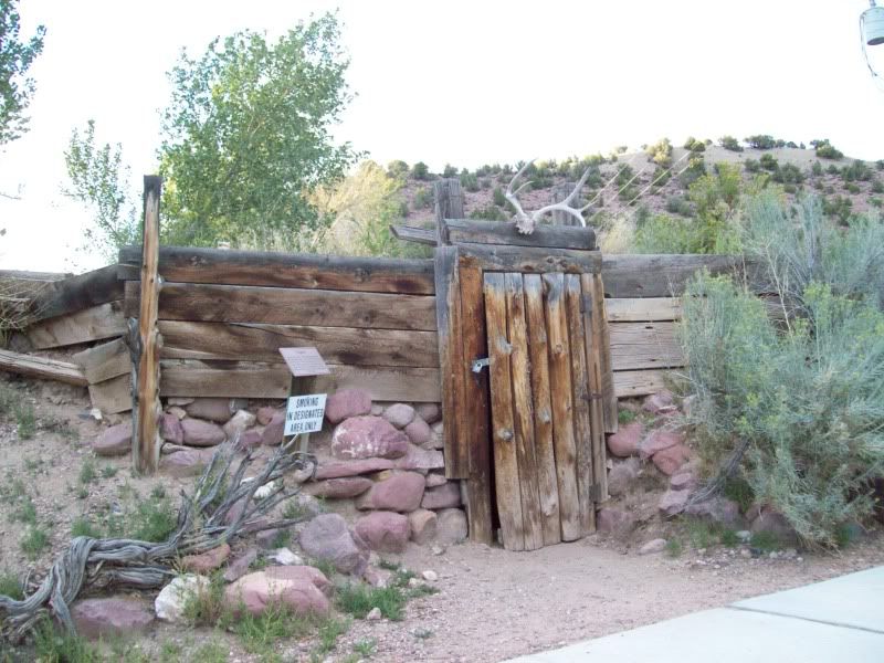
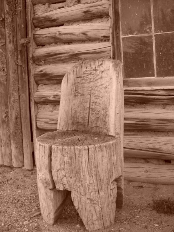
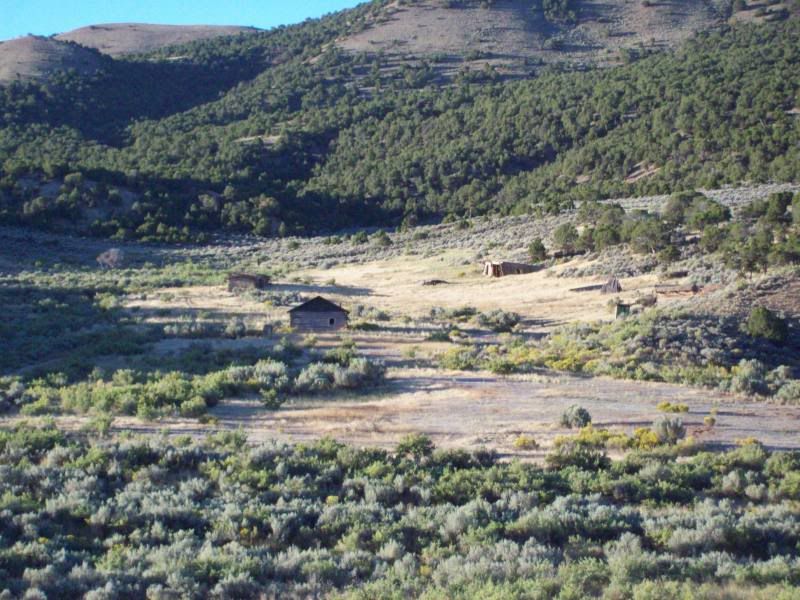
I don't remember the name of this cabin
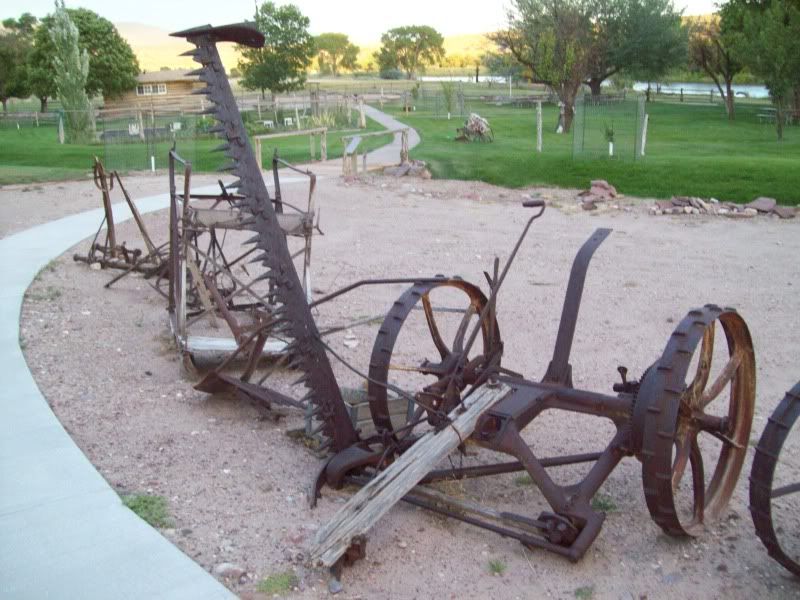
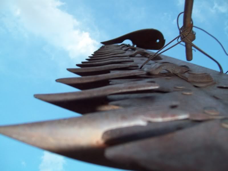
I probable spent about 15 minutes or so trying to figure out how this piece of equipment worked.
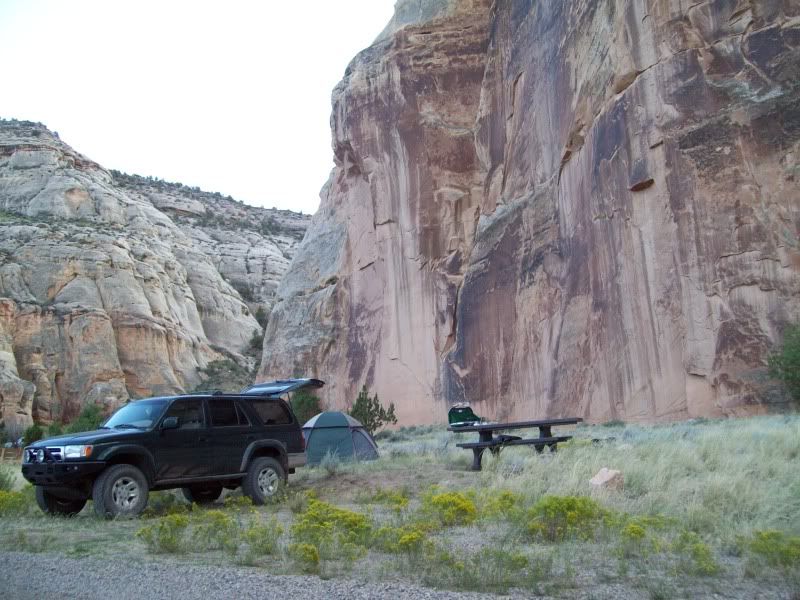
Camp for the night
With all the trips that I've done in the past few years this one had me the most nervous/apprehensive as to if I should even go. Why, I don't know.
With in the past year I've seen a few trip reports on Dinosaur National Monument on the Utah/Colorado border and some of the surrounding areas. I had been to this area as a little kid while on vacation but we never stop into the park itself only at the visitors center (my mother had to tell me this since I had to memory of it, only after did I remember). So this past Labor Day I decided to pack up and head out of dodge to areas less visited. The original plan was to leave Friday night and camp some where once I got out but after working a full day and still needing to pack I decided against it and just to leave early in the morning. Early in the morning as in 4am. Unfortunately, for me I tend to wake up early when I have things planned the following day, so up at 3am I was (energy drink #1).
After finishing some quick last minute packing (cooler and some miscellaneous items) I was out the door on my way. Only, to get sick about 45 minutes into it (won't go into details) which made for a long drive into Vernal (energy drink #2 was consumed in Roosevelt). After, making into Vernal and filling up with gas+5 gallon jerry can. I was office to Visitor Center on the Utah side to grab a map of the area and to check the road conditions. I think I came off a little smug when the ranger was telling me about the road conditions when the area was wet and of the rocky trail on Yampa Bench Road. Only later would I understand what she meant about the wet roads (see day #2).
So after that I was headed on out to the first stop along the way �Watson, Utah� or what is left of it but not without a stop or two.
Along the �Old Bonanza Highway�
Stop number one was kind of unplanned only later would I learn the first behind it.
Ignatio Stage Stop/White River Crossing
The stop over would be to the old town site of �Watson, Utah� (ran into vehicle #1 on the way out here, some oil worker I'm assuming)
One of the few remaining structures at the site.
The two other remaining structures
Just past the Evacuation Creek crossing there are tow more structures. I just caught them out of the corner of my eye and had to back up to investigate some (vehicle #2 past me here).
Lizard #1
Next on stop on trip was the old mining site of �Rainbow�
After I Rainbow I continued to follow the road on over to the �Three Mile Canyon� cutoff that would eventually take me to my next stop of �Dragon�.
As luck would have it when I reached the road that lead down to �Dragon� I ended up missing the sign on the right hand side of the road and ended up 6 miles away on the Colorado border. Opps! Time to turn around.
Town site of �Dragon, Utah�
Building/Ruin #1
Building/Ruin #2 � I found it interesting that they just milled the one side of the long and smooth side for the interior of the building while leaving the bark and the unfinished edge on the outside
This photo just kind of seems a little creepy to me
Other buildings/ruins that once were
After tooling around here for a bit and trying not to get a nail in the foot (make sure your tetanus shot is up-to-date)I headed down the canyon to explore some more. Once you reach the old cemetery you have to turn around as the road enters private property.
Building/Ruin #3
Dragon Cemetery
Lizard #2
As I was leaving the canyon I noticed a few other structures along the left hand side of the road that required some further investigation.
Old foundation � Building/Ruin #4
Building/Ruin #5
After my stop in Dragon it was time to head on up to the visitor center on the Colorado side of the park.
About two to three miles past this photo you run into a short sandy section of the road. I though I'd be smart and try to avoid the ruts in the sand created by other vehicles but low and behold I ended up sinking into the sand a but while at speed and ended up jumping my 4runner. Opps! The landing was such that it shot washer fluid out of the nozzles (never had this happen before). So I got out to check for damage only to find none. Whew! Grab a few photos before heading back out.
When I reached Colorado I stopped at the Welcome Center to check out the maps of the area over there (which they have a ton of) and to grab another energy drink (#3) since that 3am wake up was wearing on me. The ladies at the welcome center looked a little bored.
Made one other stop at the Visitor Center for a quick rest and to check in with my family before heading on in to the park.
After a brief little stop (photo above) I decided to go ahead and head into camp for the night since seeing a number of vehicles entering the park while at the visitor center.
Camp for the night would be down in Echo Park down by the Yampa River. The campground normally has a fee but at this time of the year the fee is waived. Sweet!
The road down into Echo Park that I'd eventually take.
A few shots on the way down
Once I reached the campground I did a quick drive around to a camping spot since most of the 22 sites were already full. So I quickly set up my tent to claim my spot, then headed back up the road to complete the auto tour portion of the route and to do a little hiking.
Island Park over look was the first stop. There's a hiking trail here that is a couple of miles long but due to the time of day and being tried I passed on it.
Iron Springs Bench Overlook was next
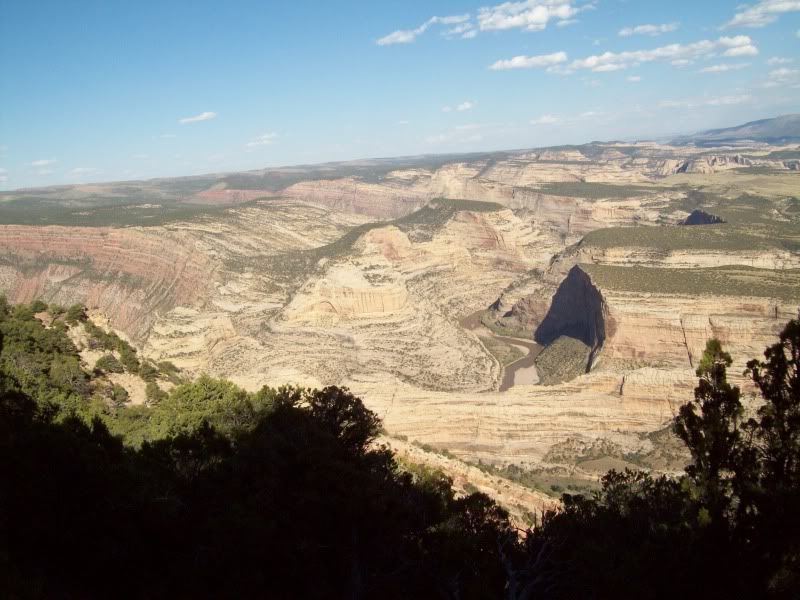
Followed by Echo Park Overlook
Can you spot the road in this picture??
Yep, there it is. That's the route down to camp.
The last stop on the trip was Harper's Corner (end of the road anyways). I'd recommend taking the short hike at the end (mile in and a mile out)to get a good view of the surrounding area. The Geology here is crazy.
Couple of random photo's.
After the hike I was worn out even more so and hungry (you can only live off from Cheez-its and granola bars for so long). So I headed back into camp for the night with a stop or two along the way.
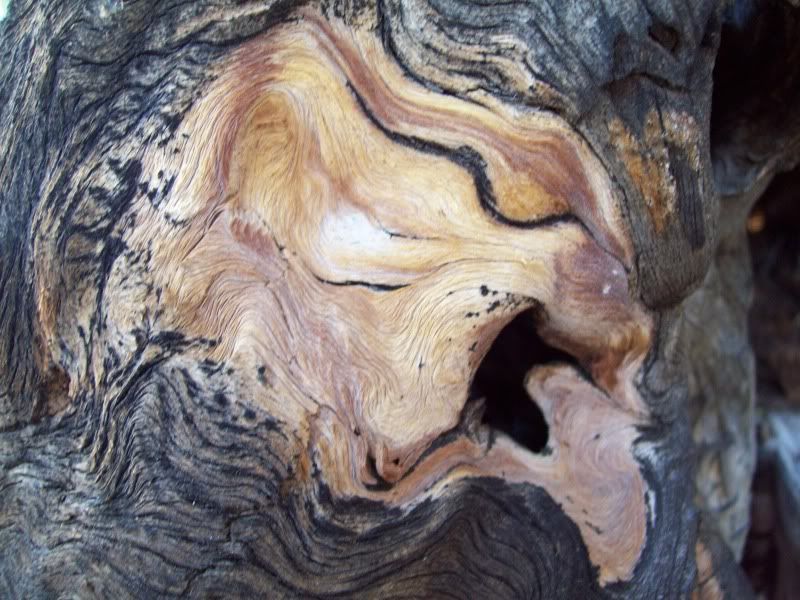
Can you spot the face?
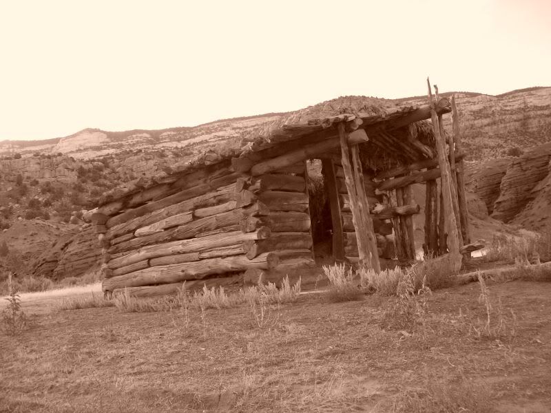
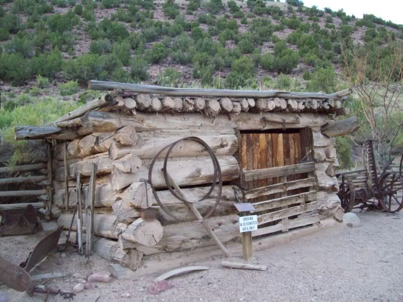
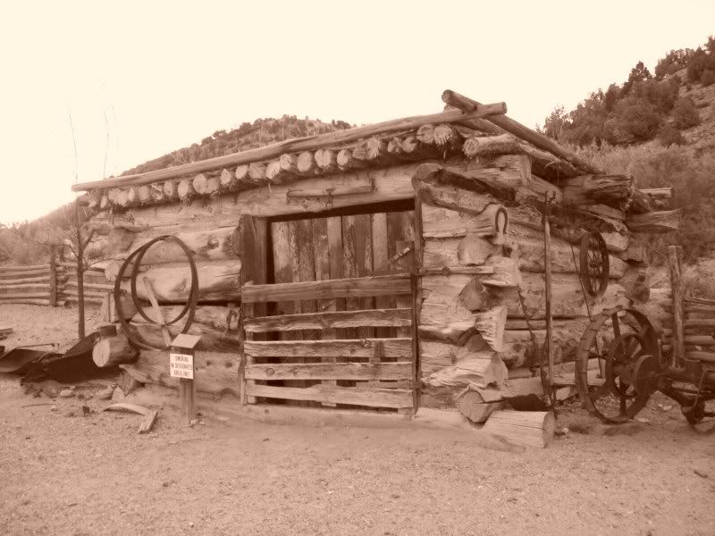
I don't remember the name of this cabin
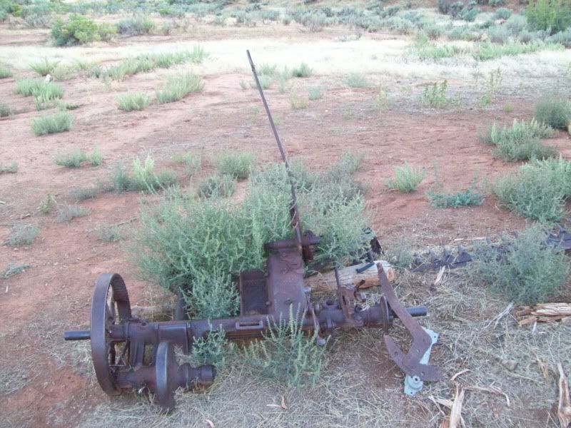
I probable spent about 15 minutes or so trying to figure out how this piece of equipment worked.
Camp for the night
 09-12-2010, 09:02 PM
#2
Registered User
Thread Starter
Join Date: Aug 2006
Location: Colorado Springs, Co
Posts: 1,691
Likes: 0
Received 0 Likes
on
0 Posts
Day 2
After I returned from the side trips to various overlooks I settle into camp for the night. Dinner was chicken, rice and carrots and an ice cold IBC Root Beer (yum!). I was questioning whether or not to have a fire that night because of the wind in canyon was not too to my liking but I went and ahead and made one anyways. As well as some other folks. All was well while the sun was still up but once the sun went down the wind picked up and you would have little micro burst here there that would send cinders into the air, which you would have too go stomp out. After about an hour of that I had enough and decided to put the fire out and hit the hay. It was close to 9:00 pm by this time.
One thing I like about being out away from the city is that the sky's are clear and the stars fill up the night sky. It was great.
The wind that contiuned to blow though out the night shaking my tent at times like someone was their moving it around. Every so often you'd hear the dog in the campsite bark echoing thoughout the canyon. This started to get annoying about 1am but then to my pleasure (I hate to say this but I was tired)you'd hear the dog yelp as if the own had down something to it.
Morning came all to early for me as I was up at 630am, with my alergies going wild (just peachy). After a breakfast of oatmeal, a banna and hot chocolate I packed up camp and went on a short hike around the campground before heading out for the day.
Camp in the morning
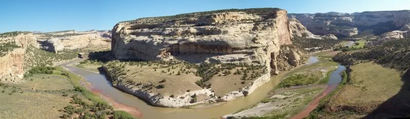
One of the reasons why I picked this spot was because of the views from inside the canyon and river.
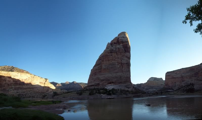
Steamboat Rock early morning (if you look to the right of the photo you can see two people and their dog, they were the only ones up besides myself at this time).
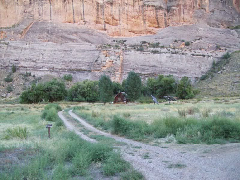
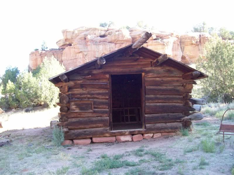
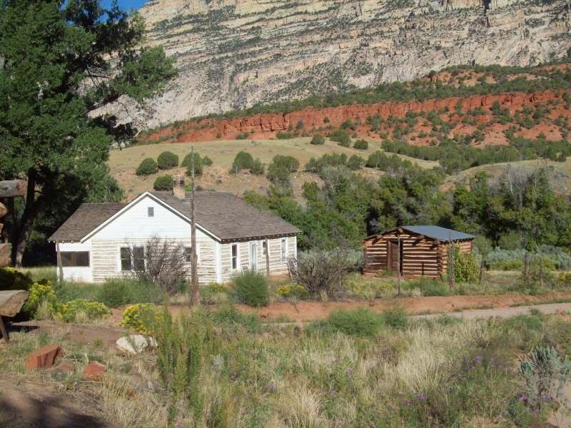
Rangers Cabin
After dinking around here for a bit I took a short hike along the river just too see were it went.
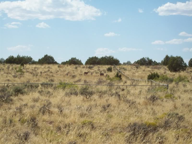
As I was coming up there ridge line I heard movement and much to my pleasure this is what I saw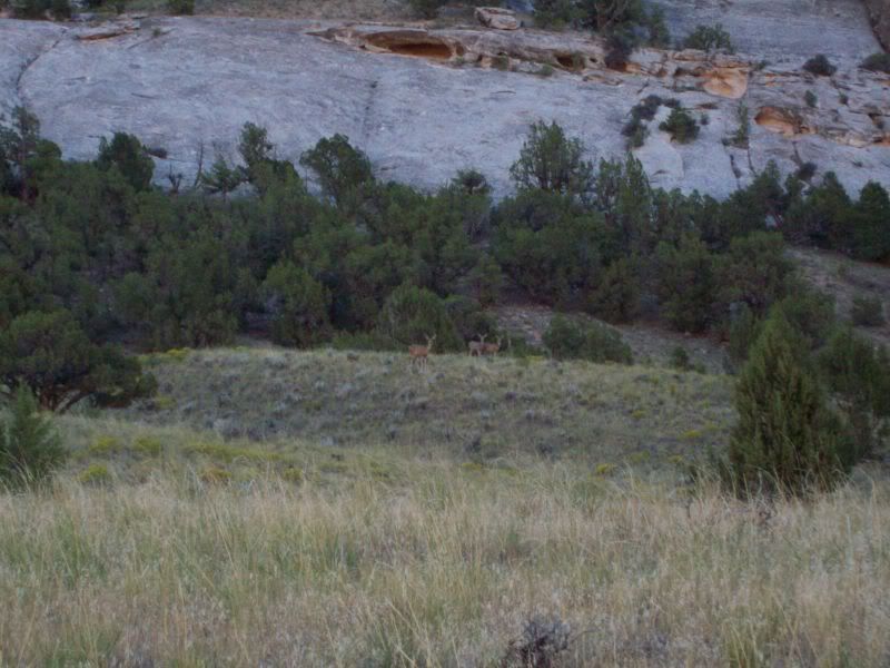
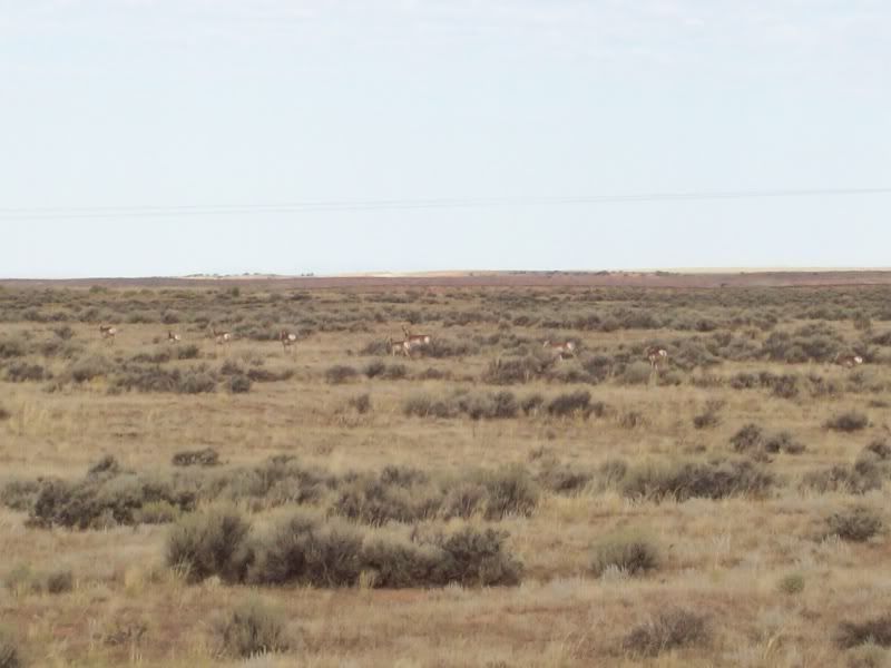
I believe another deer had past me when I heard the noise.
The trail continued on past the point where I saw the deer but I need to head out so back to camp I went to head on out.
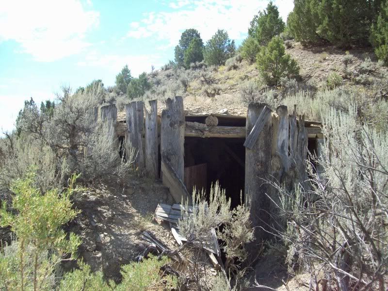
First stop Whispering Cave
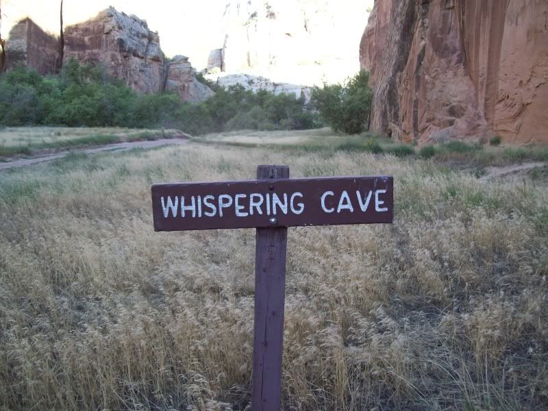
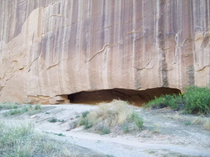
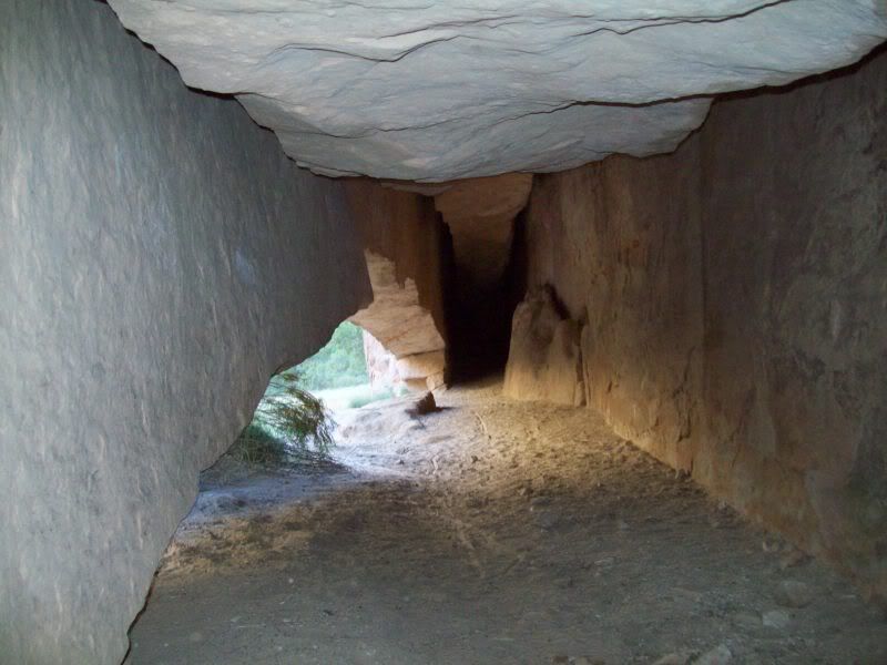
Being the individual that I am (meaning being skinny, I was able to shimmy back a ways between cracks of the rocks too see how far back it went. Which needless to say I couldn't get since it got narrower. Oh, well. Moving on.
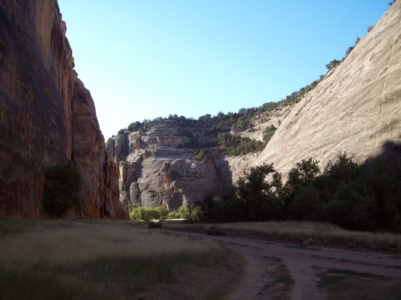
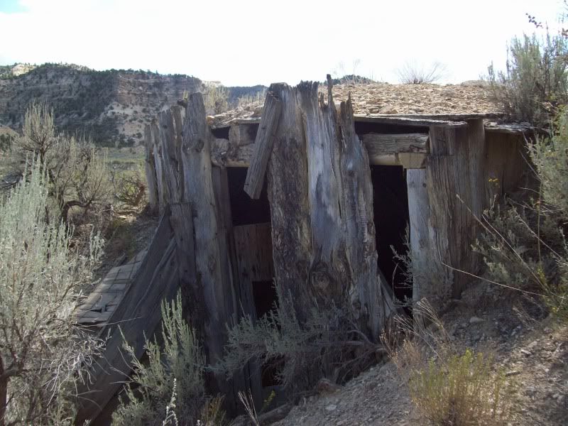
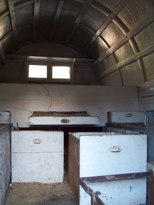
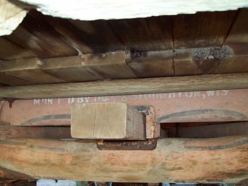
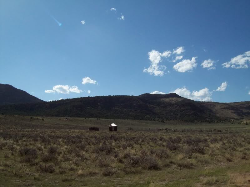
Chew Ranch was the next stop on my way out of Echo Park

Playing around with the camera
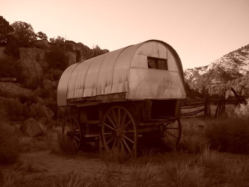
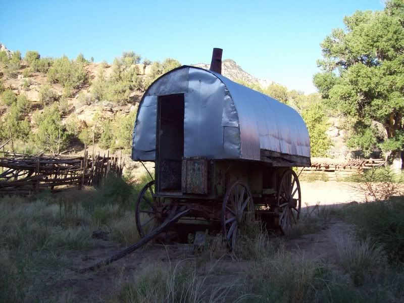
Looking inside the wagon seemed to setup pretty well. Then was an area on the right were a stove was with an opening in the roof for the stack.
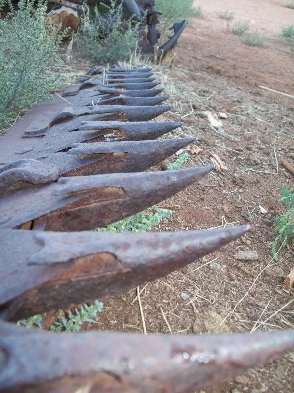
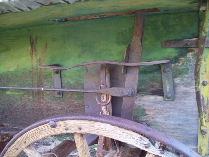
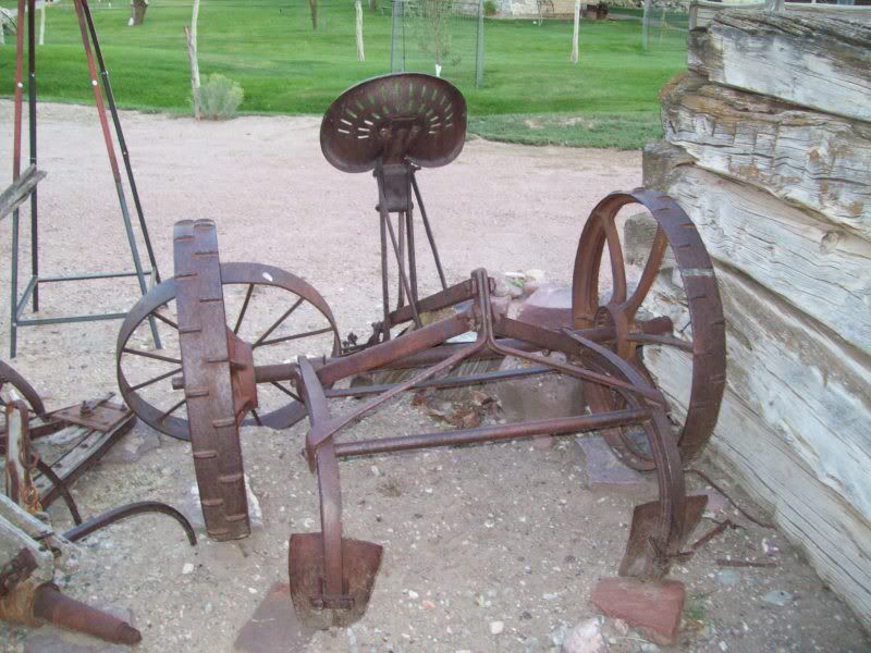
I'm assuming this was some sort of handbrake system but why would you need all the notches for.
The old homestead
After tooling around here for a bit it was time to head on out on Yampa Bench Road. The ranger the previous day had told me that if if the road was wet that it would nasty slick since it was clay in a lot of the areas. Fortunately, the road was dry as bone but I could easily see where it would not be a place you'd want to be in a rain storm. Nasty slick with a couple of creek crossing.
Anyhow moving on
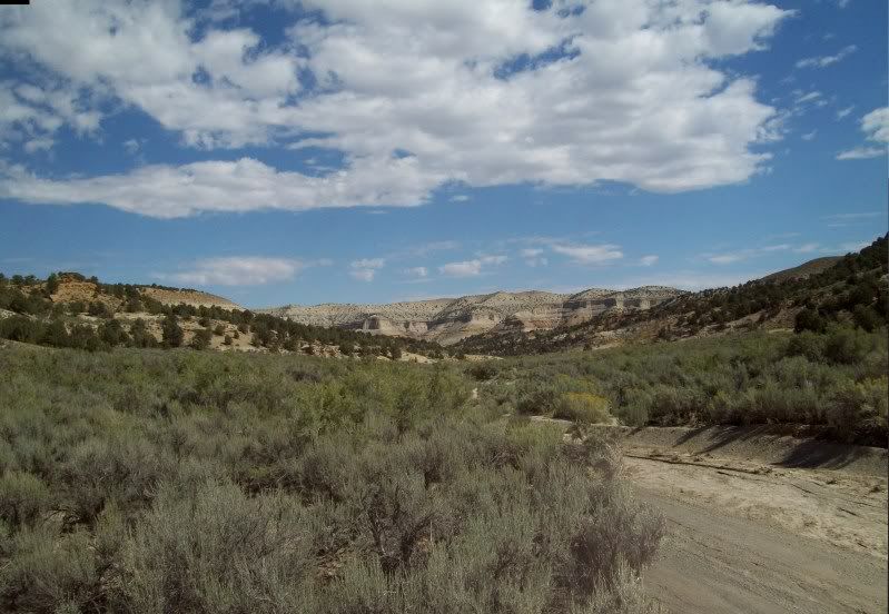
Some where along Yampa Bench Road
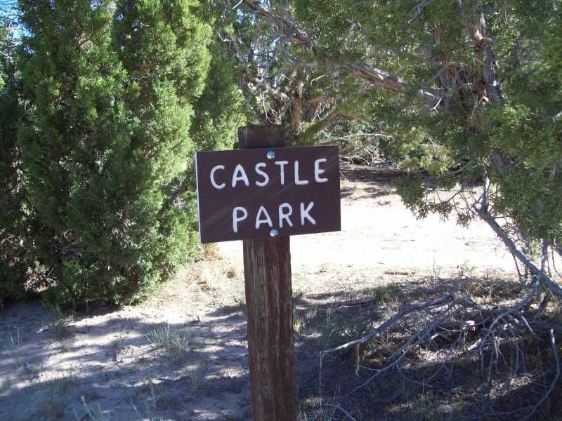
First stop along the route was Castle Park
It took me a minute to see this but if you look down to the left you can see people in the above photo hiking along.
These are them zoomed in
On the way to the next overlook I came across this site
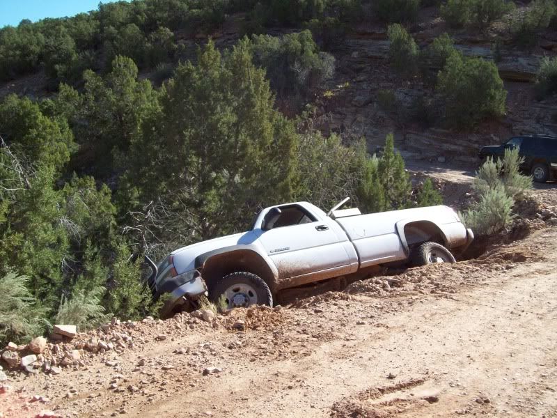
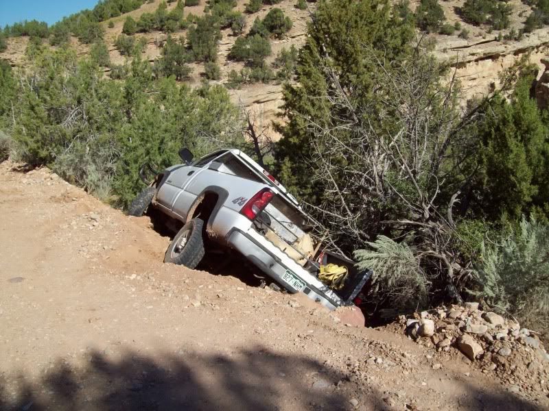
This was not something I wanted to see. I stopped to get out too see if anyone was around but there was no one. Judging by the mud on the truck I believe they came though after the last rain a little too quickly around the corner and slid off the road. The only thing keeping the truck from rolling down the hill were the trees. Otherwise it would've been gone.
How they are going to recover it is a good question since it's in the middle of an S-curve. This goes back to my previous statement where I understand what the ranger was talking about.
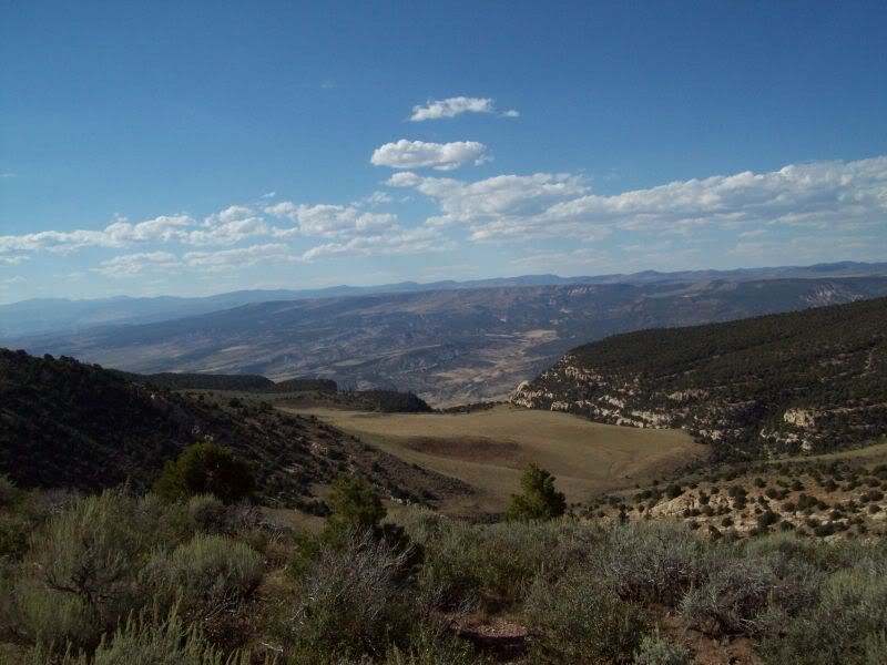
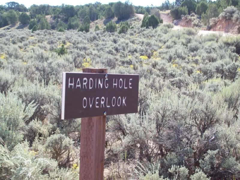
Since no one was around I went ahead and headed on out to the Harding Hole Overlook (
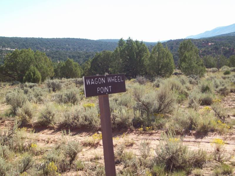
After that I stopped at Wagon Wheel Point the last overlook along Yampa Bench Road (the photo's here came out kind of crappie)
There was one other stop along the ay �Bakers Cabin� but I was unable to locate it so I continued on.
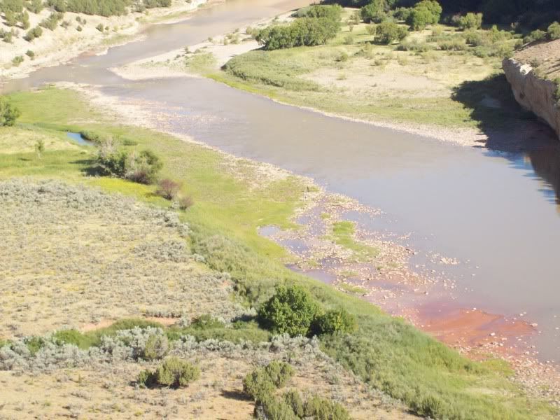
Somewhere along the bench
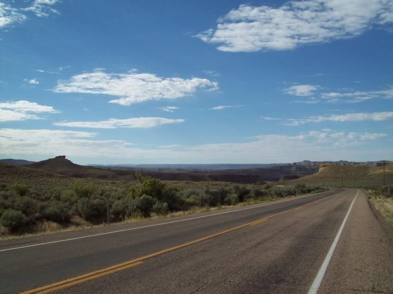
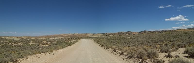
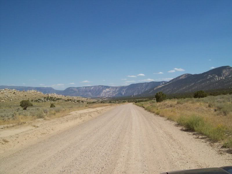
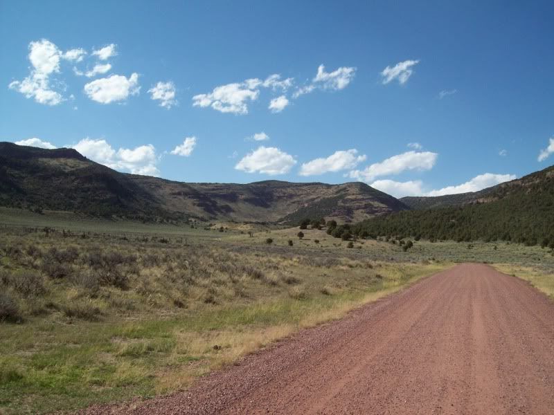
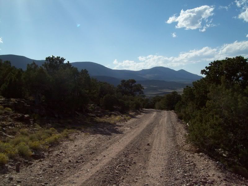
After this point you come to the junction of Yampa Bench and country roads 14 and 95. Here there is a little signage post with maps of the area and additional information. I stop here just briefly to add some fuel to my 4runner and grab a quick snack before heading on out on Blue Mountain Road an easy gravel road with some fun corners.
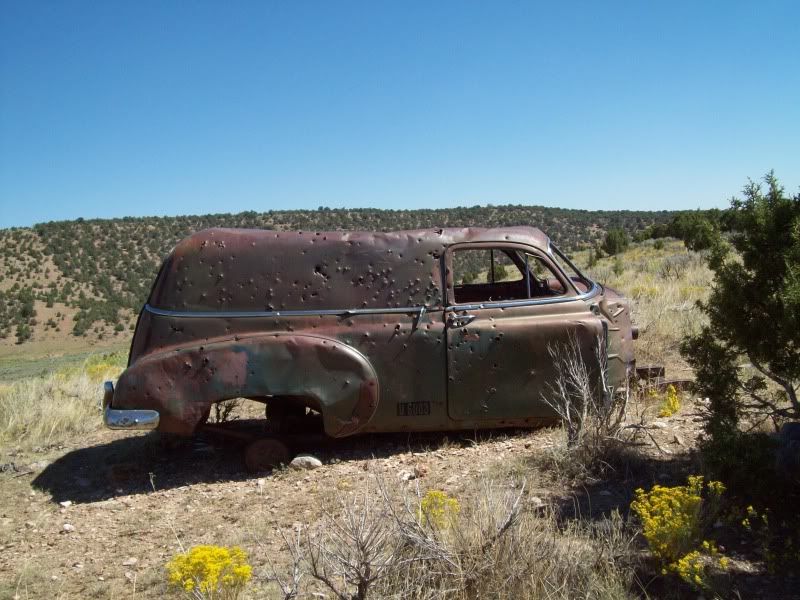
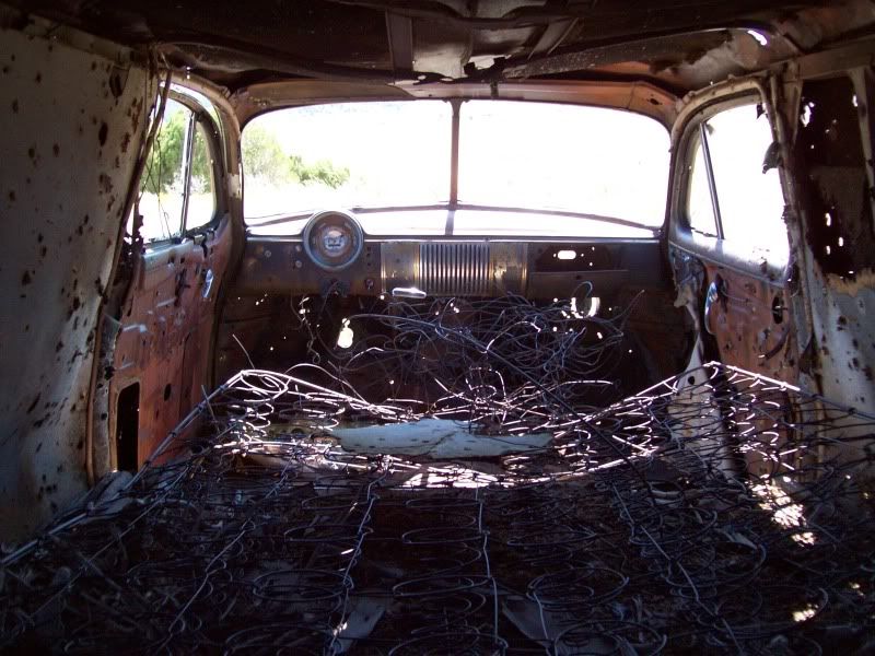
An old Chevy at the junction of 96 and 16(Blue Mountain Road)that has seen better days.
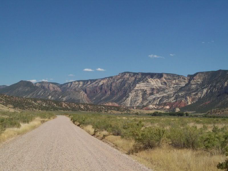
Somewhere along Blue Mountain
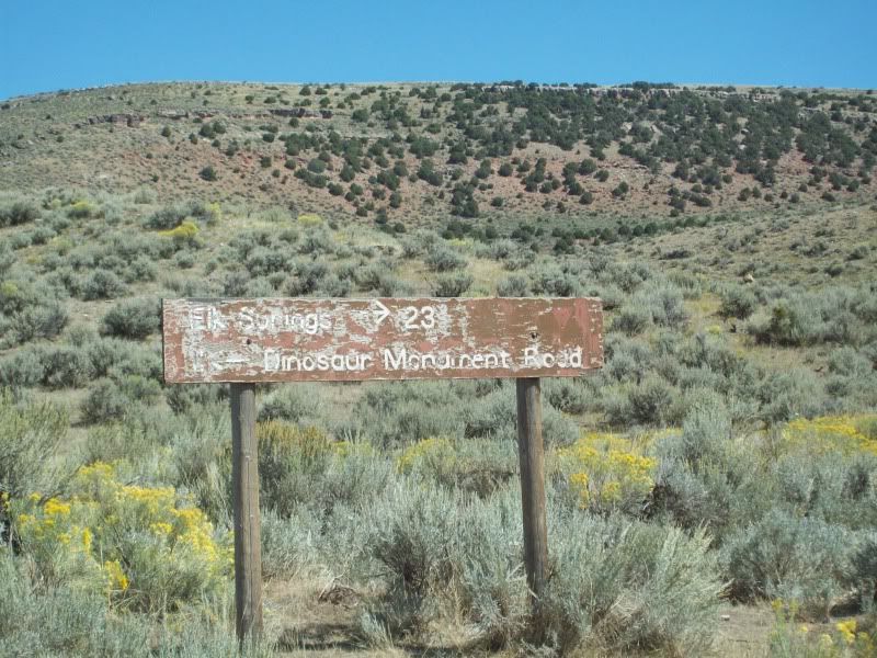
I think they need to invest in some new signs
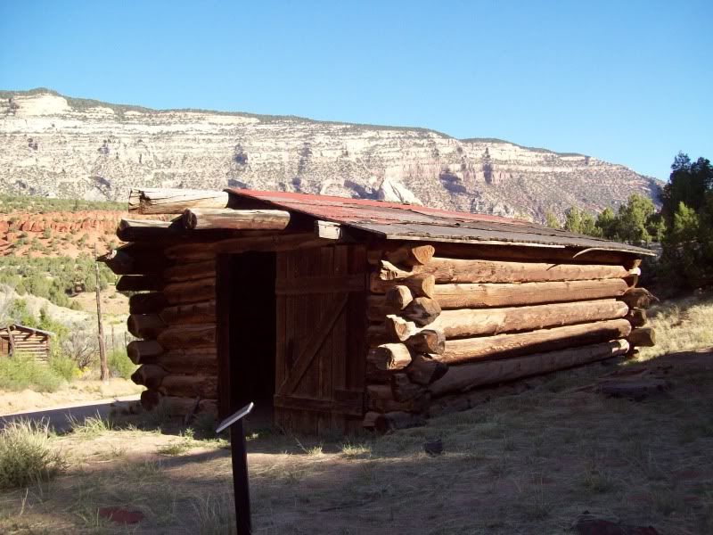
Old Cabin along the way
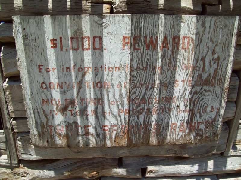
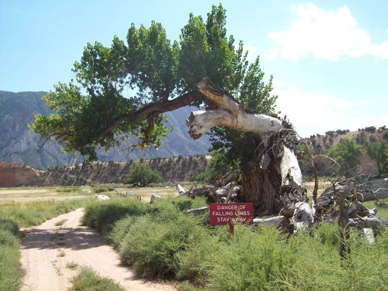
I really wonder why they have to include the 3rd sentence in the sign.
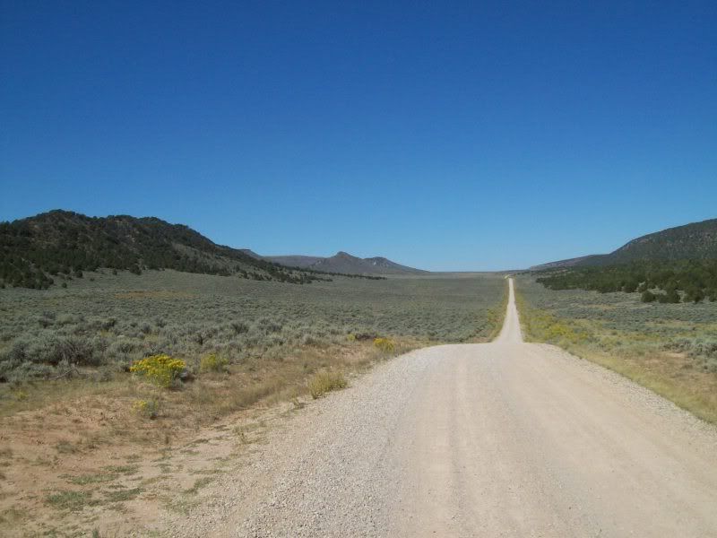
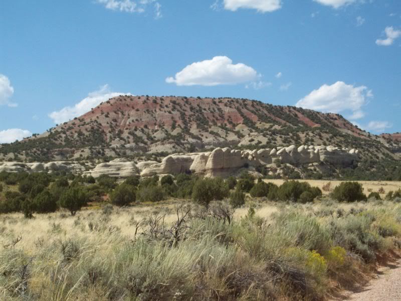
Second half of Blue Mountain Road after a quick trip along pavement
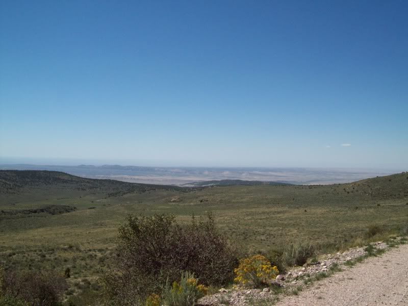
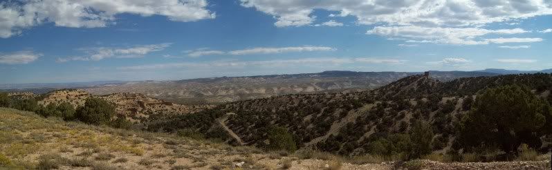
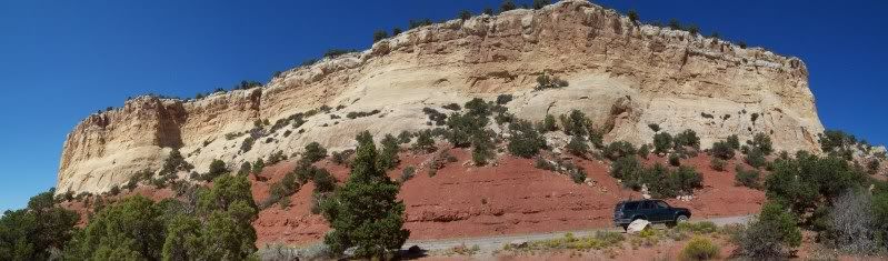
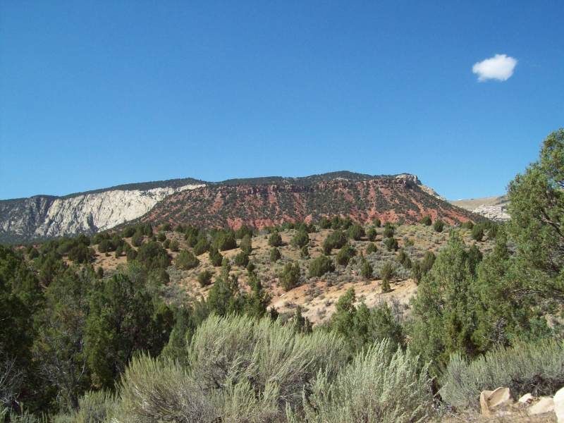
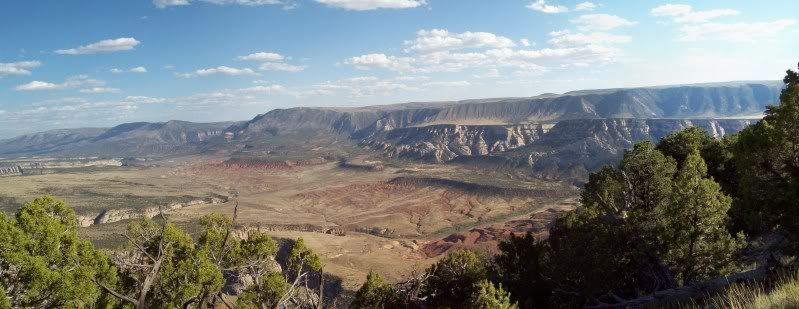
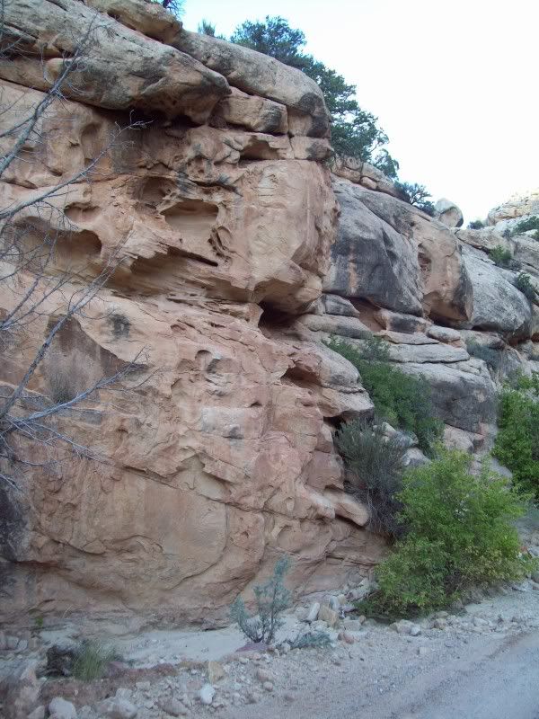
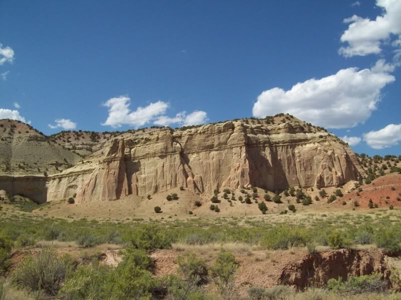
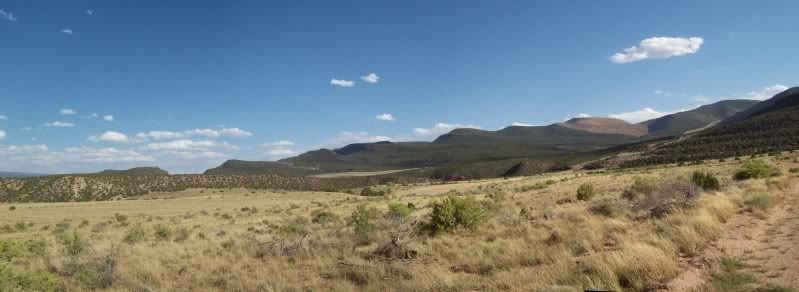
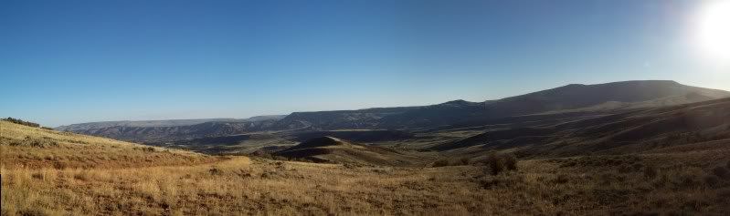
One of the things that stuck me in this photo is the bowl on the right hand side of the photo. You can see were the rock surrounding has been uplifted I'm assuming from it was a caldera or some sort of impact crater (continues past the photo).
After I reached highway 40 I headed back into Naples to fill up with gas, grab a drink (energy drink #2, day 2) and some lunch. Before heading on back out.
Next up was the Island Park area and back into Dinosaur National Monument
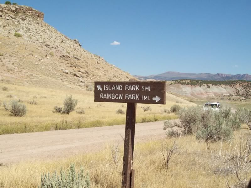
First stop along the route was Rainbow park, I didn't stay here long as there was a group camping at the end.
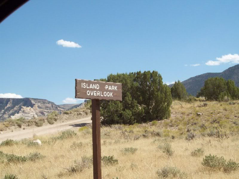
Island Park Overlook was next
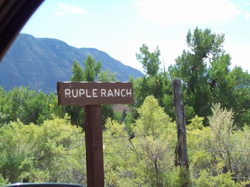
Then down to Ruple Ranch
Ruple Ranch
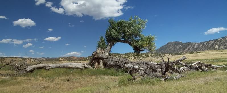
The huge tree that you must pass to continue on down the road
Down by the river
The one thing that I noticed was that there was no sign saying that you couldn't go up to the cabin to have a look around. Hopefully, I did no wrong here but I went ahead a took a look around.
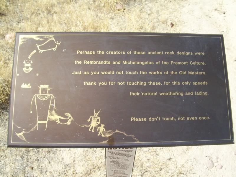
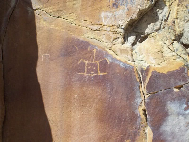
Petroglyphs
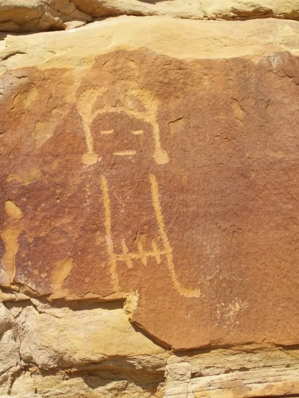
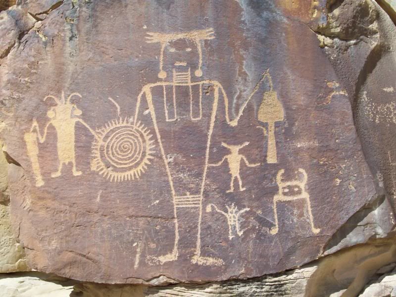
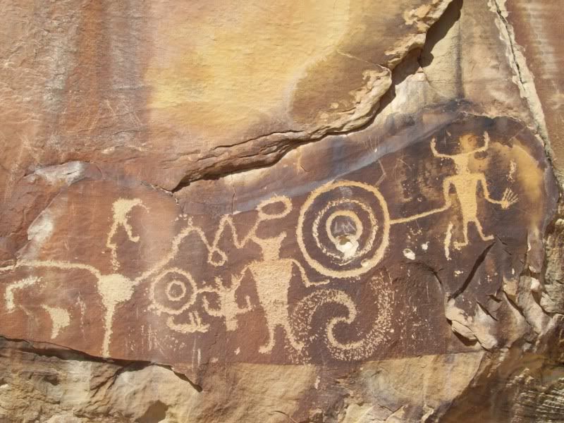
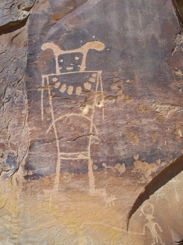
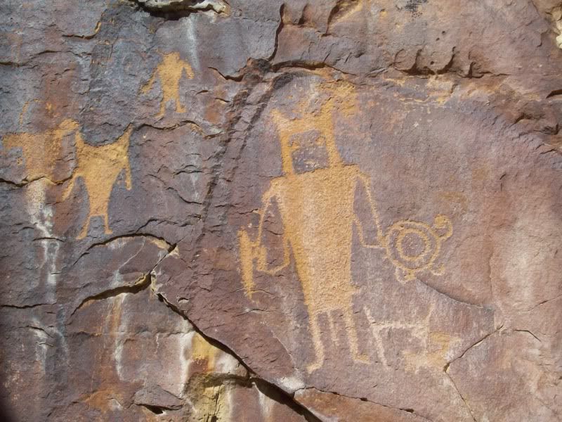
Only half finished?
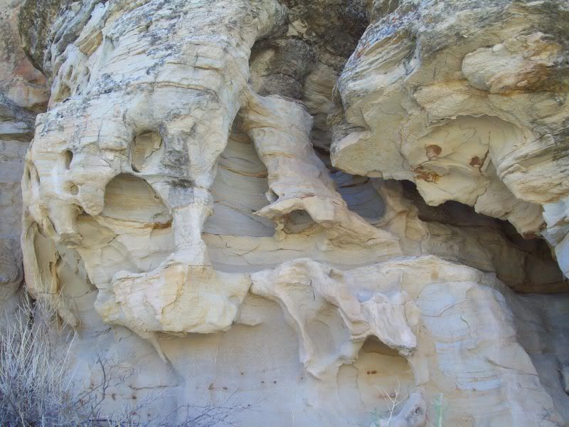
Weird rock formation and lizard #4
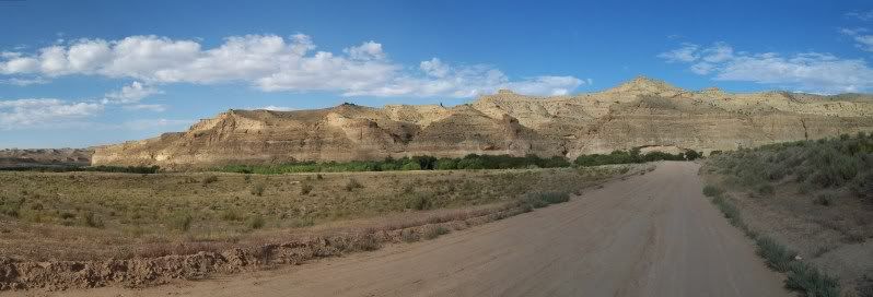
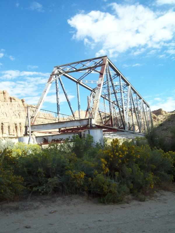
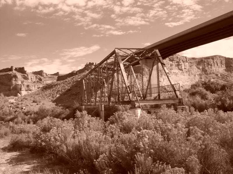
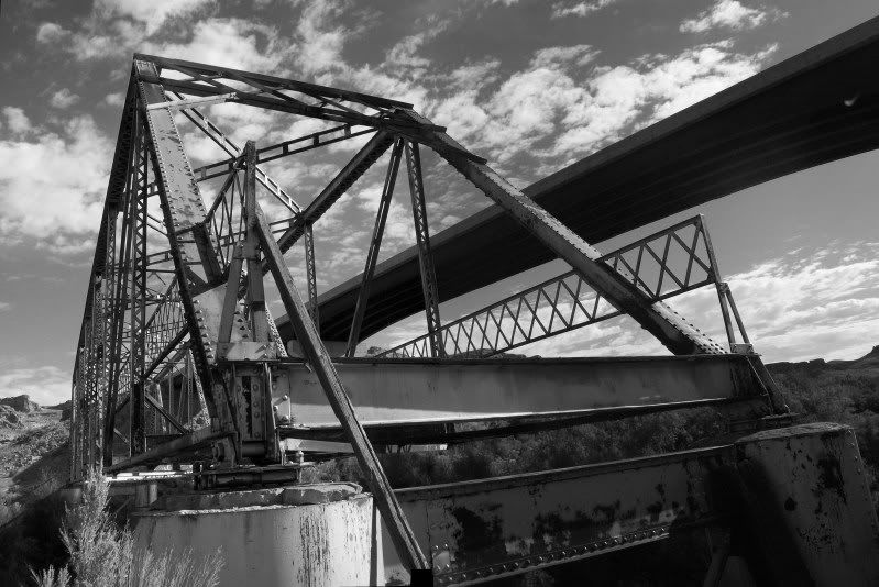
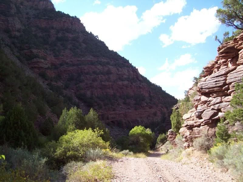
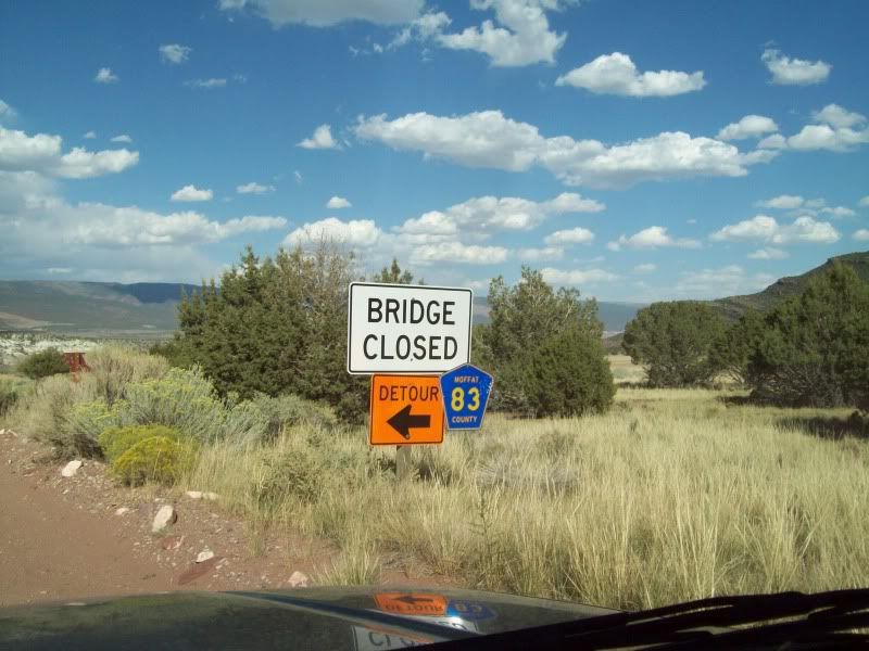
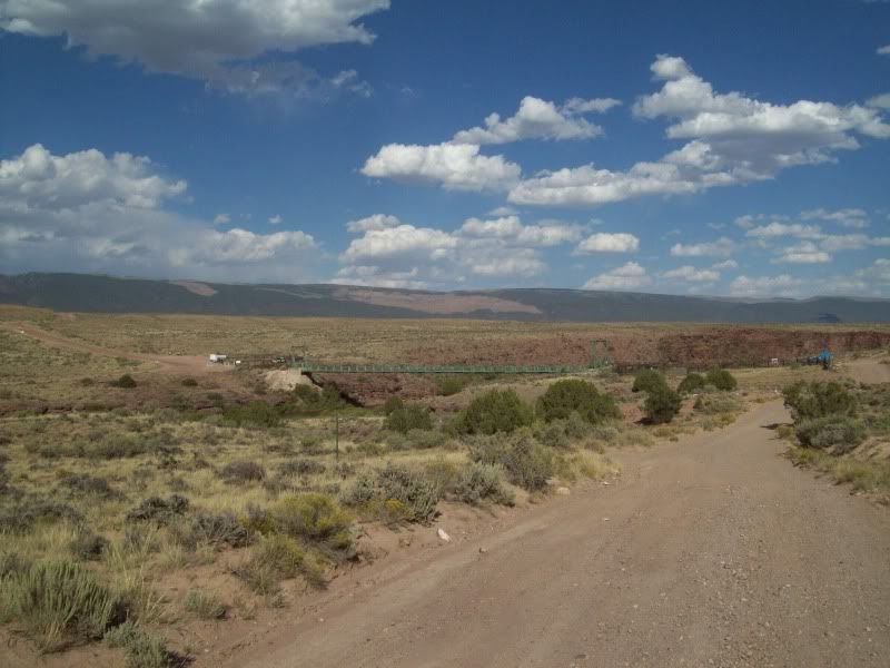
The final stop for the day or so I was hoping was the swinging bridge the crosses the Green River and campground right after. Unfortunately, once I reached the road for Crouse Canyon that lead to it there were signs noting that the bridge is was closed (repairs I believe)not to be detoured from my goals of seeing it I pressed forward I had plan out plan 'B' in case something like this happen and one I saw the sign I started planning 'C'.
Route out to Crouse Canyon
Butch Cassidy Hideout I believe, at least according to my map.
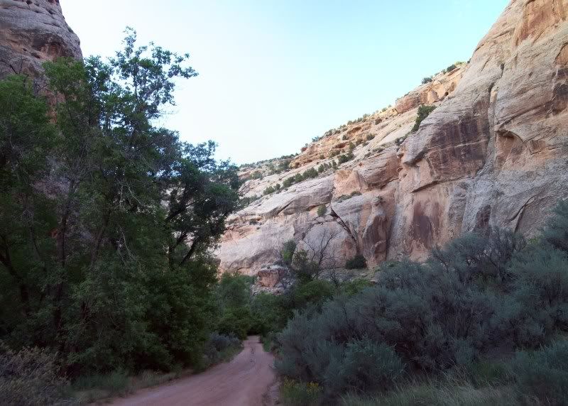
Into the canyon
Ye, old 'Bridge Closed' sign
After seeing the bridge I turned around and started to head out to Taylor Flats and the second bridge crossing
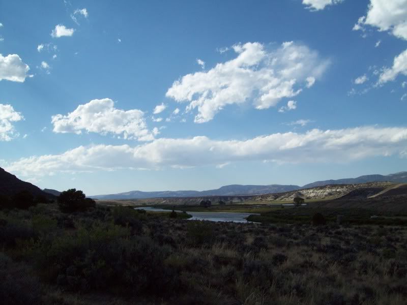
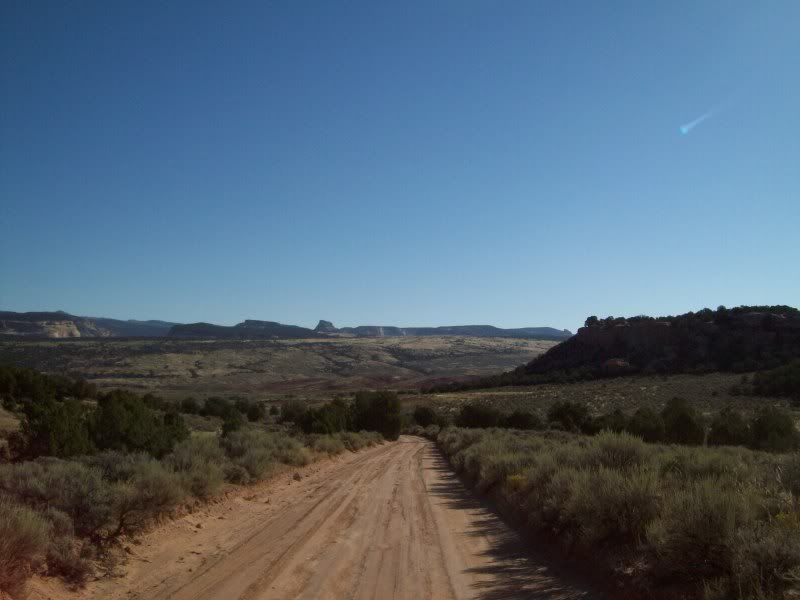
Some where along the route to Taylor Flats
Taylor Flats
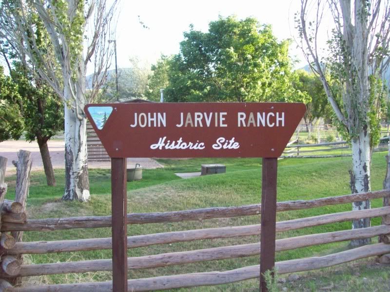
Shortly after passing Taylor Flats you come to a recreation area and a campground needless to say I'd avoid this campground, it's not very well maintained. So I headed down to the campground just past the Jarvine Ranch
Camp night two
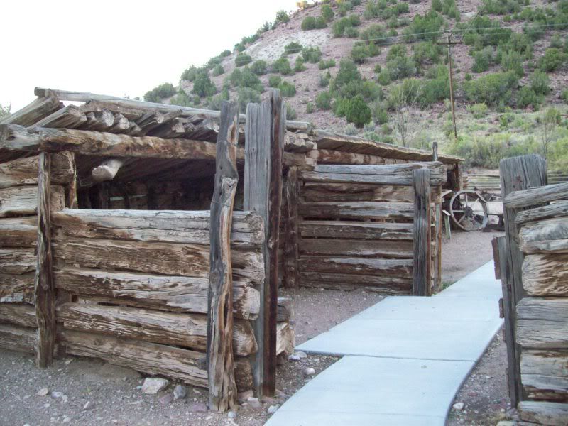
After setting up camp I made the short hike down to the Jarvine Ranch to have a look around
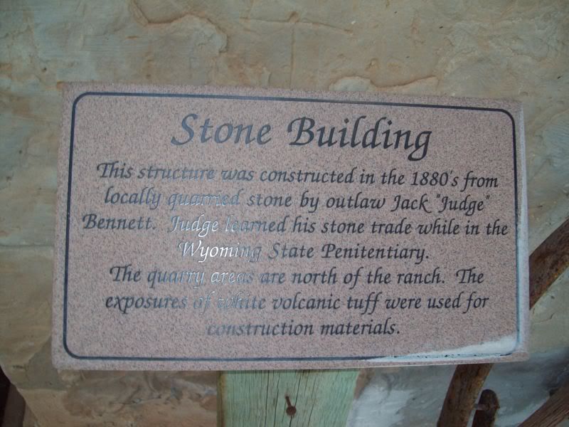
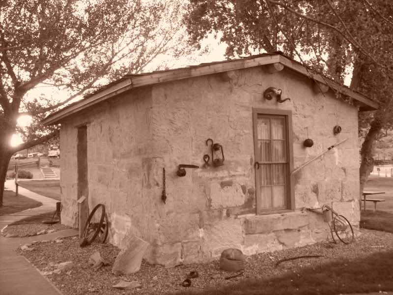
Stony Cabin
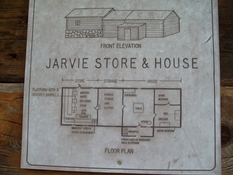
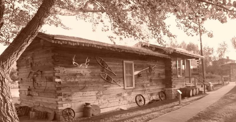
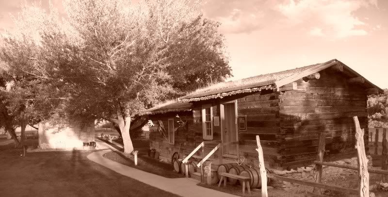
Jarvine store and house
The Jarvines first resident
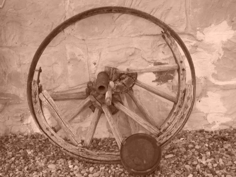
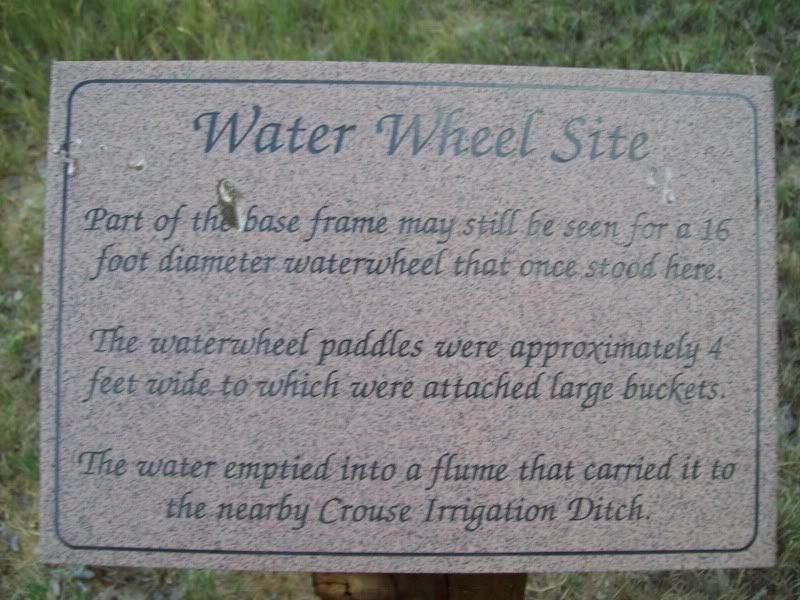
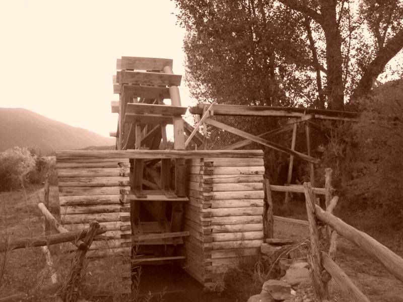
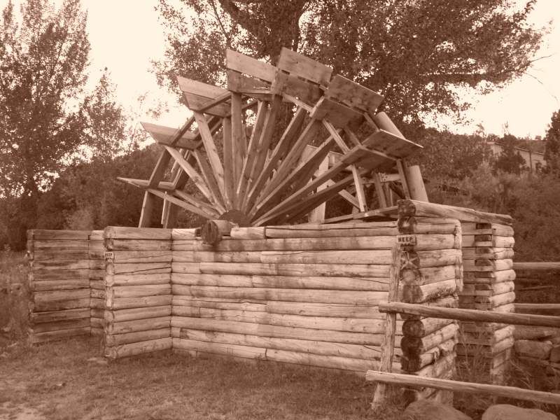
The old water wheel
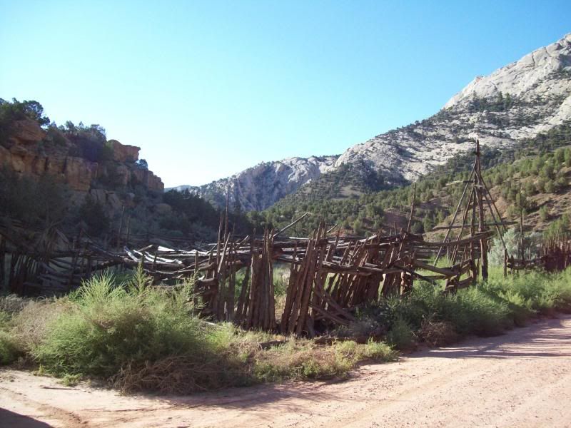
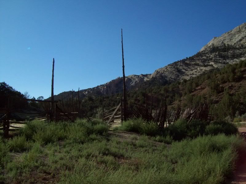
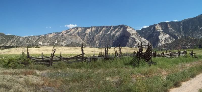
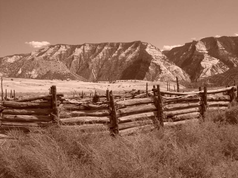
Corral
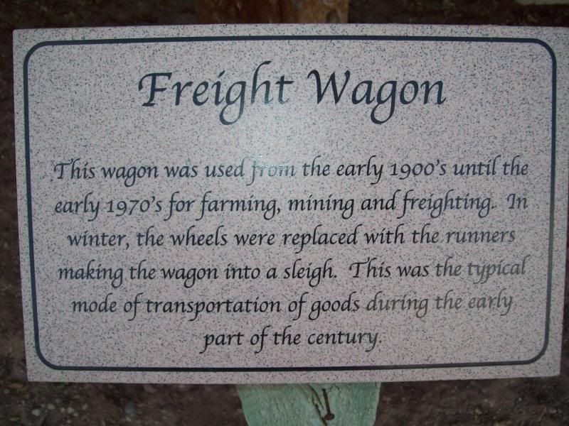
Surprisingly this wagon was used from 1900 to 1970
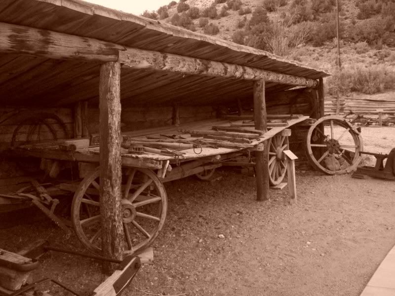
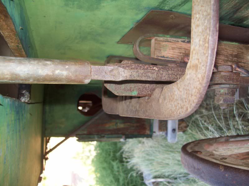
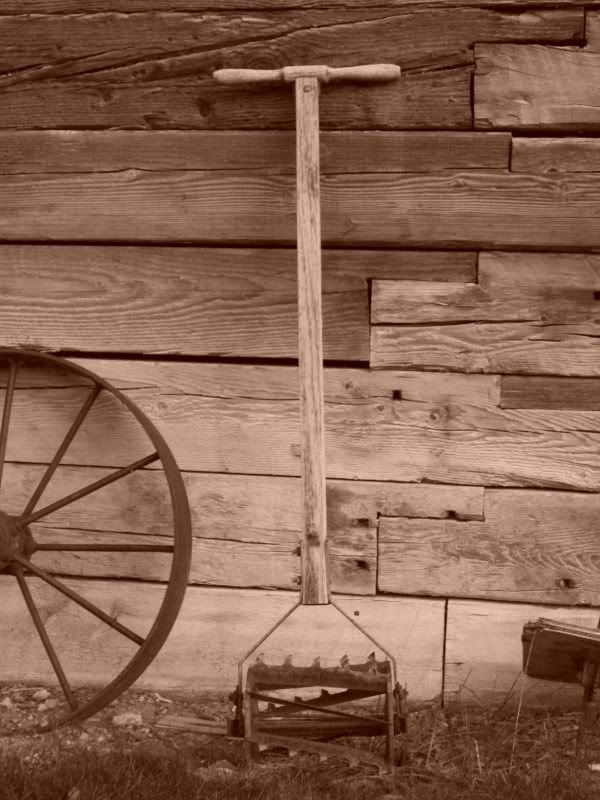
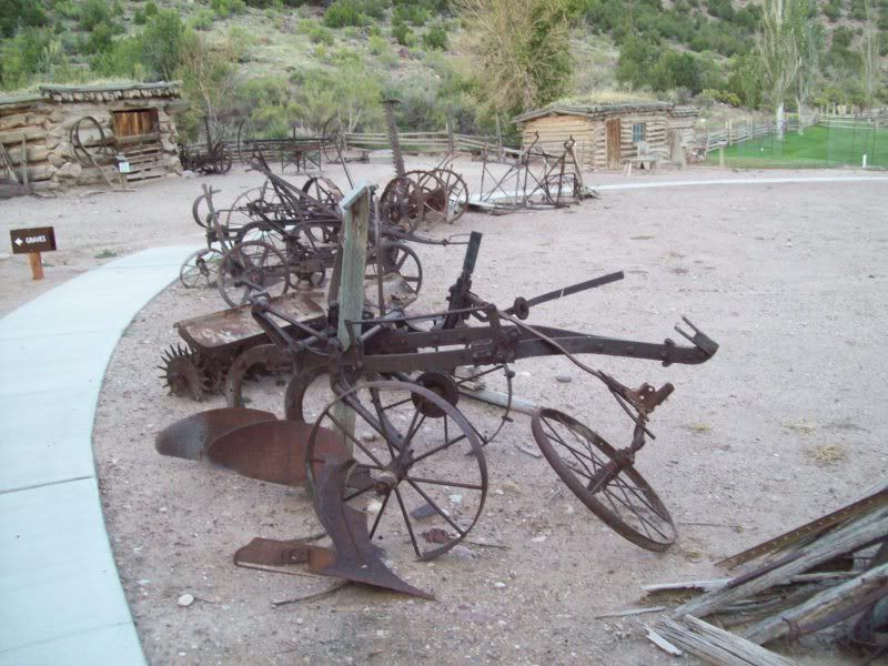
Old Equipment
Looks a little dangerous
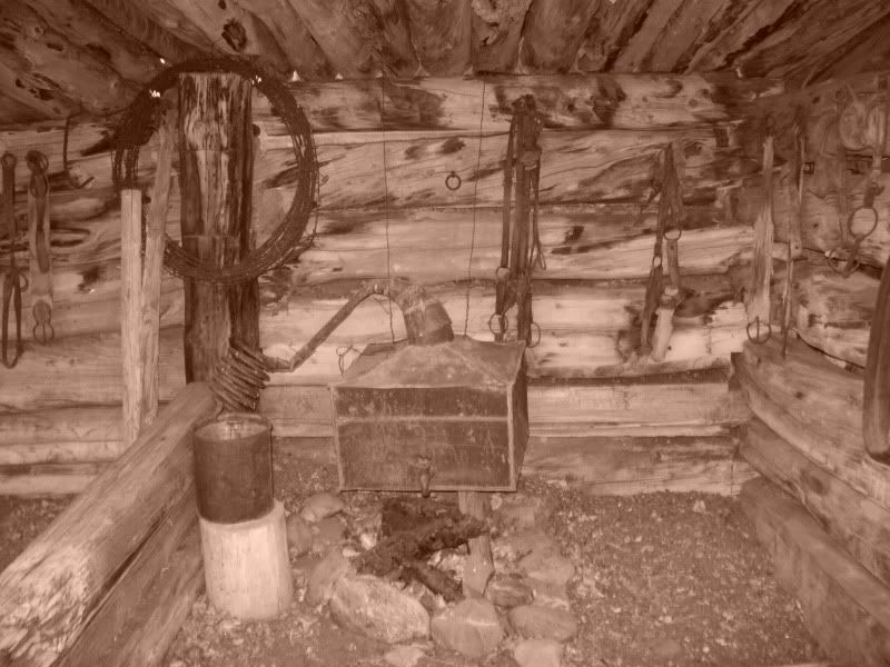
Blacksmith shop
Chicken Coop and Ice House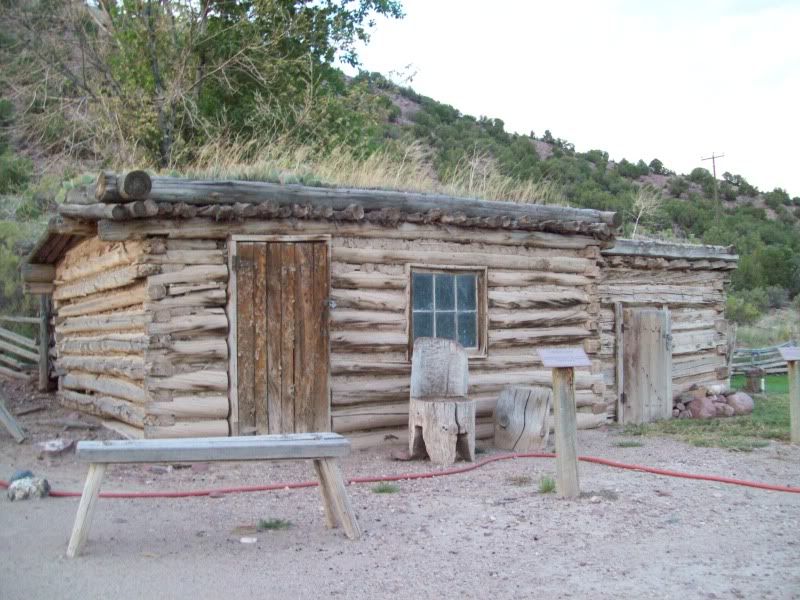
Doesn't look too comfortable
After tooling around here for a while it was starting to get dark, windy and besides all I was hungry. Beef stew, pita bread, cookies and another ice cold Root Beer was on the menu tonight. There would be no fire tonight as the wind was worse here, with taller grasses and I just didn't feel like dealing with it. So off to bed or so I thought I don't think I got more than an hour of sleep before the wind started to howl again shaking my tent like crazy and up lift the rain fly on the top of my tent.
After about half an hour of this I said screw it and packed up my gear back into 4runner tent and all and just curled up into the back seat of my 4runner not my preferred sleep arrangement but it worked and I was able to get some sleep.
After I returned from the side trips to various overlooks I settle into camp for the night. Dinner was chicken, rice and carrots and an ice cold IBC Root Beer (yum!). I was questioning whether or not to have a fire that night because of the wind in canyon was not too to my liking but I went and ahead and made one anyways. As well as some other folks. All was well while the sun was still up but once the sun went down the wind picked up and you would have little micro burst here there that would send cinders into the air, which you would have too go stomp out. After about an hour of that I had enough and decided to put the fire out and hit the hay. It was close to 9:00 pm by this time.
One thing I like about being out away from the city is that the sky's are clear and the stars fill up the night sky. It was great.
The wind that contiuned to blow though out the night shaking my tent at times like someone was their moving it around. Every so often you'd hear the dog in the campsite bark echoing thoughout the canyon. This started to get annoying about 1am but then to my pleasure (I hate to say this but I was tired)you'd hear the dog yelp as if the own had down something to it.
Morning came all to early for me as I was up at 630am, with my alergies going wild (just peachy). After a breakfast of oatmeal, a banna and hot chocolate I packed up camp and went on a short hike around the campground before heading out for the day.
Camp in the morning
One of the reasons why I picked this spot was because of the views from inside the canyon and river.
Steamboat Rock early morning (if you look to the right of the photo you can see two people and their dog, they were the only ones up besides myself at this time).
Rangers Cabin
After dinking around here for a bit I took a short hike along the river just too see were it went.
As I was coming up there ridge line I heard movement and much to my pleasure this is what I saw
I believe another deer had past me when I heard the noise.
The trail continued on past the point where I saw the deer but I need to head out so back to camp I went to head on out.
First stop Whispering Cave
Being the individual that I am (meaning being skinny, I was able to shimmy back a ways between cracks of the rocks too see how far back it went. Which needless to say I couldn't get since it got narrower. Oh, well. Moving on.
Chew Ranch was the next stop on my way out of Echo Park
Playing around with the camera
Looking inside the wagon seemed to setup pretty well. Then was an area on the right were a stove was with an opening in the roof for the stack.
I'm assuming this was some sort of handbrake system but why would you need all the notches for.
The old homestead
After tooling around here for a bit it was time to head on out on Yampa Bench Road. The ranger the previous day had told me that if if the road was wet that it would nasty slick since it was clay in a lot of the areas. Fortunately, the road was dry as bone but I could easily see where it would not be a place you'd want to be in a rain storm. Nasty slick with a couple of creek crossing.
Anyhow moving on
Some where along Yampa Bench Road
First stop along the route was Castle Park
It took me a minute to see this but if you look down to the left you can see people in the above photo hiking along.
These are them zoomed in
On the way to the next overlook I came across this site
This was not something I wanted to see. I stopped to get out too see if anyone was around but there was no one. Judging by the mud on the truck I believe they came though after the last rain a little too quickly around the corner and slid off the road. The only thing keeping the truck from rolling down the hill were the trees. Otherwise it would've been gone.
How they are going to recover it is a good question since it's in the middle of an S-curve. This goes back to my previous statement where I understand what the ranger was talking about.
Since no one was around I went ahead and headed on out to the Harding Hole Overlook (
After that I stopped at Wagon Wheel Point the last overlook along Yampa Bench Road (the photo's here came out kind of crappie)
There was one other stop along the ay �Bakers Cabin� but I was unable to locate it so I continued on.
Somewhere along the bench
After this point you come to the junction of Yampa Bench and country roads 14 and 95. Here there is a little signage post with maps of the area and additional information. I stop here just briefly to add some fuel to my 4runner and grab a quick snack before heading on out on Blue Mountain Road an easy gravel road with some fun corners.
An old Chevy at the junction of 96 and 16(Blue Mountain Road)that has seen better days.
Somewhere along Blue Mountain
I think they need to invest in some new signs
Old Cabin along the way
I really wonder why they have to include the 3rd sentence in the sign.
Second half of Blue Mountain Road after a quick trip along pavement
One of the things that stuck me in this photo is the bowl on the right hand side of the photo. You can see were the rock surrounding has been uplifted I'm assuming from it was a caldera or some sort of impact crater (continues past the photo).
After I reached highway 40 I headed back into Naples to fill up with gas, grab a drink (energy drink #2, day 2) and some lunch. Before heading on back out.
Next up was the Island Park area and back into Dinosaur National Monument
First stop along the route was Rainbow park, I didn't stay here long as there was a group camping at the end.
Island Park Overlook was next
Then down to Ruple Ranch
Ruple Ranch
The huge tree that you must pass to continue on down the road
Down by the river
The one thing that I noticed was that there was no sign saying that you couldn't go up to the cabin to have a look around. Hopefully, I did no wrong here but I went ahead a took a look around.
Petroglyphs
Only half finished?
Weird rock formation and lizard #4
The final stop for the day or so I was hoping was the swinging bridge the crosses the Green River and campground right after. Unfortunately, once I reached the road for Crouse Canyon that lead to it there were signs noting that the bridge is was closed (repairs I believe)not to be detoured from my goals of seeing it I pressed forward I had plan out plan 'B' in case something like this happen and one I saw the sign I started planning 'C'.
Route out to Crouse Canyon
Butch Cassidy Hideout I believe, at least according to my map.
Into the canyon
Ye, old 'Bridge Closed' sign
After seeing the bridge I turned around and started to head out to Taylor Flats and the second bridge crossing
Some where along the route to Taylor Flats
Taylor Flats
Shortly after passing Taylor Flats you come to a recreation area and a campground needless to say I'd avoid this campground, it's not very well maintained. So I headed down to the campground just past the Jarvine Ranch
Camp night two
After setting up camp I made the short hike down to the Jarvine Ranch to have a look around
Stony Cabin
Jarvine store and house
The Jarvines first resident
The old water wheel
Corral
Surprisingly this wagon was used from 1900 to 1970
Old Equipment
Looks a little dangerous
Blacksmith shop
Chicken Coop and Ice House
Doesn't look too comfortable
After tooling around here for a while it was starting to get dark, windy and besides all I was hungry. Beef stew, pita bread, cookies and another ice cold Root Beer was on the menu tonight. There would be no fire tonight as the wind was worse here, with taller grasses and I just didn't feel like dealing with it. So off to bed or so I thought I don't think I got more than an hour of sleep before the wind started to howl again shaking my tent like crazy and up lift the rain fly on the top of my tent.
After about half an hour of this I said screw it and packed up my gear back into 4runner tent and all and just curled up into the back seat of my 4runner not my preferred sleep arrangement but it worked and I was able to get some sleep.
09-12-2010, 09:04 PM
#3
Registered User
Thread Starter
Join Date: Aug 2006
Location: Colorado Springs, Co
Posts: 1,691
Likes: 0
Received 0 Likes
on
0 Posts
Day 3
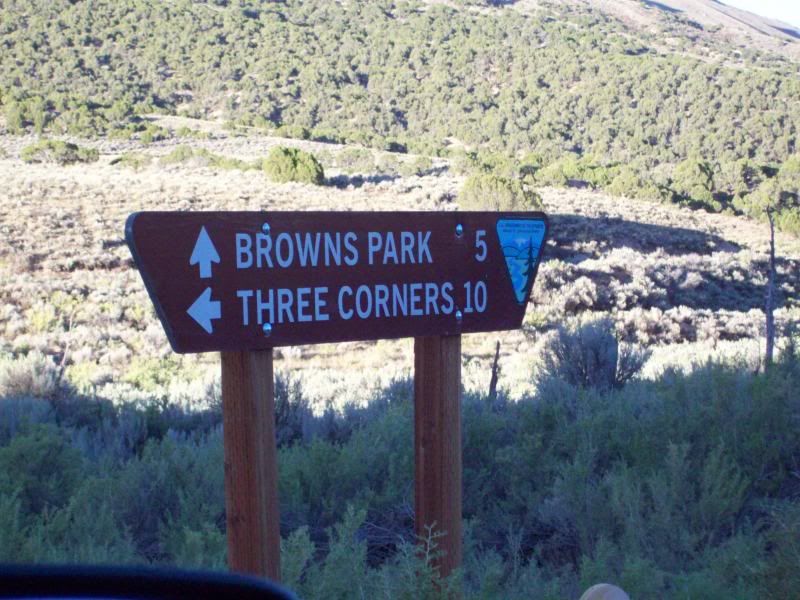
Again, day 3 started with a 630am wake up call (I just woke up)and a chilly morning. After a quick breakfast of oatmeal, a banana and some more hot chocolate I was off for the final leg of the trip back on Brown's Park road to the highway that would eventually take up to Rocksprings, Wyoming and the interstate.
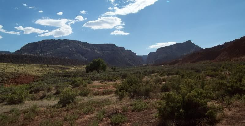
Looking back out too were I had been the previous evening
Somewhere along the way out
This cabin was on private property but clearly visible from the road
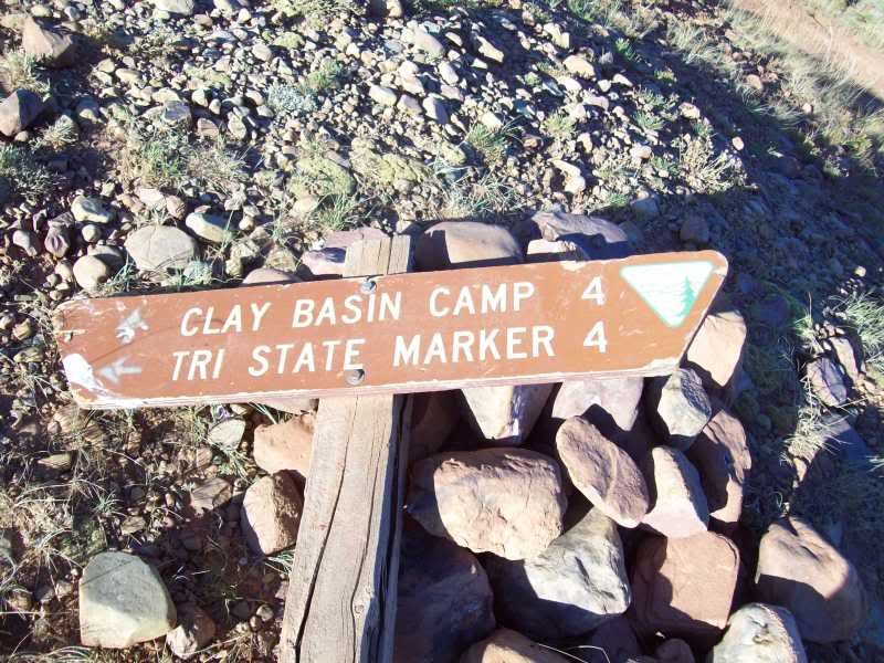
I made one side trip on the way out top try and find 'Three Corners' you know where Utah, Wyoming and Colorado meet.
Unfortunately, when you come across down signs it's kind of difficult to know where to go. So I turned around and headed back. I believe had I taken the trail on the right it would've taken me to my goal.
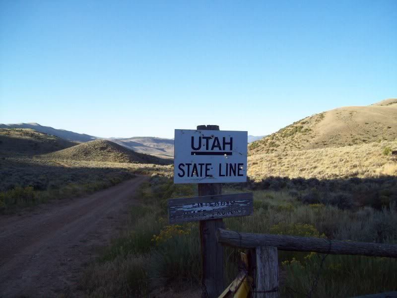
Back into Utah
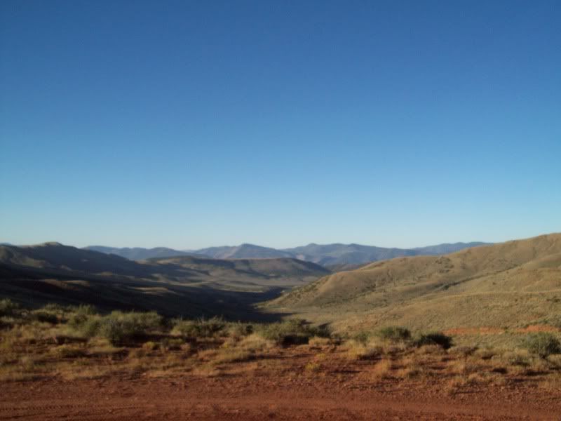
The remainder of the trip was pretty uneventful, I could've taken an alternate route to Rocksprings along the gravel but I was getting tried of gravel and I just wanted to get back to rest and clean up before heading back to work the next day.
Overall, this trip was well worth it despite my nervousness at the beginning. It was sorely needed. There so much more to do in the area that will require another trip some time in the near future.
Again, day 3 started with a 630am wake up call (I just woke up)and a chilly morning. After a quick breakfast of oatmeal, a banana and some more hot chocolate I was off for the final leg of the trip back on Brown's Park road to the highway that would eventually take up to Rocksprings, Wyoming and the interstate.
Looking back out too were I had been the previous evening
Somewhere along the way out
This cabin was on private property but clearly visible from the road
I made one side trip on the way out top try and find 'Three Corners' you know where Utah, Wyoming and Colorado meet.
Unfortunately, when you come across down signs it's kind of difficult to know where to go. So I turned around and headed back. I believe had I taken the trail on the right it would've taken me to my goal.
Back into Utah
The remainder of the trip was pretty uneventful, I could've taken an alternate route to Rocksprings along the gravel but I was getting tried of gravel and I just wanted to get back to rest and clean up before heading back to work the next day.
Overall, this trip was well worth it despite my nervousness at the beginning. It was sorely needed. There so much more to do in the area that will require another trip some time in the near future.

Trending Topics
 09-20-2010, 07:53 PM
#10
Registered User
Join Date: Mar 2005
Location: Elko, NV
Posts: 384
Likes: 0
Received 0 Likes
on
0 Posts
what a trip report! yikes it probably took forever to write up but im glad ya did. the notches in the hand brake on the wagon were used to hold the block against the wheel acting as a parking brake.
that machine you couldnt identify is known as a sickle(sp?) mower. it was driven by a team (mules, horses, oxen, etc.) gears inside the wheels made one row of the teeth move back and fourth and cut whatever against the other row of teeth which are stationary.
the wierd rock formations were caused by wind erosion.
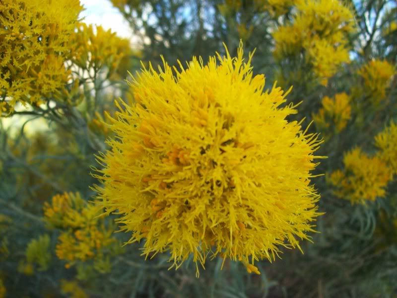
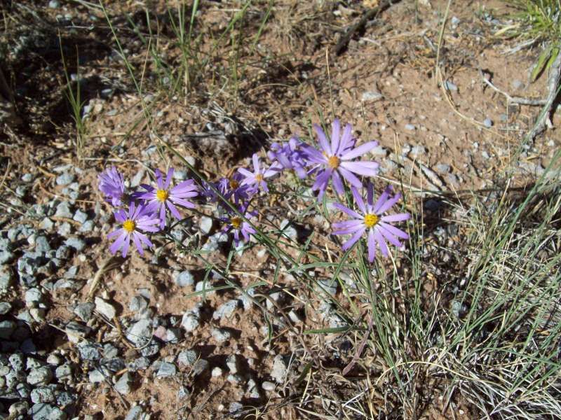
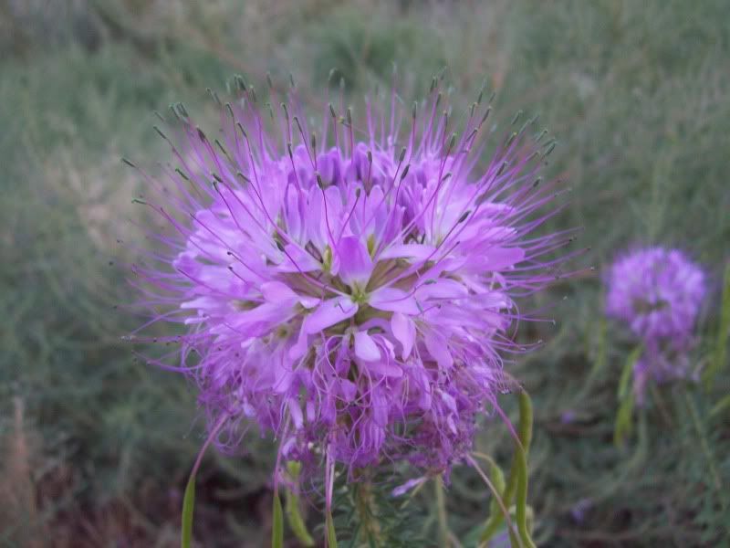
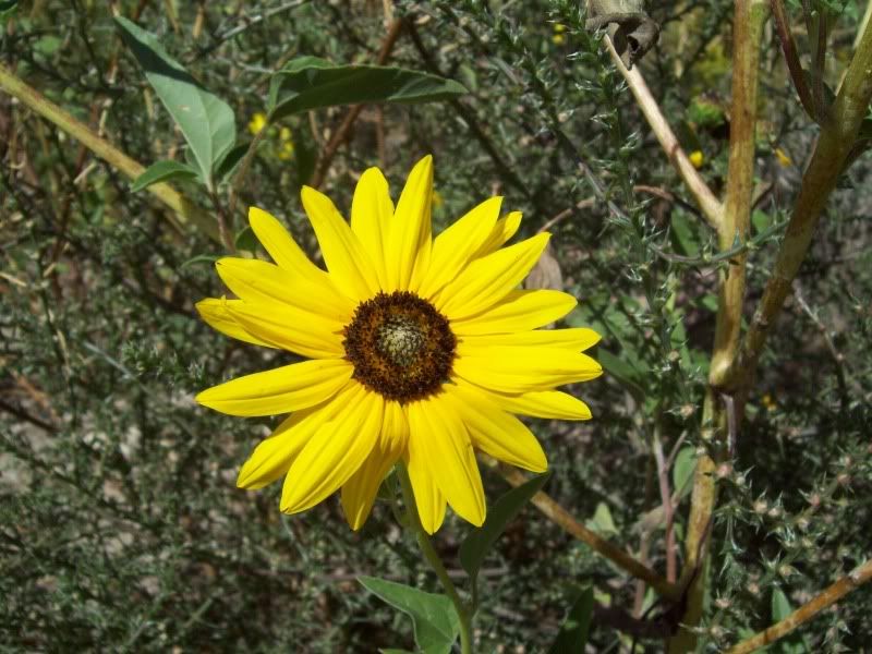
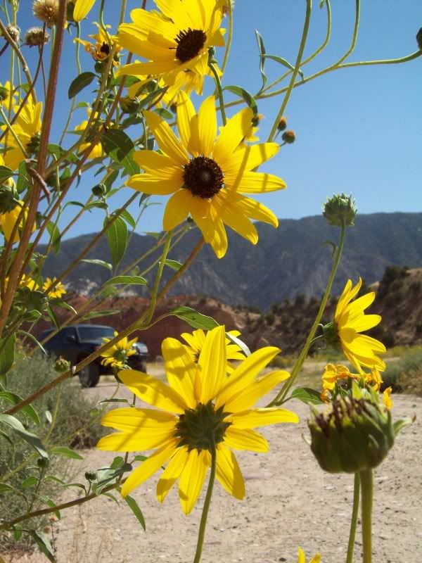
i loved the desolate scenery and the close up pics of the flowers. what do you think they were mining in those old towns? uranium maybe...
that machine you couldnt identify is known as a sickle(sp?) mower. it was driven by a team (mules, horses, oxen, etc.) gears inside the wheels made one row of the teeth move back and fourth and cut whatever against the other row of teeth which are stationary.
the wierd rock formations were caused by wind erosion.
i loved the desolate scenery and the close up pics of the flowers. what do you think they were mining in those old towns? uranium maybe...


Thread
Thread Starter
Forum
Replies
Last Post
crammit442
95.5-2004 Tacomas & 96-2002 4Runners
7
11-29-2017 12:30 PM
alanh
Off Road Trip Planning, Expeditions, Trips, & Events
0
07-24-2003 07:19 PM


